111 min walk
Menai Bay Conservation Area
- Must see
- Activity
Language · 11 published
Nature site · Zanzibar City
Kisiwa cha Kwale
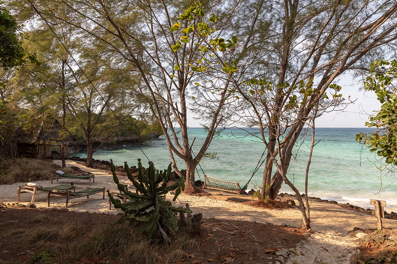
Kwale Island, known locally as Kisiwa cha Kwale, is a wooded island situated in Menai Bay southwest of Zanzibar City. It forms a central stop on excursion itineraries operating from the city into the protected marine area. The island is characterised by dense vegetation, a natural lagoon, sandy beach areas, and notably large baobab trees. Menai Bay itself is recognised as a conservation zone, and the island contributes to the broader ecological and recreational value of the bay area for visitors based in Stone Town and surrounding districts.
Checked 2026-08-26
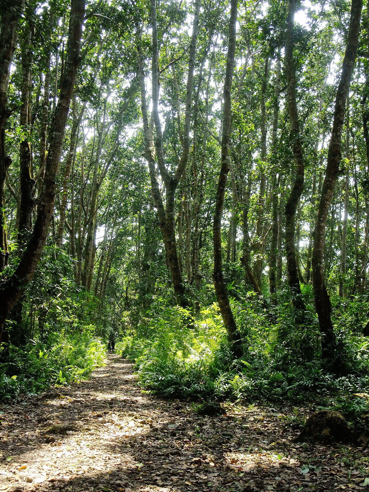
The island's interior is heavily wooded, with giant baobab trees standing as prominent features of the landscape. A natural lagoon provides sheltered water adjacent to the island. Beach areas offer landing points and coastal access. The combination of forested interior, lagoon environment, and shoreline creates varied habitats. Specific counts of baobab specimens, trail networks, or developed facilities are not recorded. The natural state of the island appears to be its primary draw, with vegetation and water features forming the core visitor experience rather than constructed attractions or interpretive installations.
Checked 2026-08-26
Duration of visit depends on the excursion structure offered by Menai Bay tour operators, who typically combine multiple stops including Kwale Island. Individual time on the island varies with tide conditions, group size, and overall itinerary design. Full-day excursions from Zanzibar City commonly allocate portions of the day across several bay locations. Visitors should anticipate that island time forms one component of a broader marine excursion rather than a standalone extended visit. Exact recommended duration is not recorded pending review of current operator schedules.
Checked 2026-08-26
Menai Bay excursions generally operate year-round subject to weather and sea conditions. The southwest monsoon period from approximately March to May can bring rougher seas, potentially affecting boat access. Dry season months typically offer more predictable conditions for marine travel. Morning departures from Zanzibar City are standard for full-day bay excursions. Visitors should verify current operational status and timing directly with licensed tour providers, as schedules adjust to seasonal demand, weather forecasts, and regulatory requirements for the conservation area. Check the operator's own site for the travel date before relying on a schedule or fare.
Checked 2026-08-26
Costs for Menai Bay excursions incorporating Kwale Island vary by provider, group size, inclusions such as meals or snorkelling equipment, and booking channel. Excursions are typically sold as complete packages rather than island-specific tickets. Conservation fees for the marine area may apply and could be incorporated into package pricing or collected separately. Visitors should obtain written quotations from licensed operators, confirm what is included, and establish payment terms before departure. No standardised public pricing structure for independent island access is documented. Check the operator's own site for the travel date before relying on a schedule or fare.
Checked 2026-08-26
Access to Kwale Island is exclusively by boat from Zanzibar City or coastal departure points. Excursion vessels depart from Stone Town harbour or nearby landing points on the southwest coast of Unguja island. Journey time across Menai Bay depends on vessel type, sea conditions, and routing via other stops. No public ferry service operates to the island. Private boat charter is possible but requires appropriate licensing and local knowledge of channel conditions. Visitors should use registered tour operators with valid permits for the conservation area, as independent access lacks established infrastructure.
Checked 2026-08-26
Marine conditions in Menai Bay can change rapidly; visitors should assess weather forecasts and operator safety briefings. The wooded terrain may harbour insects and uneven ground. Giant baobabs, while stable, are substantial trees in natural forest setting requiring normal caution. Lagoon and beach areas may have tidal currents or submerged features. Limited shade away from tree cover necessitates sun protection. No emergency services or medical facilities exist on the island. Visitors should carry adequate water, confirm communication methods with boat crew, and ensure excursion vessels carry required safety equipment for open water travel.
Checked 2026-08-26
The giant baobab trees offer distinctive subjects against sky and forest backdrop. The natural lagoon provides reflective water surfaces and potential wildlife opportunities. Beach areas allow shoreline and vessel composition. Dense canopy creates variable light conditions requiring adjustment for forest interior shots. Tide state affects lagoon appearance and access angles. Drone operation would require verification of Tanzanian aviation regulations and conservation area restrictions. Early morning excursion timing may provide favourable directional light. No designated viewpoints or maintained clearings are recorded; photographers should respect vegetation and avoid damaging root systems or undergrowth for positioning.
Checked 2026-08-26
No established public transport or independent access infrastructure exists. The island is reached by boat through Menai Bay excursion providers.
Developed facilities are not recorded. Excursions typically include provisions as part of package arrangements or visitors bring supplies.
The natural lagoon and beach areas suggest swimming is possible, but specific conditions, safety markings, or designated zones are not recorded.
Menai Bay is recognised as a conservation zone. Visitor access is subject to relevant regulations and operator permits.
Specific species inventories are not recorded. The wooded habitat and marine environment suggest general coastal and forest ecology.
Beach landing from boats and walking on natural, potentially uneven forest terrain is required. No graded paths or accessibility accommodations are recorded.
Loading the interactive map…
The interactive map could not be loaded.
Last updated:
Source: OpenStreetMap contributors, Wikidata ·