Smart Self-Managed Tours

City guide · Vietnam

Da Nang

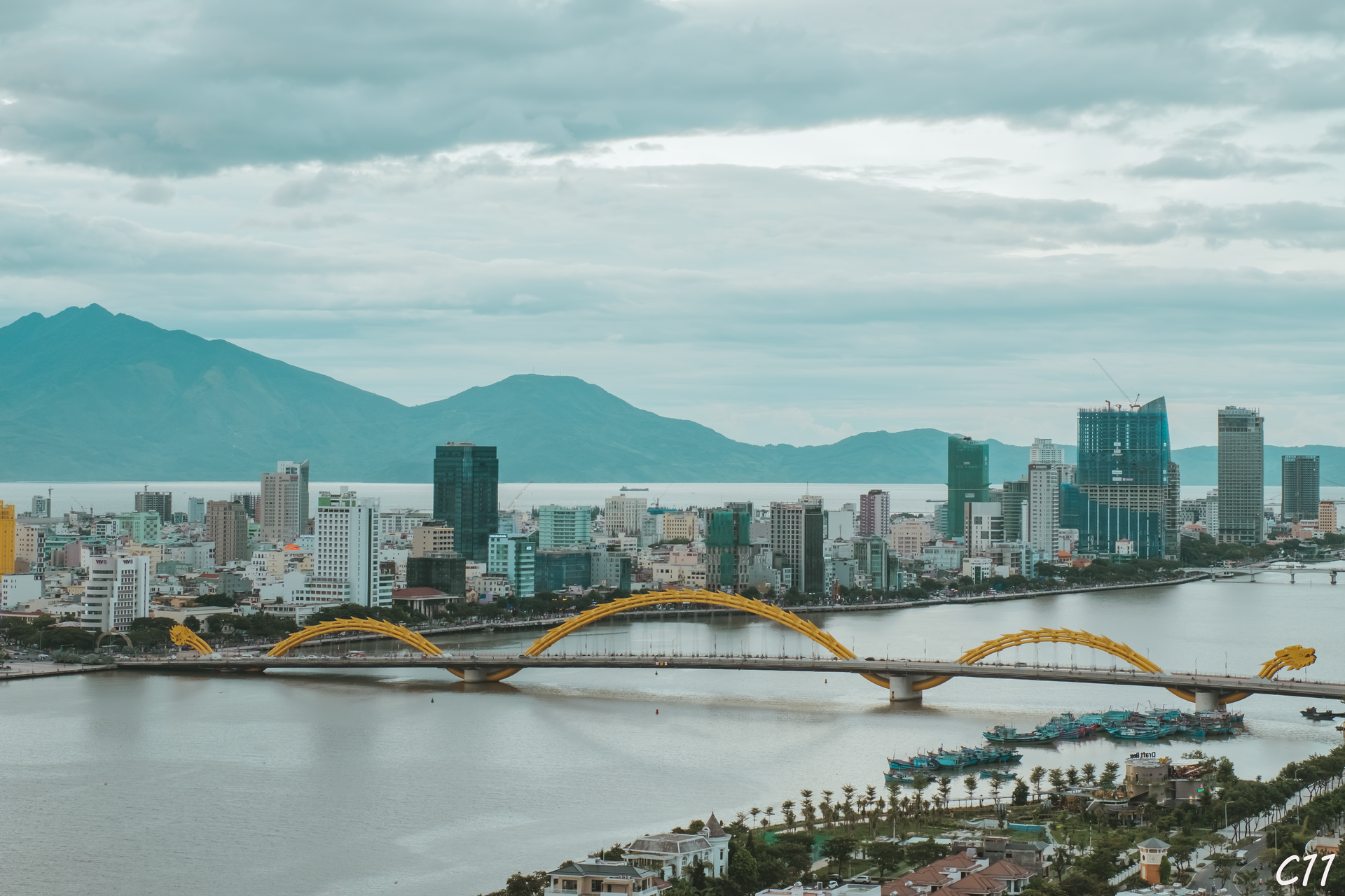
A photograph of Da Nang
Photograph · Cuong Tran · Public domain

Da Nang is divided by the Han River, with the civic centre and markets on the west bank and the main beach strip on the east. The river bridges connect these two practical visitor zones. The Marble Mountains lie south toward Hoi An, while the Son Tra Peninsula and Hai Van Pass extend north beyond the compact urban core.

Practical information

Language spoken
Vietnamese
National practical orientation; regional and minority languages may also be used
Dialling code
+84
International calling code; local area and mobile prefixes still apply
Currency
Vietnamese đồng (VND)
Use the official local currency; card acceptance varies by place
Emergency number
113 police · 114 fire · 115 ambulance
Use only for an emergency; tourist assistance may use a separate number
Plug type
Type A and C · 220 V
Check that chargers support the recorded voltage before using an adapter
Tap water
Not recorded
No verified nationwide visitor drinking-water statement was recorded

Turn this list into a plan

Set your days, your pace and the hours you actually want to be out. The planner works around closing days and travel time, and leaves room to eat.

Plan Da Nang

Planning a visit

Suggested stay
Not recorded
Getting around
Walking, public bus, bicycle and licensed taxi
  1. January: viable with meaningful trade-offs
  2. February: best time to visit
  3. March: best time to visit
  4. April: good time to visit
  5. May: viable with meaningful trade-offs
  6. June: recurring difficult conditions
  7. July: recurring difficult conditions
  8. August: recurring difficult conditions
  9. September: recurring difficult conditions — current month
  10. October: recurring difficult conditions
  11. November: recurring difficult conditions
  12. December: recurring difficult conditions
  • Best time
  • Good time
  • Viable with trade-offs
  • Difficult conditions

Sources

Top things to see

Ranked by importance — sitelinks, pageviews and heritage status, not editor preference.

  1. Sun World Bà Nà Hills Sun World Bà Nà Hills
    02 2 hours

    Sun World Bà Nà Hills

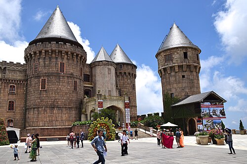
    Sun World Ba Na Hills is a hill station and resort complex in the Truong Son Mountains near Da Nang, Vietnam.

    • Must see
    • Entertainment venue
  2. Đà Nẵng Museum Đà Nẵng Museum
    03 1 hr 30 min

    Đà Nẵng Museum

    Bảo tàng Đà Nẵng

    Da Nang Museum is the city's principal civic-history museum, now situated in a new waterfront location. It serves as the main institution dedicated to preserving and presenting the history, culture, and development of Da Nang and its surrounding region.

    • Must see
    • Museum
  3. Dinh Dong Museum and Café
    04 1 hr 30 min

    Dinh Dong Museum and Café

    Dong Dinh Museum is a private museum located on Son Tra Peninsula in Da Nang. The institution occupies a forested setting and presents itself as a distinctive cultural venue combining regional memory, architectural elements, and natural surroundings.

    • Must see
    • Museum
  4. Tran Thi Ly Bridge Tran Thi Ly Bridge
    05 2 hours

    Tran Thi Ly Bridge

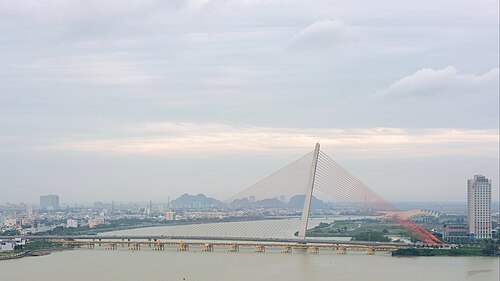
    Tran Thi Ly Bridge is a cable-stayed bridge spanning the Han River in Da Nang, Vietnam. The structure serves as a vital transportation link connecting districts of the central Vietnamese city.

    • Must see
    • Activity
  5. Thuan Phuoc Bridge Thuan Phuoc Bridge
    06 2 hours

    Thuan Phuoc Bridge

    Thuan Phuoc Bridge is a cable-stayed bridge spanning the Han River in Da Nang, central Vietnam. It connects the city centre with the eastern peninsula and Son Tra Peninsula.

    • Must see
    • Activity
  6. Hoi An Museum Hoi An Museum
    08 1 hr 30 min

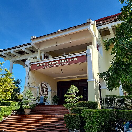
    Hoi An Museum

    Bảo tàng Hội An

    • High
    • Museum

Source: OpenStreetMap contributors, Wikidata ·

How the city is laid out

Group Han Market, the cathedral, Cham Museum and west-bank riverfront together. Cross one bridge for My Khe Beach and the eastern waterfront, then reserve a separate block for Son Tra because its roads climb away from the centre. Marble Mountains and the southern coast fit another route; Ba Na Hills and Hai Van Pass need standalone excursions.

Checked 2026-08-26

Getting around

Central riverfront sights are walkable in short clusters, but beaches and outer attractions require wheels. Da Nang lists public buses, public bicycles, taxis and app-based cars or motorbikes as local options, with DanaBus providing route information. Distances to Son Tra, Marble Mountains and the mountain approaches make a planned return ride more reliable than an improvised walk.

Checked 2026-08-26

Common questions

How many days should I spend in Da Nang?

A fixed stay length is not recorded. Build the visit around the Han River banks and My Khe, then add Son Tra, Marble Mountains and Hai Van Pass only when the available time supports a separate journey.

What is the best way to organise sightseeing in Da Nang?

Group places by district instead of crossing the city repeatedly. Start with the Han River banks and My Khe; treat Son Tra, Marble Mountains and Hai Van Pass as separate routes with their own travel allowance.

How do I get around Da Nang?

Use Walking, public bus, bicycle and licensed taxi. Walk within compact clusters and consult the linked official transport information before making longer transfers or relying on a particular route.

Can I explore Da Nang mainly on foot?

Only within individual neighbourhood clusters. The main visitor areas are separated by distances, waterways, major roads or regional approaches, so longer links normally need public transport or a licensed vehicle.

Which Da Nang sights need separate transport planning?

Plan Son Tra, Marble Mountains and Hai Van Pass separately from the Han River banks and My Khe. Check the current route, return connection and any access requirements on the official source before departure.