_-_img_09.jpg)
_-_img_10.jpg)
_-_img_16.jpg)
1 min walk
Hai Van Pass
- Must see
- Historic monument
Language · 11 published
Historic monument · Da Nang
Hải Vân Quan

Read from the OpenStreetMap access tags; anything not listed has no tag recorded.
Set the group type to family in the planner and the day window contracts to about three quarters of a solo day.
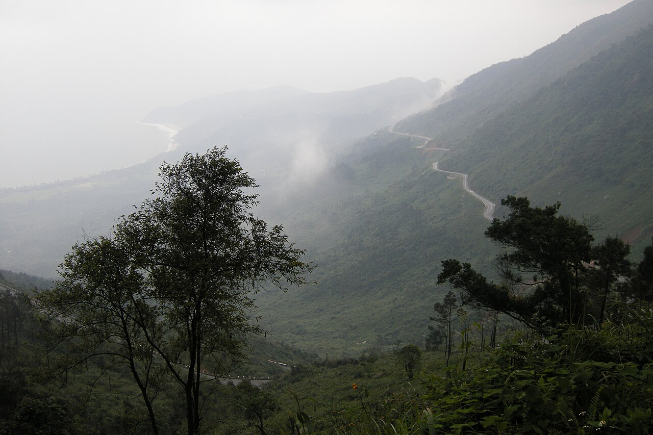
Hai Van Quan is a historic military gate situated at the summit of Hai Van Pass, which forms the natural boundary between Da Nang and Thua Thien-Hue provinces in central Vietnam. The structure represents a significant remnant of defensive architecture from periods of Vietnamese imperial history. Its position atop the pass affords commanding views over the surrounding coastal mountains and the East Sea. The site holds cultural and historical importance as a frontier checkpoint that once controlled movement between the ancient Champa territories and Dai Viet realms.
Checked 2026-08-31 · Source
The gate structure itself comprises stone fortifications with arched passageways, flanked by deteriorated defensive walls that extend along the ridgeline. Visitors can examine the weathered masonry construction and remaining architectural features of the original checkpoint. The immediate vicinity contains overgrown foundations of ancillary buildings and scattered remnants of former military installations. No visitor centre, museum exhibition, interpretive signage, or maintained facilities are present at the site. The attraction consists principally of the atmospheric ruins and the dramatic mountain landscape that surrounds them.
Checked 2026-08-31 · Source
A visit to Hai Van Quan typically requires between thirty minutes and one hour for examination of the structure and appreciation of the panoramic views. travellers incorporating the site into a broader Hai Van Pass crossing by motorbike or private vehicle should allocate additional time for the winding mountain road. Those arriving by organised transport or train will find the duration constrained by their return arrangements. The unstructured nature of the site permits flexible pacing according to individual interest in historical ruins and landscape photography.
Checked 2026-08-31 · Source

Open daily; the operator does not publish Hai Van Quan-specific clock times. The operator lists admission for the site and publishes no weekly closure day. Access may be interrupted for severe mountain weather or official safety measures. Weather conditions at Hai Van Pass vary considerably with elevation and season, affecting both road safety and visibility. Morning hours generally offer clearer atmospheric conditions before afternoon cloud accumulation common at altitude. The rainy season from approximately September to December increases landslide risk and reduces visibility. travellers should verify current road conditions locally before ascending, as maintenance closures occur without systematic notification.
Checked 2026-08-31 · Source
General admission is 70,000 VND per person per visit for Vietnamese and international visitors. This statutory tariff is effective from 2026-06-02 through 2028-12-31. No formal admission infrastructure exists at Hai Van Quan. travellers should carry sufficient funds for transport arrangements, as the remote location necessitates private vehicle, hired motorbike, or train passage. No facilities for refreshment, equipment rental, or guided services operate at the summit. Appropriate preparation for self-sufficient visitation is essential.
Checked 2026-08-31 · Source
Hai Van Quan stands at the summit of Hai Van Pass on National Route 1A. From central Da Nang, follow National Route 1A north for about 20 km to the foot of the pass, then take the approximately 20 km pass road; the ascent typically takes 45–60 minutes. Official city guidance names motorbike or scooter, a hired rider, a guided motorbike tour, and car as arrival options; it does not list a public bus serving the summit. Motorbikes cannot use the Hai Van Tunnel. The gate occupies the highest point of Hai Van Pass, accessible via National Route 1A or the older mountain road offering superior scenic value. Motorbike rental from Da Nang provides independent access for experienced riders comfortable with steep, winding gradients. Private car with driver represents a safer alternative for those unaccustomed to Vietnamese mountain road conditions. The reunification express train traverses the pass through tunnels, with brief stops not guaranteed. No public bus service terminates at the summit. Navigation requires attention as signage is minimal.
Checked 2026-08-31 · Source

The principal visitor route includes restored brick and stone steps between the gates, walls and defensive structures; no ramp or lift is documented. Handrails and guardrails are installed on parts of the stepped route. Visitors with a legally defined severe disability receive free admission; those with a legally defined heavy disability receive a 50% reduction. Mountain road conditions demand cautious driving, particularly during wet weather when surfaces become slippery and landslide debris may obstruct passage. Fog reduces visibility dramatically and unpredictably at altitude. The ruinous state of structures presents physical hazards including unstable masonry and unprotected drops. No emergency services or communication infrastructure operate at the remote summit. travellers should inform others of their itinerary, carry water and weather-appropriate clothing, and assess personal fitness for altitude exposure. Wildlife encounters, including macaque monkeys, require respectful distance.
Checked 2026-08-31 · Source
The summit position offers exceptional opportunities for landscape photography encompassing coastal plains, mountainous terrain, and atmospheric cloud formations. Early morning provides optimal natural lighting and reduced haze interference. The weathered textures of historic stonework suit detailed architectural study. Drone operation should observe Vietnamese aviation regulations and respect the sensitive border province location. No restrictions on photography are visibly posted, though discretion near any active military installations encountered in the broader pass area is prudent. Tripod use on uneven surfaces requires stability awareness.
Checked 2026-08-31 · Source
Emperor Minh Mang ordered Hai Van Quan built in 1826 as a military fortress protecting the southern approach to the imperial capital at Hue.
The complex includes two arched gates, the garrison residence known as Tru So, the ammunition store known as Vu Kho, defensive walls and associated guard structures.
Vietnam's Ministry of Culture, Sports and Tourism designated Hai Van Quan a national historical and architectural monument under Decision 1531/QD-BVHTTDL dated 2017-04-14.
The monument spans Da Nang and Hue and is jointly managed by the two municipal authorities; the Hue Monuments Conservation Centre is the statutory fee collector.
Children under 13 and visitors legally classified as having an especially severe disability enter free. Vietnamese citizens also enter free on Lunar New Year's Day, 26 March, 29 March, 19 August, 2 September, 23 November and 24 November.
The 50% reduction covers people legally classified as having a severe disability, older people, low-income households, eligible cultural-policy beneficiaries, residents of Hue and Da Nang, and specified student groups.
Loading the interactive map…
The interactive map could not be loaded.

Last updated:
Source: OpenStreetMap contributors ·