

7 min walk
Maison Alphonse-Desjardins
- Must see · Heritage site
- Museum
Language · 11 published
Nature site · Quebec City
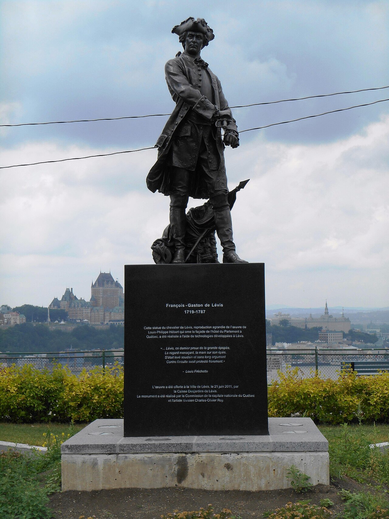
Terrasse du Chevalier-de-Lévis is an outdoor public terrace on the Lévis bluff, on the south shore of the St. Lawrence River opposite Québec City. Its purpose is simple and compelling: to provide an elevated view across the river toward Québec City’s historic waterfront. The terrace belongs to the municipal network of Lévis parks and green spaces. Its name refers to the Chevalier de Lévis, a military figure connected with the region’s colonial history. This is a viewpoint rather than a museum or enclosed attraction, so the visit centres on open sky, river distance, city architecture, and the changing atmosphere of the waterfront.
Checked 2026-08-26 · Source
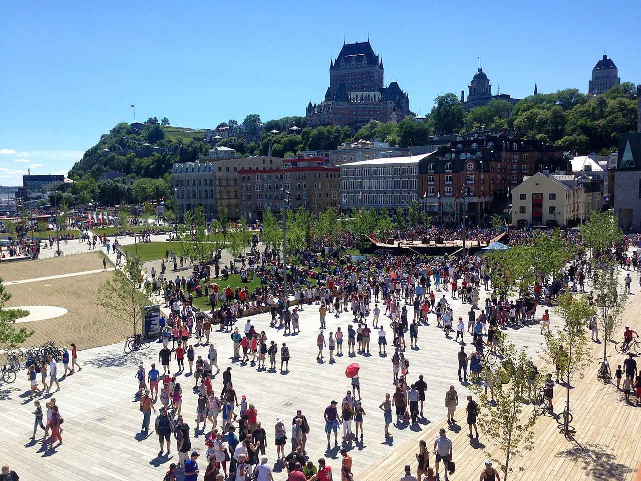
The terrace is an open paved viewing platform facing the river. From this elevated position, visitors can take in Québec City’s Lower Town, the Old Port, and the Upper Town rising behind them, with the distinctive profile of Château Frontenac forming a memorable focal point. Landscaped municipal park surroundings frame the panorama, but the view remains the principal reason to come. There are no galleries, exhibits, or indoor rooms to explore. Instead, the terrace offers a spacious pause above the river, where the relationship between Lévis and Québec City becomes clear through distance, elevation, shoreline, and skyline.
Checked 2026-08-26 · Source
A quick stop for the panorama can take fifteen to thirty minutes. Give yourself longer if you are watching the light move across Québec City, photographing the river, or combining the terrace with a walk along the Lévis waterfront and neighbouring park areas. Because the space is an open public viewpoint, there is no exhibition route or indoor programme that dictates the pace. It works equally well as a short scenic pause or as part of a relaxed south-shore outing. In poor weather, the view may be less rewarding, while clear conditions encourage a longer stay.
Checked 2026-08-26 · Source
The terrace is most rewarding when the air is clear enough to reveal Québec City across the St. Lawrence. Sunrise and sunset bring changing colour to the skyline and river, while evening can suit visitors interested in the illuminated cityscape. Fog and precipitation can obscure the view, so atmospheric conditions matter as much as the clock. Summer offers more comfortable time outdoors, but the exposed bluff becomes colder and more demanding in winter. Snow and ice also affect the paved surface. Dress for wind rather than relying on the temperature alone, and treat the terrace as an outdoor stop in every season.
Checked 2026-08-26 · Source
The terrace is a municipal public viewpoint, so a normal visit is free and does not follow the ticketed model of a museum or paid attraction. There is no reason to plan for an admission purchase simply to stand on the viewing platform. Its value lies in the panorama, not in a programme of commercial activities. If you are carrying photographic equipment or staying for an extended period, remember that the terrace is exposed to the elements and wind. Combine it with a Lévis waterfront walk if you want to turn the free viewpoint into a broader south-shore outing.
Checked 2026-08-26 · Source
Terrasse du Chevalier-de-Lévis is in Lévis, across the St. Lawrence from Québec City. Travellers coming from Québec City must cross the river by bridge or ferry before continuing through Lévis toward the bluff. The Québec Bridge, Pierre Laporte Bridge, and ferry connections provide the main crossing choices described for the two shores. The exact final approach is best handled with a current map, since local roads and pedestrian routes determine the last part of the journey. If you are already staying in Lévis, the terrace fits naturally into a waterfront walk or local park outing.
Checked 2026-08-26 · Source
The terrace occupies an elevated, exposed bluff above the river. Take care near edges and any sections without substantial protection, especially when snow, ice, fog, or darkness reduces visibility. Wind from the St. Lawrence can make the site feel much colder and can affect balance or loose belongings. Winter conditions may make the paved platform slippery. Summer storms can develop over the river, and the open terrace offers little shelter. Visitors with limited mobility should consider gradients and surface conditions when planning the final approach. Treat the viewpoint as an unstaffed public space and carry the self-reliance appropriate for an outdoor stop.
Checked 2026-08-26 · Source
The terrace’s main photographic strength is its broad opposite-shore perspective. Québec City’s waterfront, Lower Town, Old Port, Upper Town, and Château Frontenac can be arranged across a wide panorama, while the river supplies depth between foreground and skyline. Clear mornings reveal detail; evening light and illuminated buildings create a different mood. Wind is the practical challenge, particularly for tripods and lightweight equipment on the bluff. Secure cameras and bags, and allow extra time for changing weather. The terrace is also useful for observing the city as a whole rather than isolating a single building, making it a strong location for landscape and cityscape compositions.
Checked 2026-08-26 · Source
No. The terrace is in Lévis on the south shore of the St. Lawrence River, facing Québec City from across the water.
The elevated platform looks across the river toward Québec City’s Lower Town, Old Port, Upper Town, waterfront, and Château Frontenac skyline.
No. The St. Lawrence River separates the Old Town from the terrace. Cross by bridge or ferry, then continue through Lévis to the bluff.
Allow fifteen to thirty minutes for the view. Photographers and visitors combining it with a Lévis waterfront walk may stay considerably longer.
No normal admission fee is required for this municipal public viewpoint. The terrace is an open park space centred on its river panorama.
Clear conditions provide the best visibility across the river. Sunrise, sunset, and evening illumination create changing light on Québec City’s waterfront and skyline.
Loading the interactive map…
The interactive map could not be loaded.

Last updated:
Source: OpenStreetMap contributors ·