Smart Self-Managed Tours

City guide · Canada

Quebec City

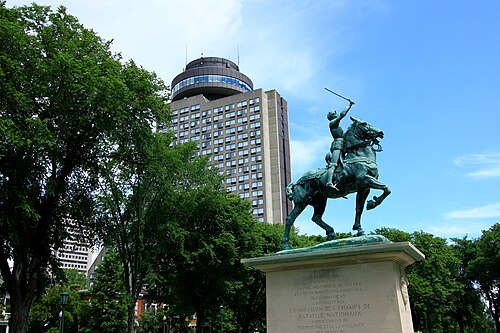
A photograph of Quebec City
Photograph · Wilfredor · CC0

Québec City is organised around a compact historic core above and below the St. Lawrence River cliffs. Old Québec divides into Upper Town and Lower Town, with the Old Port beside the river. Parliament Hill, Montcalm and Saint-Jean-Baptiste extend west from the walls, while Saint-Roch and Limoilou form lower, more local districts. Central neighbourhoods are close together; outer attractions require bus or another planned connection.

Practical information

Language spoken
English and French
National practical orientation; regional and minority languages may also be used
Dialling code
+1
International calling code; local area and mobile prefixes still apply
Currency
Canadian dollar (CAD)
Use the official local currency; card acceptance varies by place
Emergency number
911
Use only for an emergency; tourist assistance may use a separate number
Plug type
Type A and B · 120 V
Check that chargers support the recorded voltage before using an adapter
Tap water
Not recorded
Water systems and advisories are managed by multiple jurisdictions

Turn this list into a plan

Set your days, your pace and the hours you actually want to be out. The planner works around closing days and travel time, and leaves room to eat.

Plan Quebec City

Planning a visit

Suggested stay
Not recorded
Getting around
Walk and use RTC buses
  1. January: recurring difficult conditions
  2. February: recurring difficult conditions
  3. March: recurring difficult conditions
  4. April: viable with meaningful trade-offs
  5. May: best time to visit
  6. June: best time to visit
  7. July: good time to visit
  8. August: good time to visit
  9. September: best time to visit — current month
  10. October: good time to visit
  11. November: viable with meaningful trade-offs
  12. December: recurring difficult conditions
  • Best time
  • Good time
  • Viable with trade-offs
  • Difficult conditions

Sources

Top things to see

Ranked by importance — sitelinks, pageviews and heritage status, not editor preference.

  1. Roger-Van den Hende botanical garden Roger-Van den Hende botanical garden
    02 1 hour

    Roger-Van den Hende botanical garden

    Jardin botanique Roger-Van den Hende

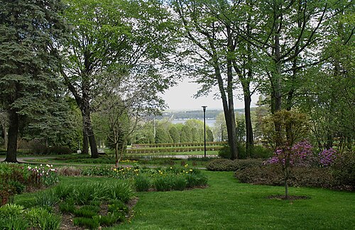
    Jardin botanique Roger-Van den Hende is a botanical garden operated by Université Laval in the Sainte-Foy district of Quebec City. It serves as both a public horticultural destination and an academic resource for the university.

    • Must see
    • Nature site
  2. Bois-de-Coulonge Park Bois-de-Coulonge Park
    03 1 hour

    Bois-de-Coulonge Park

    Parc du Bois-de-Coulonge

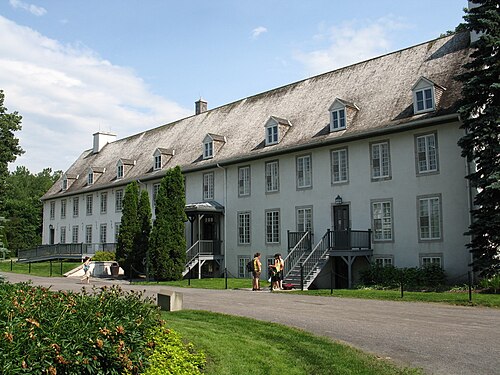
    Bois-de-Coulonge Park, known locally as parc du Bois-de-Coulonge, comprises landscaped former vice-regal grounds situated along a riverside in Québec City. The property served as the residence of Quebec lieutenant-governors, reflecting its historical significance in provincial governance.

    • Must see
    • Nature site
  3. Domaine de Maizerets Domaine de Maizerets
    04 1 hour

    Domaine de Maizerets

    Domaine de Maizerets is a historic estate on Quebec City's east side, encompassing extensive gardens and parkland. The property functions as a public green space where visitors can experience landscaped grounds with heritage character.

    • Must see
    • Nature site
  4. Parc Chauveau Parc Chauveau
    05 1 hour

    Parc Chauveau

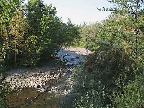
    Parc Chauveau is Quebec City's largest park, situated along the Saint-Charles River. This extensive green space serves as a genuine riverfront outdoor destination for residents and visitors seeking natural surroundings within the urban environment.

    • Must see
    • Nature site
  5. Parc des Moulins Parc des Moulins
    06 1 hour

    Parc des Moulins

    Parc des Moulins is a public park in Quebec City situated on the former grounds of the city's zoo. The site has been transformed into a broad garden space and family recreation area.

    • Must see
    • Nature site
  6. Base de plein air de Sainte-Foy Base de plein air de Sainte-Foy
    07 1 hour

    Base de plein air de Sainte-Foy

    Base de plein air de Sainte-Foy is an outdoor recreation area located in the Sainte-Foy district of Quebec City. It operates as a municipal facility providing urban residents and visitors with access to natural spaces for seasonal activities.

    • Must see
    • Nature site
  7. Quai Paquet Quai Paquet
    08 1 hour

    Quai Paquet

    Quai Paquet is a redeveloped public plaza and ferry terminal located in Lévis, directly across the Saint Lawrence River from Québec City.

    • Must see
    • Nature site
  8. Terrasse du Chevalier-de-Lévis Terrasse du Chevalier-de-Lévis
    09 1 hour

    Terrasse du Chevalier-de-Lévis

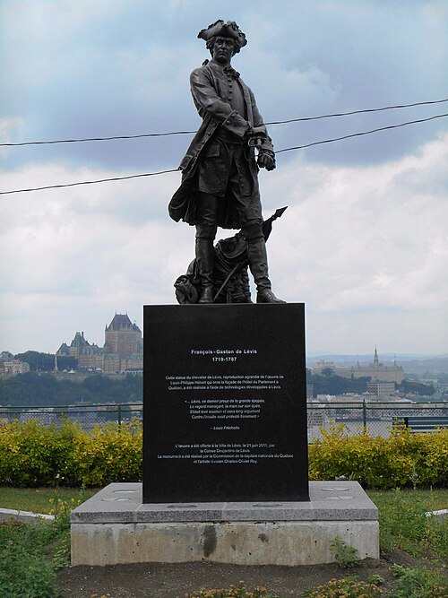
    Terrasse du Chevalier-de-Lévis is a public terrace situated on the Lévis bluff overlooking the St. Lawrence River. The terrace is positioned on the south shore, directly facing Québec City's historic waterfront and skyline.

    • Must see
    • Nature site
  9. Place des Canotiers Place des Canotiers
    10 1 hour

    Place des Canotiers

    Place des Canotiers is a public plaza situated in Quebec City's Old Port area, positioned at river level beneath the elevated historic district of Old Quebec.

    • Must see
    • Nature site
  10. Jardin Jeanne-d'Arc Jardin Jeanne-d'Arc
    11 1 hour

    Jardin Jeanne-d'Arc

    Jardin Jeanne-d'Arc is a formal garden located within the broader Plains of Abraham in Quebec City. Named after Joan of Arc, the garden features seasonal flower displays and a statue of its namesake.

    • Must see
    • Nature site

Source: OpenStreetMap contributors, Wikidata ·

How the city is laid out

Upper Town occupies the fortified plateau around Château Frontenac and the main gates. Lower Town sits beneath the cliff around Place Royale and the Old Port, linked by steep streets, stairs and the funicular. Parliament Hill and the Plains of Abraham are west of the walls; Saint-Jean-Baptiste and Montcalm continue beyond them. Saint-Roch lies below the escarpment, with Limoilou farther north across the Saint-Charles River.

Checked 2026-08-26

Getting around

Walk between the central neighbourhoods, allowing for steep grades between Upper and Lower Town. The RTC bus network serves the city centre, central districts, suburbs, the airport and both train stations. Frequent Métrobus routes carry numbers in the 800s and are useful beyond the historic core. Use the official RTC trip planner and current notices because construction, weather and traffic can alter stops and schedules.

Checked 2026-08-26

Common questions

How many days should I spend in Québec City?

A fixed stay length is not recorded. Plan Upper and Lower Town first, then add Parliament Hill, Montcalm, Saint-Roch or an outer excursion according to your priorities.

Is Old Québec walkable?

Yes. Its principal areas are compact, but Upper and Lower Town are separated by a steep escarpment, stairs and sloping streets.

What is the difference between Upper and Lower Town?

Upper Town occupies the fortified plateau; Lower Town lies beneath it around Place Royale and the Old Port. Routes between them include steep streets, stairs and the funicular.

How do I get around beyond Old Québec?

Use RTC buses. The network serves central neighbourhoods, suburbs, the airport and both train stations, with frequent Métrobus routes on major corridors.

Are Québec City's central neighbourhoods far apart?

No. The official visitor guide describes them as concentrated in a relatively small area, though elevation changes can make short map distances more demanding on foot.