.jpg)

121 min walk
Kaunos
- Must see · Heritage site
- Historic monument
Language · 11 published
Nature site · Muğla
Köyceğiz Gölü
| Monday | 00:00 – 23:59 |
|---|---|
| Tuesday | 00:00 – 23:59 |
| Wednesday | 00:00 – 23:59 |
| Thursday | 00:00 – 23:59 |
| Friday | 00:00 – 23:59 |
| Saturday | 00:00 – 23:59 |
| Sunday | 00:00 – 23:59 |
Checked 2026-09-02 · Source
Read from the OpenStreetMap access tags; anything not listed has no tag recorded.
Set the group type to family in the planner and the day window contracts to about three quarters of a solo day.
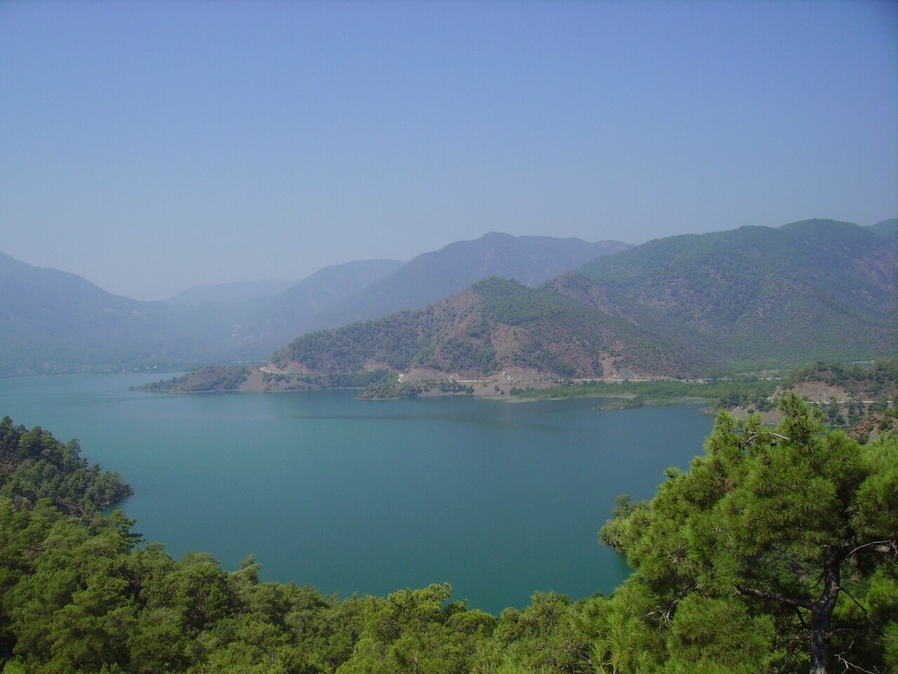
Lake Köyceğiz is a large natural lake beside Köyceğiz town in Muğla Province. Muğla Governorate gives its area as about 54 square kilometres, while the municipality describes the lake area as 6,300 hectares. It is an open landscape rather than a compact attraction with one entrance gate. The municipality says the lake retains its character in summer and winter. Its water is described as sulphurous, and the lake is a spawning area for mullet. The lake belongs to a wider wetland and channel system linking Köyceğiz, Dalyan and the Mediterranean. Visit Lake Köyceğiz for broad water views and the changing relationship between the shoreline, open water and connected waterways.
Checked 2026-09-02 · Source
Lake Köyceğiz offers shoreline views, broad water vistas and access to a water system leading towards the coast. Namnam Çayı, Kargıcak Çayı and Yuvarlak Çay feed the lake. The lake drains through the approximately 10-kilometre Dalyan channel to the Mediterranean, and its depth varies from approximately 15 to 150 metres. The main experience is the landscape itself: open water, surrounding land and the town-side edge. Boat-based sightseeing is available separately, extending the visit into the connected lake and channel route.
Checked 2026-09-02 · Source
Allow at least one hour for a simple lakeside visit, and longer if Lake Köyceğiz is part of a relaxed day in Köyceğiz. The lake covers about 54 square kilometres, so no short walk represents the entire natural area. Walking or driving from town lets you choose a shoreline point and set your own pace. A boat tour needs separate time because it crosses the lake and continues through the Dalyan channel towards İztuzu Beach. A brief stop works for orientation, while a longer half-day plan allows time for views, photography and a boat-based perspective.
Checked 2026-09-02 · Source
Lake Köyceğiz is suitable for an outdoor visit throughout the year. The municipality specifically describes the lake as retaining its character in both summer and winter. Summer is the season identified by Muğla Governorate for day boat tours across Lake Köyceğiz and the Dalyan channel to İztuzu Beach. Choose summer for the clearest boat-tour opportunity. For a shoreline visit, timing is flexible, although weather, shade and surface conditions vary between different points around the lake. A quieter winter visit offers the same enduring natural setting without relying on a boat service.
Checked 2026-09-02 · Source
Natural shoreline access at Lake Köyceğiz is free. Muğla Governorate distinguishes this open access from boat tours, which are separate services rather than part of a lake admission ticket. No staffed visitor gate or general entrance tariff is identified for the natural area. A boat journey must be arranged separately through the service providing it; departure point, operating conditions and payment belong to that transport or tour service. Free entry means access to the natural shore, not a bundled pass for the wider lake-and-channel system.
Checked 2026-09-02 · Source
From Köyceğiz town, reach Lake Köyceğiz by walking or by car along the lakeside. Because the lake is extensive, arrival depends on the shoreline point selected rather than one official entrance address. Muğla Governorate information also identifies boat tours crossing Lake Köyceğiz and the Dalyan channel towards İztuzu Beach. Transport on the lake and Dalyan channels is overseen through the relevant public administration board. For a shore visit, choose the point that matches your intended walk and access needs. For a water-based outing, use an organised service operating within the regulated transport framework.
Checked 2026-09-02 · Source
Step-free access at Lake Köyceğiz is limited because shoreline conditions vary. No official step-free facility is identified for the lake as a whole, so wheelchair and pushchair users should assess the chosen access point before travelling. There is no identified staffed gate, controlled route or uniform surface across the natural area. The lake is a mullet spawning area, and its water is described as sulphurous. Keep clear of unstable edges and respect the wetland setting. Boat travel is separate, with transport on the lake and channels subject to public administration oversight.
Checked 2026-09-02 · Source
Photograph Lake Köyceğiz as a broad landscape, including the water, opposite shore and the channels’ changing relationship with the lake. Its approximately 54-square-kilometre scale suits wide compositions better than a tight attempt to frame the whole setting. Shoreline surfaces differ, so choose stable ground away from edges before using a camera or phone. A summer boat tour provides a moving viewpoint across Lake Köyceğiz and the Dalyan channel towards İztuzu Beach. Keep equipment secure on the moving vessel, follow the operator’s directions and avoid disturbing wildlife or mullet spawning areas. The open scale rewards photographs showing water, distance and surrounding land together.
Checked 2026-09-02 · Source
Muğla Governorate gives Lake Köyceğiz an area of about 54 square kilometres. The municipality describes the lake area as 6,300 hectares.
Lake Köyceğiz has a variable depth of approximately 15 to 150 metres.
Namnam Çayı, Kargıcak Çayı and Yuvarlak Çay feed Lake Köyceğiz.
Lake Köyceğiz drains through the approximately 10-kilometre Dalyan channel to the Mediterranean.
Yes. Muğla Governorate identifies summer day boat tours crossing Lake Köyceğiz and the Dalyan channel to İztuzu Beach. These tours are separate from free shoreline access.
Lake Köyceğiz is a spawning area for mullet, and Muğla Governorate describes its water as sulphurous.
Loading the interactive map…
The interactive map could not be loaded.


Last updated:
Source: OpenStreetMap contributors, Wikidata ·