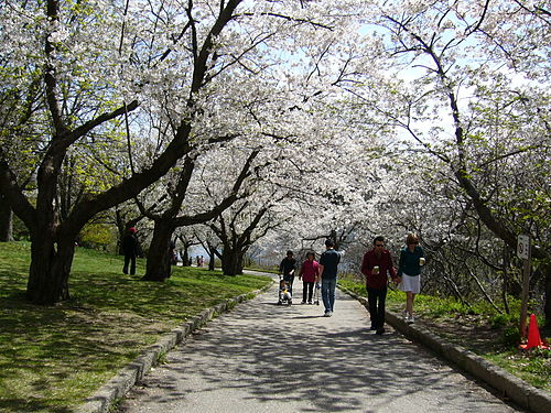
High Park
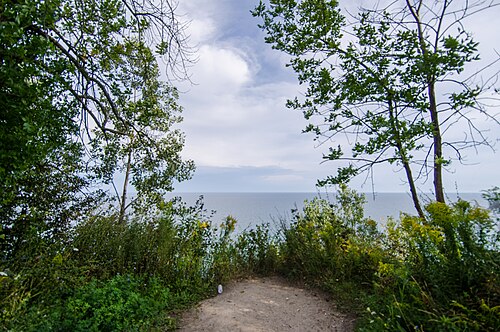
High Park is Toronto's largest central public park, situated in the city's west end. The municipal park encompasses a significant natural area including oak savannah, woodlands, and waterfront along Grenadier Pond.
- Must see
- Nature site
Language · 11 published
City guide · Canada
Toronto is a city of neighbourhoods arranged around a compact downtown and long transit corridors. The City Centre contains the financial, entertainment and waterfront districts; Old Town lies east, the Westside extends through Queen West and beyond, and Midtown and Uptown follow the main north-south axes. Toronto Islands, Scarborough and Etobicoke are separate trips. Group downtown sights on foot and use the TTC for wider movement.
Set your days, your pace and the hours you actually want to be out. The planner works around closing days and travel time, and leaves room to eat.
Ranked by importance — sitelinks, pageviews and heritage status, not editor preference.
20 places match
Category
Typical visit duration
Interests
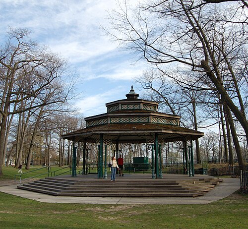
High Park is Toronto's largest central public park, situated in the city's west end. The municipal park encompasses a significant natural area including oak savannah, woodlands, and waterfront along Grenadier Pond.
Toronto Music Garden is a waterfront public garden on Lake Ontario, designed with cellist Yo-Yo Ma to interpret Johann Sebastian Bach’s First Cello Suite through landscape architecture.
Roundhouse Park
Roundhouse Park is a railway heritage park located in downtown Toronto, adjacent to the CN Tower. The park occupies a historically significant site that was once part of the Canadian Pacific Railway's John Street Roundhouse operations.
Guild Park and Gardens is a public park in the Scarborough district of Toronto, Ontario. The park occupies the grounds of the former Guild Inn, a historic artists' colony and hotel that operated from the 1930s until 2001.
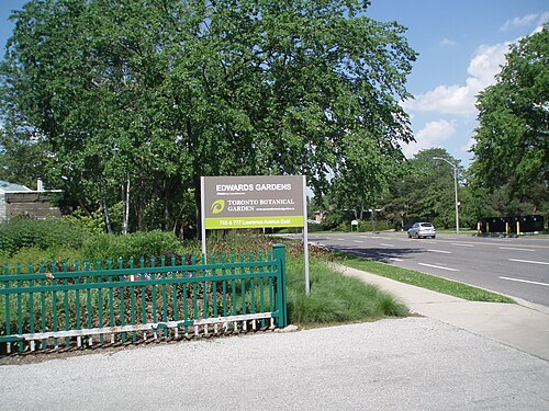
The Toronto Botanical Garden is a major public garden complex located in Toronto, Ontario, Canada. It occupies a significant site beside Edwards Gardens, forming part of an important horticultural destination in the city's northeastern area.
Edwards Gardens is a formal former estate garden located in Toronto, Ontario. It serves as the landscape setting for the adjacent Toronto Botanical Garden. The gardens were originally developed as a private estate before becoming a public space.
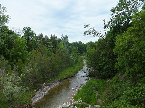
Rouge National Urban Park is Canada's first national urban park, established to protect natural, cultural, and agricultural landscapes within a major metropolitan area. It encompasses diverse ecosystems along the Rouge River watershed at Toronto's eastern edge, extending into neighbouring municipalities.
Tommy Thompson Park
Tommy Thompson Park occupies the Leslie Street Spit, a long waterfront peninsula extending into Lake Ontario from Toronto’s port lands. Its wetlands, meadows, forests and shoreline create an urban nature destination with important wildlife habitat.
Sunnyside Beach is a west-end lakefront beach and boardwalk in Toronto, Ontario. It occupies a historic recreational area along the northwestern shore of Lake Ontario, within the broader Sunnyside neighbourhood.
Woodbine Beach is the principal public swimming beach in The Beaches neighbourhood of Toronto, Ontario. It stretches along the shore of Lake Ontario and serves as the area's main summer recreation destination.
Trinity Bellwoods Park is a large public green space in Toronto’s west end, between Queen Street West and Dundas Street West.
Queen’s Park is a civic park in central Toronto, surrounding the Ontario Legislative Building. It combines landscaped grounds, open lawns, mature trees, pathways, monuments, and the visible exterior of the provincial legislature.
Grange Park is a public green space in downtown Toronto, directly behind the Art Gallery of Ontario and beside OCAD University.
Christie Pits Park
Christie Pits is a large urban park in Toronto, Ontario. The park occupies a significant depression in the city's topography, forming a natural amphitheatre with a prominent hill at its centre.
Corktown Common
Corktown Common is a large public park in Toronto’s West Don Lands. It combines recreation, habitat, and flood protection for the lower Don River area.
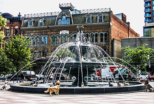
Berczy Park is a compact public park in Toronto’s Old Town, close to Front Street, Scott Street, St. Lawrence Market, and the historic commercial streets around them.
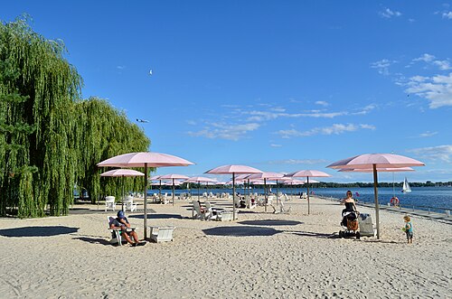
Sugar Beach is a public waterfront park on Toronto's eastern harbour. Its sandy beach, pink umbrellas, and shoreline seating create a distinctive public space beside an area shaped by industrial harbour activity.
HTO Park is an urban beach park located on Toronto's central waterfront. The park features sandy beach areas, grassy lawns, and distinctive yellow umbrellas that have become a visual signature.
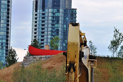
Canoe Landing Park is a public park in Toronto's CityPlace neighbourhood, surrounded by high-rise residential towers and former railway lands. Its identity comes from public art by Canadian artist and author Douglas Coupland, especially the large red canoe.
Kew Gardens is a historic public park in Toronto’s Beaches neighbourhood, close to Lake Ontario. It is a neighbourhood green space rather than a botanical institution, offering landscaped areas, lawns, trees and room for community life.
Source: OpenStreetMap contributors, Wikidata ·
Lake Ontario forms Toronto's southern edge, with the downtown core immediately north of the waterfront. The Entertainment District and Financial District sit centrally; Old Town and the Distillery District are east, while Queen West, Ossington and High Park extend west. Midtown and Uptown follow Yonge Street north. The Toronto Islands require a ferry, and Scarborough and Etobicoke sit well outside the central walking area.
Checked 2026-08-26
Walk through the compact downtown and use the TTC subway, streetcars and buses for longer journeys. Streetcars are particularly useful across east-west neighbourhood corridors, while the subway handles the principal north-south and cross-city axes. The PATH provides an underground pedestrian network through the downtown core. Ferries serve the Toronto Islands, and regional rail is useful for airport and Greater Toronto connections.
Checked 2026-08-26
A fixed stay length is not recorded. Plan the downtown and waterfront first, then add neighbourhoods, Toronto Islands or an outer district according to your interests.
Yes. The City Centre, waterfront, Old Town and nearby westside districts are accessible on foot, with the TTC available for longer links.
Use a combination of walking and TTC subway, streetcar and bus services. The network connects downtown with neighbourhoods along the city's main corridors.
PATH is an underground pedestrian network through downtown Toronto. It links buildings and services and can provide a sheltered walking option in poor weather.
No. The islands are offshore and require a ferry or another authorised water connection. Treat them as a separate excursion from the downtown waterfront.