
36 min walk
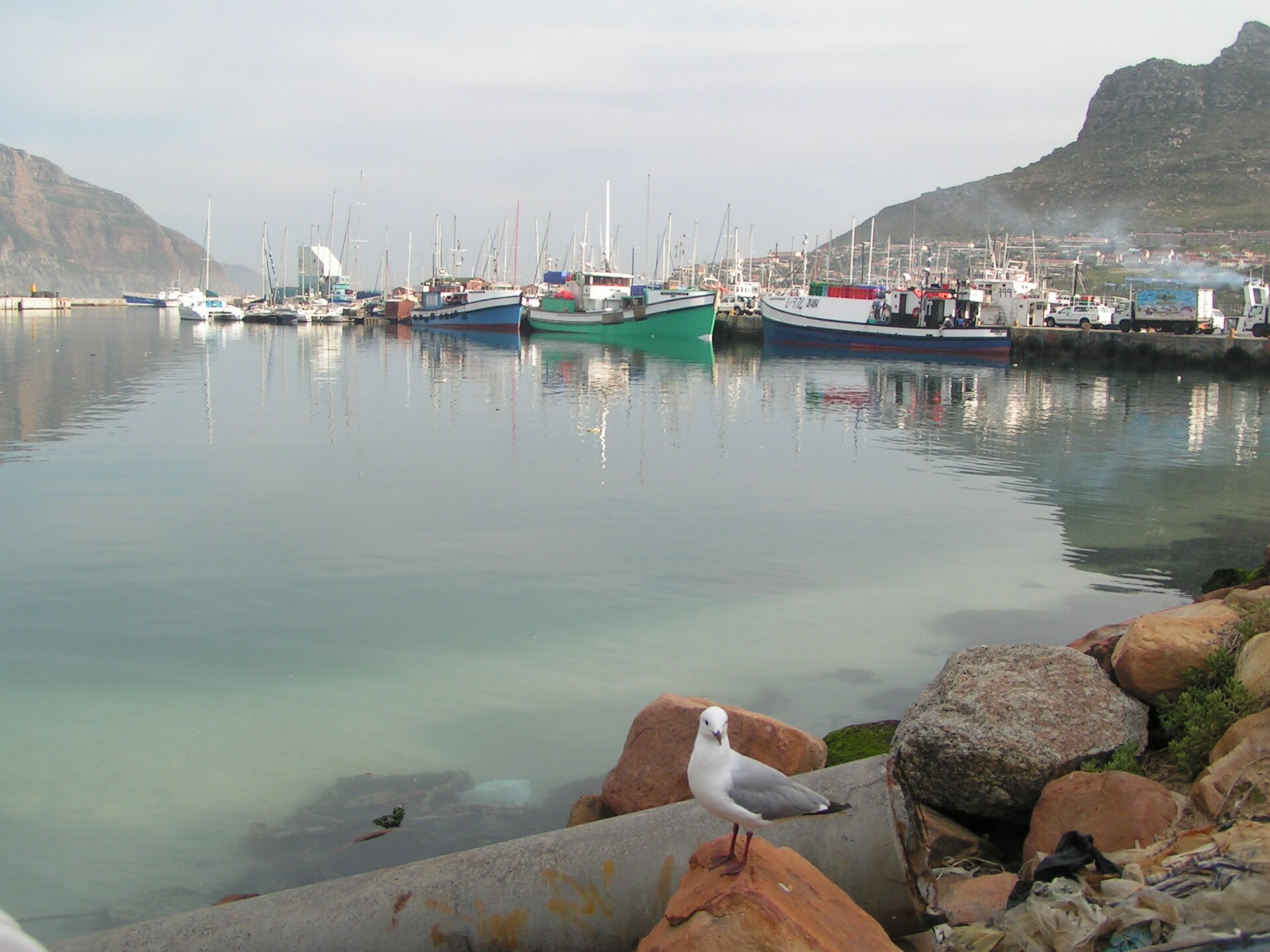
Hout Bay Harbour
- Must see
- Activity
Language · 11 published
Activity · Cape Town
Reviewed by Elena Voss · SSMTour Travel Editor
Read from the OpenStreetMap access tags; anything not listed has no tag recorded.
Set the group type to family in the planner and the day window contracts to about three quarters of a solo day.
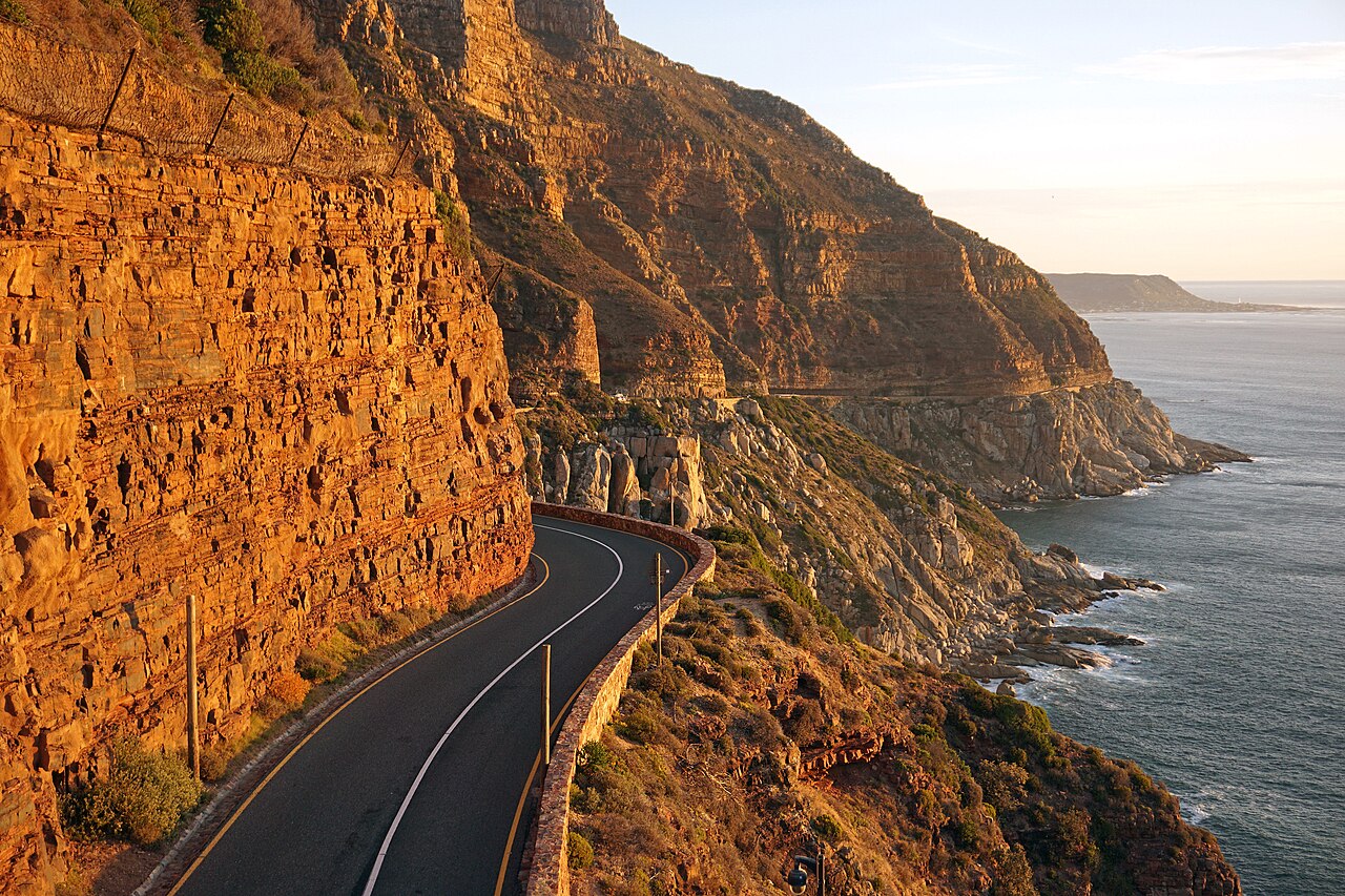
Chapman's Peak Drive is a spectacular coastal road that winds along the Atlantic-facing cliffs between Hout Bay and Noordhoek on the Cape Peninsula. The route is carved into the steep mountainside, offering dramatic ocean views from elevated vantage points. It forms an essential segment of the longer Cape Point scenic route, connecting communities on the western side of the Peninsula. The road has achieved iconic status among visitors to Cape Town for its engineering and natural setting. The operator currently lists the road as closed. When open, free Day Pass access from Hout Bay operates 06:00–20:00 October–March and 07:00–18:30 April–September.
Checked 2026-08-31 · Source
The drive itself constitutes the primary experience, with multiple viewpoints positioned along its length for stopping and appreciating the scenery. The surrounding terrain consists of rugged cliff faces, fynbos vegetation, and the open Atlantic below. Hout Bay lies at the northern end, a working harbour community with fishing vessels and waterfront activity. Noordhoek sits at the southern terminus, known for its expansive beach and more rural atmosphere. The transition between these two environments frames the journey. There are no fixed weekly closure days. Safety closures may occur because of high winds, heavy or continuous rain, maintenance, or rock clearance.
Checked 2026-08-31 · Source
The distance covered is relatively modest, though travel time varies considerably depending on traffic conditions and stopping patterns. Many visitors incorporate the drive into a full-day Peninsula excursion continuing to Cape Point. Allowing sufficient time for brief stops at viewpoints extends the experience beyond mere transit. The road demands attentive driving regardless of duration. Seasonal traffic fluctuations affect pacing, with peak visitor periods bringing slower progress. The standard once-off toll is R68 per light vehicle, per direction, including 15% VAT. A free Day Pass covers the first 2.7 km from the Hout Bay entrance to the Day Pass Control Unit during seasonal Day Pass hours.
Checked 2026-08-31 · Source
Clear visibility significantly enhances the experience, as cloud and mist can obscure the coastal panoramas that define the route. Morning light often provides favourable conditions for westward ocean views. Weather on this exposed coastline changes rapidly, and conditions at the Hout Bay end may differ from those at Noordhoek. Wind is a frequent factor. The operator currently lists the road as closed. When open, free Day Pass access from Hout Bay operates 06:00–20:00 October–March and 07:00–18:30 April–September. The principal scenic experience is available from a road vehicle. The free Day Pass section includes designated viewing spots and picnic areas before the control point.
Checked 2026-08-31 · Source
The road operates as a tolled route, with fees collected for passage. Visitors should anticipate that costs may apply and prepare accordingly. The toll infrastructure suggests that unmanned or free passage should not be assumed. The standard once-off toll is R68 per light vehicle, per direction, including 15% VAT. A free Day Pass covers the first 2.7 km from the Hout Bay entrance to the Day Pass Control Unit during seasonal Day Pass hours. The principal scenic experience is available from a road vehicle.
Checked 2026-08-31 · Source
The drive connects Hout Bay, accessible from Cape Town via Victoria Road through Camps Bay, with Noordhoek, which links onward to the Cape Point route through Kommetjie. Self-drive represents the standard means of traversing the route. The southern connection integrates with broader Peninsula exploration. The toll road runs between Hout Bay at its northern end and Noordhoek at its southern end. MyCiTi route 109 provides service to the named Hout Bay stop; continue by road vehicle to the Hout Bay toll entrance. Free Day Pass entry is available only from the Hout Bay side. Buses using the drive may travel only from Hout Bay toward Noordhoek.
Checked 2026-08-31 · Source
The road features tight curves with steep drops to the ocean side, requiring consistent driver concentration and appropriate speed. Cyclists and pedestrians occasionally share portions of the route, particularly near viewpoints. Rockfall remains an inherent hazard in this geologically active cliff environment, with protective netting and catchment structures visible but not eliminating risk. Overtaking opportunities are limited. The principal scenic experience is available from a road vehicle. The Day Pass also covers mountain trails, so the complete visitor experience is not step-free. The route is 9 km long and has 114 curves.
Checked 2026-08-31 · Source
Numerous informal stopping points provide opportunities to capture the cliff and ocean relationship, though designated viewpoint infrastructure varies. The elevation above sea level creates dramatic perspective possibilities. Mid-morning to early afternoon typically offers the most favourable light on the western-facing coastline. Safety considerations should override optimal positioning, as the road edge presents genuine hazard. Wide-angle lenses accommodate the sweeping vistas, while telephoto options compress the cliff layers. Drone operation would require careful assessment of wind conditions and regulatory compliance. The route is 9 km long and has 114 curves. It follows the Atlantic coast between Hout Bay and Noordhoek.
Checked 2026-08-31 · Source
The route is 9 km long and has 114 curves.
It follows the Atlantic coast between Hout Bay and Noordhoek.
The Day Pass covers the first 2.7 km from the Hout Bay toll-plaza building to the Day Pass Control Unit.
The toll plaza accepts cash and cards, except American Express and Diners Club.
No. Buses may travel only southbound from Hout Bay to Noordhoek.
No. Pedestrian movement is prohibited at all times between Lookout Point and Noordhoek Corner, from km 28.6 to km 33.1.
Loading the interactive map…
The interactive map could not be loaded.
Last updated:
Source: OpenStreetMap contributors, Wikidata ·