


6 min walk
Jardin de l'Agdal
- High
- Historic monument
Language · 11 published
Historic monument · Marrakesh
Bab Hmar

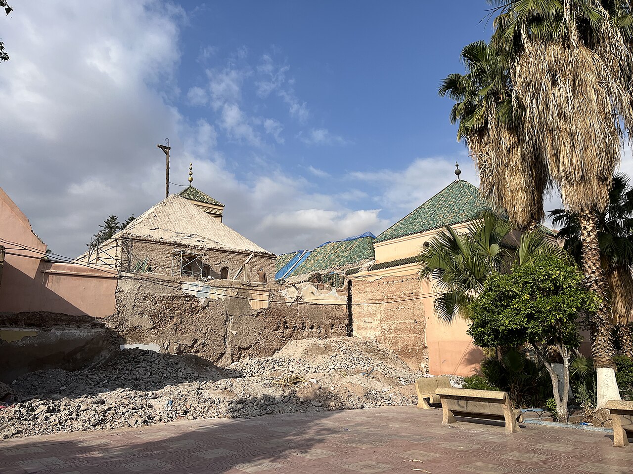
Bab Hmar is a historic city gate in Marrakesh, Morocco. The name translates to Red Gate, reflecting the distinctive ochre-colored architecture typical of the city. As one of the fortified entrances to the old medina, it forms part of the defensive walls that have enclosed Marrakesh for centuries. The gate represents traditional Moroccan military architecture and urban planning. Visitors encounter an authentic landmark that has witnessed the passage of traders, travelers, and residents throughout the city's history. Its preservation contributes to understanding how medieval Islamic cities organized their boundaries and controlled access to commercial and residential quarters.
Checked 2026-08-26
Bab Hmar functions primarily as a passage rather than an enclosed monument with interior chambers. The structure comprises the gate archway itself, with surrounding defensive wall segments visible to observers. The immediate vicinity contains narrow medina streets that extend inward from the threshold. Nearby areas typically feature small commercial establishments, residential buildings, and the dense urban fabric characteristic of old Marrakesh. The gate does not contain dedicated exhibition spaces, visitor centers, or interpretive installations. The architectural interest lies in the stonework, arch configuration, and the spatial experience of moving through a historic threshold between the city exterior and the medina interior.
Checked 2026-08-26
A visit to Bab Hmar requires minimal dedicated time if approached as a photographic stop or brief architectural observation. Most visitors integrate the gate into broader medina exploration rather than treating it as a standalone destination. Allow approximately fifteen to thirty minutes for appreciation of the structure and surrounding context. Those interested in architectural details or comparative study of Marrakesh gates may extend this duration. The gate serves effectively as a waypoint during longer walking itineraries through the old city. Its value increases substantially when combined with visits to adjacent quarters, markets, and other historic monuments within walking distance.
Checked 2026-08-26
Operator-confirmed hours are Not recorded pending review. Bab Hmar operates as a public thoroughfare rather than a ticketed attraction with controlled access. The gate remains passable at all hours as part of the functioning medina infrastructure. Visitors should consider daylight hours for optimal visibility of architectural details and safer navigation of surrounding streets. Early morning and late afternoon typically offer favorable lighting conditions for observation and photography. The climate of Marrakesh features extremely hot summers and mild winters, influencing comfort during extended outdoor exploration. Evening passage may present reduced visibility and requires additional caution in narrow, irregularly lit medina passages.
Checked 2026-08-26
Operator-confirmed prices are Not recorded pending review. Bab Hmar does not function as a commercial tourist attraction requiring admission fees. Access through the gate is free as part of the public street network. No ticket offices, turnstiles, or payment checkpoints exist at this location. Visitors should remain alert to unofficial individuals soliciting payments for access or guidance, which are not legitimate requirements. Standard travel budgeting for Marrakesh should account for nearby commercial activities, refreshments, or guided services if separately engaged. The absence of formal ticketing reflects the gate's integration into daily urban life rather than museum or monument management protocols.
Checked 2026-08-26

Bab Hmar sits within the historic medina of Marrakesh, accessible primarily by foot once visitors reach the old city perimeter. The medina's narrow streets and irregular layout make private vehicle access impractical in immediate proximity. Taxis and buses serve points outside the walls, requiring subsequent walking. Visitors should obtain specific local directions as medina navigation challenges even experienced travelers. Distinctive landmarks and asking residents typically prove more reliable than street signage. The gate's position on the medina edge may offer more straightforward approach than interior destinations. Allow additional time for wayfinding in this complex urban environment.
Checked 2026-08-26
Medina navigation presents genuine challenges including dead ends, similar-looking passages, and limited signage. Visitors should maintain awareness of personal belongings in crowded conditions. Motorcycles frequently traverse narrow streets at surprising speed, requiring vigilance. The gate passage may become congested with local traffic, commerce, and pedestrians. Independent exploration after dark demands additional caution regarding visibility and orientation. Some individuals may offer unsolicited guidance expecting compensation; clear communication about expectations prevents disputes. The physical environment includes uneven surfaces, steps, and low passages unsuitable for mobility-impaired visitors. Hydration and sun protection prove essential during warmer months given limited shade and the exertion of medina walking.
Checked 2026-08-26
Bab Hmar offers substantial photographic interest through its architectural form, textural surfaces, and contextual setting. The red-hued stonework responds dynamically to varying light conditions throughout the day. Morning and evening light particularly enhance dimensional qualities and color saturation. The gate functions effectively as both subject and framing device for street scenes extending into the medina. Photographers should exercise sensitivity regarding residents and passersby, obtaining implicit or explicit permission when individuals feature prominently. Tripod use in narrow, trafficked passages may obstruct movement and attract unwanted attention. Interior gate shadows contrast sharply with exterior brightness, presenting exposure challenges requiring technical adjustment.
Checked 2026-08-26
The gate operates as a public thoroughfare without controlled access hours. It remains passable daily as part of the functioning medina infrastructure.
No admission fee is required. The gate is freely accessible as part of the public street network.
The narrow dimensions and medina context suggest pedestrian and limited motorcycle traffic rather than general vehicle access.
Standard urban precautions apply. Visitors should remain aware of surroundings, secure belongings, and exercise caution with navigation and traffic.
No formal tour operations are based at this location. Visitors may encounter independent guides offering services in the surrounding area.
Modest dress consistent with Moroccan cultural norms is appropriate. Comfortable walking shoes are essential for medina exploration.
Loading the interactive map…
The interactive map could not be loaded.

Last updated:
Source: OpenStreetMap contributors, Wikidata ·