
2 min walk
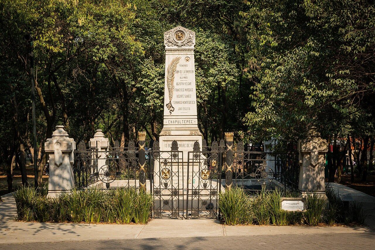
Obelisco a los Niños Héroes
- High
- Historic monument
Language · 11 published
Nature site · Mexico City

Chapultepec Park, known locally as Bosque de Chapultepec, is one of the largest city parks in the Western Hemisphere and a defining public space of Mexico City. The park spans multiple sections across a major urban forest, serving as ecological reserve, recreational ground, and cultural corridor. It contains lakes, wooded areas, and open lawns that have been central to Mexico City life since pre-Hispanic times. The name derives from Nahuatl, meaning grasshopper hill. The park operates under city environmental authority oversight.
Checked 2026-08-26
The park contains numerous separately entered institutions distributed across its sections. These include the Chapultepec Castle, the National Museum of Anthropology, the Modern Art Museum, the Tamayo Museum, the Natural History Museum, and a zoo. Lakes with boat rentals, walking paths, and monuments are scattered throughout. Each museum and the castle maintain their own entry protocols. The park functions as the containing landscape; visitors should not assume unified access or ticketing across these distinct cultural venues.
Checked 2026-08-26
Duration depends entirely on visitor intent. Casual park exploration of green spaces and lakes may occupy two to three hours. Individual museums typically demand half-days each. The castle requires additional dedicated time. A comprehensive visit attempting multiple major institutions plus park grounds would extend across multiple days. Most visitors select specific destinations within the park rather than attempting complete coverage. Walking distances between sections are substantial; internal navigation time must be factored into planning. Chapultepec Park also earns time in a mexico city itinerary because Chapultepec Park is the broader landscape and public-space visit; the castle and museums remain separately entered institutions within it. Its value becomes clearer when the stop is compared with the surrounding streets and the other ranked places nearby.
Checked 2026-08-26
The park is publicly accessible as urban green space, though specific operating parameters for the grounds and any controlled access points are Not recorded pending review. Operator-confirmed hours are Not recorded pending review. Weekend crowds are consistently heavier across all sections. Morning hours generally offer calmer conditions for walking and photography. Seasonal variations in Mexico City climate affect comfort; rainy season afternoons may disrupt outdoor activity. Visitors should verify current conditions through official channels before finalizing plans.
Checked 2026-08-26
The park landscape itself functions as public space without entry fee for general ground access. However, operator-confirmed prices are Not recorded pending review. Each internal institution—the castle, museums, zoo—maintains separate ticketing structures. Some museums offer free entry on specific days, though these policies change and are Not recorded pending review. Visitors should not assume bundled access. Budgeting requires treating each destination as independent expense. Verification through individual institutional websites is essential before visit. A flexible visit lets travellers connect Chapultepec Park with the rest of the day without treating one room, viewpoint or photograph as the whole experience. The useful pace depends on personal interest and conditions on arrival.
Checked 2026-08-26
The park sits centrally within Mexico City, accessible via multiple transit modes. Metro stations flank different sections, including Chapultepec and Auditorio on Line 7. Metrobus corridors serve adjacent avenues. Ride-hailing and taxi drop-off points cluster near major entrances, though traffic congestion is predictable. Bicycle lanes connect to the park perimeter. Walking approaches vary by neighborhood origin. Visitors should identify their target section before selecting transit, as distances between park extremities are considerable and not efficiently traversable on foot.
Checked 2026-08-26
Crowd density fluctuates dramatically; weekends and holidays bring extreme visitor numbers. Personal belongings require attention in congested areas. The park's scale creates disorientation risk; maps or digital navigation assist orientation. Food and beverage vendors operate throughout, though quality varies. Some peripheral zones after dark warrant caution consistent with large urban park protocols. Physical preparedness matters given walking distances and Mexico City altitude. Weather shifts rapidly; layered clothing and rain protection prove practical. Emergency service points are not prominently marked.
Checked 2026-08-26
The park offers diverse photographic subjects: lake reflections, forest canopy, architectural backdrops, and monument details. Morning light penetrates tree cover most effectively. Each internal institution maintains distinct photography policies; some museums prohibit flash or restrict commercial equipment. Drone operation falls under Mexican federal aviation regulations and local park prohibitions. Crowded periods complicate clean compositions. The castle viewpoint provides elevated city panoramas. Tripod use may attract security attention. Respect for individuals' privacy in recreational spaces remains standard practice.
Checked 2026-08-26
The general park grounds function as public space without entry fee, though internal institutions charge separately.
No. The park's scale and the independent nature of its major attractions make comprehensive single-day visitation impractical.
No. Each institution maintains separate entry protocols and ticketing.
Caution is warranted in peripheral zones after dark, consistent with protocols for large urban parks.
Drone operation is subject to federal aviation regulations and local park prohibitions; assume restriction without explicit verified permission.
Identify your target section before arrival and select corresponding transit; internal distances are substantial and walking between distant sections is inefficient.
Loading the interactive map…
The interactive map could not be loaded.


Last updated:
Source: OpenStreetMap contributors ·