.jpg)
4 min walk
Currency Museum of the Bank of Japan
- High
- Museum
Language · 1 published
Historic monument · Tokyo
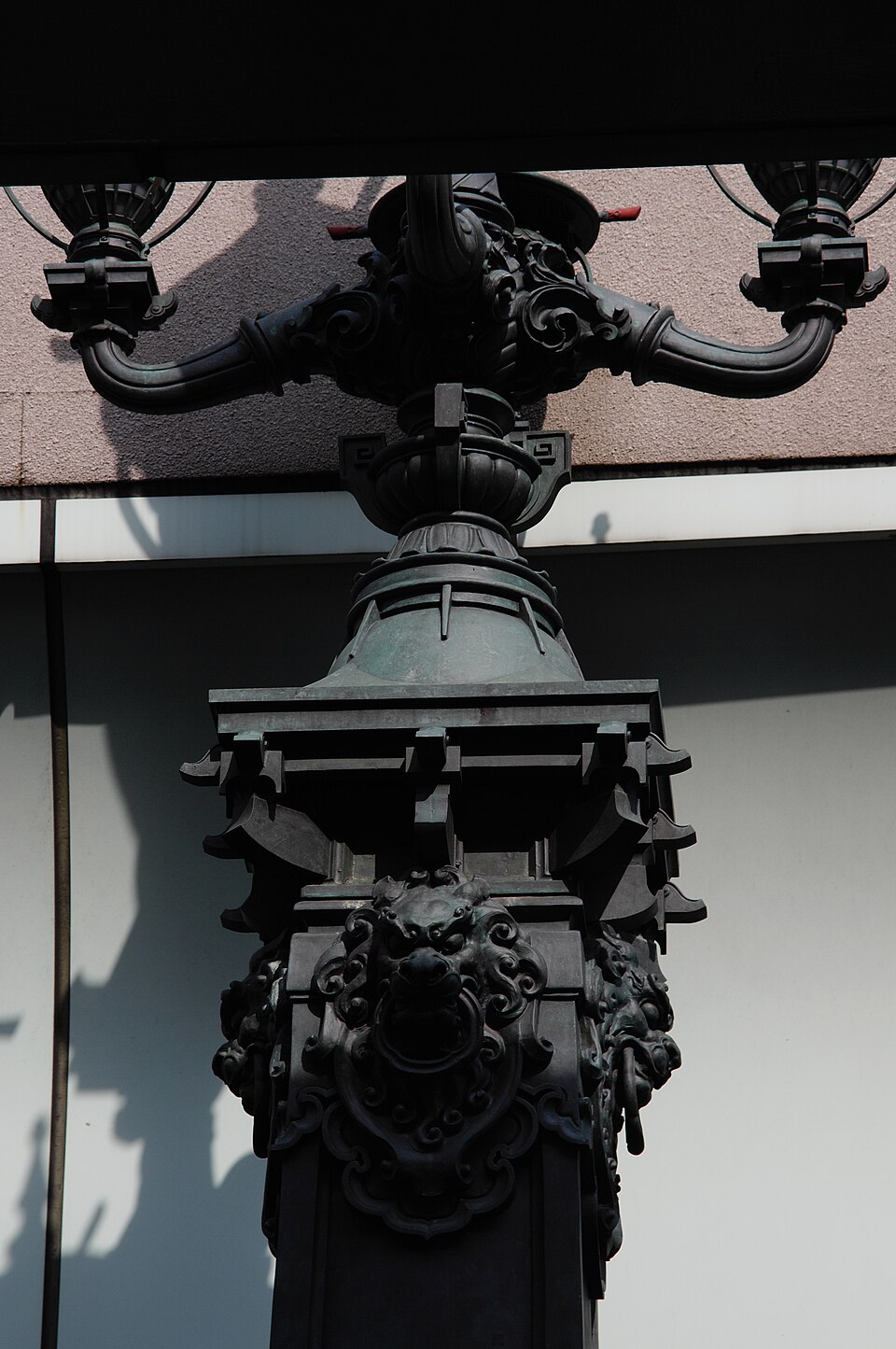
Nihonbashi Bridge is a historic bridge in central Tokyo, Japan. The current structure is a reconstruction of the original wooden bridge first built in 1603 during the Edo period. It stands as the symbolic starting point for Japan's national highway network, with distances to Tokyo measured from this point. The bridge spans the Nihonbashi River in the Nihonbashi district, a commercial and financial center. The area developed as a major merchant quarter during the Edo period and remains significant today.
Checked 2026-08-26
The bridge features a distinctive double-arched stone design with ornate bronze lion statues and decorative lanterns. A central bronze pillar marks kilometer zero for national roads. The surrounding Nihonbashi district contains historic shops, department stores, and financial institutions. The Mitsukoshi flagship department store, one of Japan's oldest, stands nearby. The area preserves traditional merchant architecture alongside modern developments. Visitors can observe the bridge structure, river views, and the bustling commercial atmosphere of this historic district. Nihonbashi Bridge also earns time in a tokyo itinerary because Tokyo production has zero POIs assigned through city_place_id, so no identifier or coordinate is inferred. Its value becomes clearer when the stop is compared with the surrounding streets and the other ranked places nearby.
Checked 2026-08-26
A visit to Nihonbashi Bridge typically requires thirty minutes to one hour for observation and photography. The bridge itself is a compact structure that can be crossed in minutes. Many visitors combine this stop with exploration of the surrounding Nihonbashi district, which can extend the visit to two or three hours. The area rewards walking exploration of historic streets, traditional shops, and architectural details. The duration depends on individual interest in historical infrastructure and urban heritage sites.
Checked 2026-08-26
Operator-confirmed hours for Nihonbashi Bridge are Not recorded pending review. The bridge is an outdoor public structure accessible at all times. The surrounding district operates on standard commercial schedules. Early morning and evening may offer quieter conditions for photography and observation. Seasonal considerations include cherry blossom viewing along the river in spring. The district hosts various traditional events throughout the year. Visitors should verify any specific access restrictions or maintenance schedules through official sources before planning.
Checked 2026-08-26
Operator-confirmed prices for Nihonbashi Bridge are Not recorded pending review. The bridge is a public thoroughfare with no admission fee for crossing or viewing. No ticketing system operates for this outdoor infrastructure. Visitors should budget for transportation costs to reach the district. Nearby attractions, museums, or commercial establishments may have separate charges. The surrounding shops and restaurants operate on standard commercial pricing. Free public access to the bridge structure and immediate riverbank areas is expected. A flexible visit lets travellers connect Nihonbashi Bridge with the rest of the day without treating one room, viewpoint or photograph as the whole experience. The useful pace depends on personal interest and conditions on arrival.
Checked 2026-08-26
Nihonbashi Station serves the area via Tokyo Metro Ginza Line, Tozai Line, and Toei Asakusa Line. Mitsukoshimae Station provides additional access via Ginza and Hanzomon lines. Tokyo Station is within walking distance to the west. Multiple bus routes serve the district. The bridge is located in Chuo Ward, central Tokyo. Signage in the station areas directs visitors toward the historic bridge. The district is compact and navigable on foot once arrived. Visitors should consult current transit schedules for operational status.
Checked 2026-08-26
The bridge carries vehicle traffic and requires pedestrian awareness. The surrounding district experiences heavy commercial activity and crowds during business hours. The expressway overhead creates significant noise and visual impact. River edges may lack protective barriers in all areas. Weather conditions affect outdoor comfort and photography quality. Cyclists share some pathways nearby. The historic character competes with modern development, which may disappoint expectations of preserved Edo-period atmosphere. Visitors should maintain awareness of traffic patterns when photographing from the bridge surface.
Checked 2026-08-26
Photography of the bridge and bronze pillar is permitted from public areas. The overhead expressway substantially obstructs views of the sky and traditional backdrop. Early morning light may reduce shadow impact from the elevated highway. River-level angles require positioning along the embankments. The lion statues and lanterns offer detailed close-up subjects. Night photography benefits from commercial district illumination. Tripod use in traffic areas requires caution. The contrast between historic structure and modern infrastructure presents compositional challenges. Panoramic views are limited by surrounding buildings.
Checked 2026-08-26
No. The current bridge is a reconstruction. The original wooden bridge built in 1603 has been replaced multiple times. The present stone structure dates to a later reconstruction period.
Yes. The bridge functions as a public thoroughfare for both pedestrians and vehicles. Visitors can cross freely as part of normal traffic flow.
The bronze pillar marks kilometer zero, the official starting point for measuring distances on Japan's national highway network. Road distances from Tokyo are calculated from this point.
No admission fee is required. The bridge is public infrastructure. No ticketing or controlled access operates for the structure itself.
A major elevated expressway was constructed over the river and bridge. This substantially affects views, noise levels, and the historic atmosphere of the site.
Specific guided tours for the bridge alone are Not recorded. The surrounding district may be included in broader Tokyo walking tours or cultural programs.
Loading the interactive map…
The interactive map could not be loaded.
Last updated:
Source: OpenStreetMap contributors ·