
01
45 min
Deji Plaza Phase 2
- High
- Market
Language · 1 published
City guide · China
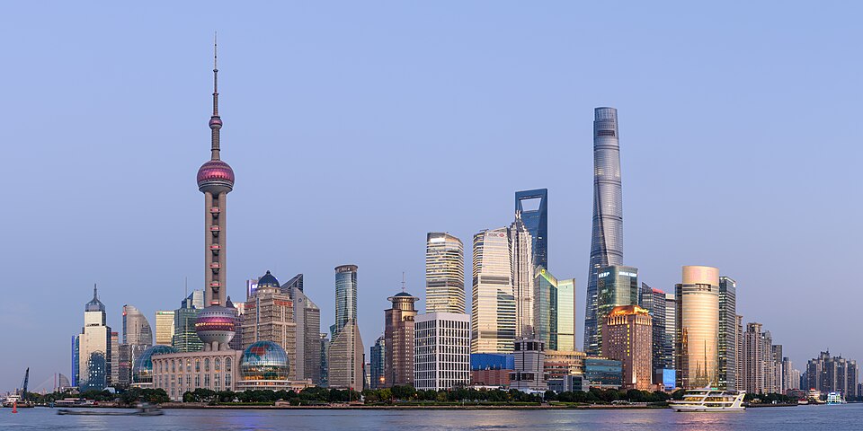
Shanghai’s visitor core spans both sides of the Huangpu River. The Bund, People’s Square and Nanjing Road anchor Puxi, while Lujiazui’s towers rise directly opposite in Pudong. The former French Concession spreads southwest through tree-lined neighbourhoods, and older water towns or distant cultural sites require journeys beyond the central metro grid.
Ranked by importance — sitelinks, pageviews and heritage status, not editor preference.
50 places match
Category
Typical visit duration
Interests
Source: OpenStreetMap contributors, Wikidata ·
Walk the Bund and Nanjing Road as one Puxi route, with People’s Square and its museums nearby. Cross by metro or ferry for Lujiazui rather than treating it as the same walking cluster. Yu Garden and the old city form another compact zone, while the former French Concession rewards a separate route through several neighbourhoods.
Checked 2026-08-26
The municipal guide describes the metro as an efficient way to cross Shanghai’s large urban area. Use it between Puxi, Pudong and the former French Concession, then walk locally. Single tickets, transport cards and supported contactless options are available under current rules. Ferries can make useful river crossings, while suburban water towns need additional rail or road planning.
Checked 2026-08-26
A fixed stay length is not recorded. Build the visit around the Bund, People’s Square, Lujiazui and the former French Concession, then add water towns and suburban districts only when the available time supports a separate journey.
Group places by district instead of crossing the city repeatedly. Start with the Bund, People’s Square, Lujiazui and the former French Concession; treat water towns and suburban districts as separate routes with their own travel allowance.
Use Walking, metro, bus and ferry. Walk within compact clusters and consult the linked official transport information before making longer transfers or relying on a particular route.
Only within individual neighbourhood clusters. The main visitor areas are separated by distances, waterways, major roads or regional approaches, so longer links normally need public transport or a licensed vehicle.
Plan water towns and suburban districts separately from the Bund, People’s Square, Lujiazui and the former French Concession. Check the current route, return connection and any access requirements on the official source before departure.
Set your days, your pace and the hours you actually want to be out. The planner works around closing days and travel time, and leaves room to eat.