


.jpg)
.jpg)

14 min walk
National Museum of American Jewish Military History
- Notable
- Museum
Language · 11 published
Nature site · Washington
| Monday | 05:00 – 00:00 |
|---|---|
| Tuesday | 05:00 – 00:00 |
| Wednesday | 05:00 – 00:00 |
| Thursday | 05:00 – 00:00 |
| Friday | 05:00 – 00:00 |
| Saturday | 05:00 – 00:00 |
| Sunday | 05:00 – 00:00 |
Checked 2026-08-31 · Source
Read from the OpenStreetMap access tags; anything not listed has no tag recorded.
Set the group type to family in the planner and the day window contracts to about three quarters of a solo day.
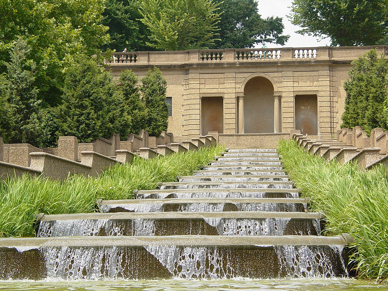
Meridian Hill Park, also called Malcolm X Park, is a formal terraced public park in Washington, D.C. Set on a hillside, it is known for landscape architecture, layered gardens, and a strong neighborhood identity. Its designation as a National Historic Landmark reflects the importance of its early twentieth-century design. The park works both as a place to stroll and rest and as a shared community space with cultural significance. Meridian Hill Park, also known locally as Malcolm X Park, is a formal terraced park in Washington, D.C. The park occupies a prominent hillside location and is recognized for its distinctive landscape architecture. It was designated a National Historic Landmark and reflects early 20th-century design principles. The park serves as both a recreational space and a site of cultural significance, with its dual name reflecting different aspects of its identity and community relationship over time. The Wikipedia entry Q6819327 documents its historical importance. Water feature operation may be seasonal or subject to maintenance interruption.
Checked 2026-08-26 · Source
The park's terraces descend the hillside around a central mall, landscaped gardens, open lawns, paths, and seating areas. A prominent waterfall forms the main visual focus, while the James Buchanan Memorial stands within the grounds. The changing levels create a sequence of views rather than one single overlook. Community gatherings and informal activities add to the park's character, making it feel like a neighborhood commons as well as a designed historic landscape. The park features a formal terraced design with cascading levels descending the hillside. Notable elements include a large central mall, statuary, and landscaped gardens. The James Buchanan Memorial stands within the grounds. A prominent waterfall cascades down the terraces, forming a dramatic focal point. The park contains walking paths, seating areas, and open lawns suitable for recreation.
Checked 2026-08-26 · Source

Set aside one to two hours to walk the terraces, follow the paths, see the waterfall, and spend time in the gardens or seating areas. A brief walk can cover the principal features, while a picnic, relaxed break, photography session, or longer neighborhood route will naturally take more time. The linear hillside layout rewards moving at an unhurried pace, especially when you want to notice the relationship between stonework, water, planting, and city views.
Checked 2026-08-26 · Source

Spring and autumn offer comfortable conditions for walking the terraces and bring seasonal changes to the gardens. Summer evenings are associated with drum circles and community gatherings, adding a lively social atmosphere. Winter reveals more of the park's formal structure when foliage is reduced. Daylight is the most useful time for seeing the waterfall, paths, and landscape clearly. Choose the season according to whether you prefer greenery, open architectural views, or neighborhood activity.
Checked 2026-08-26 · Source
Meridian Hill Park is a public urban park with free access. There is no admission ticket for walking its terraces, viewing the waterfall, or using the open landscape. Your visit may still involve normal city costs such as transport, food, or purchases in the surrounding neighborhood. Special events and permitted activities can have separate arrangements, but ordinary exploration of the park is an accessible addition to a Washington day.
Checked 2026-08-26 · Source

The park occupies a hillside location reached from the surrounding streets. Metrobus routes serve the vicinity, while Columbia Heights and U Street stations are among the Metrorail options depending on your approach. Walking from either station involves reaching the elevated park and then negotiating its terraces. Bicycle access is practical through nearby city routes. Street parking exists in the surrounding neighborhood, where ordinary urban restrictions apply.
Checked 2026-08-26 · Source

The hillside design includes elevation changes, stepped surfaces, and paths that require steady footing. Areas beside the waterfall can be slippery, and wet weather affects stone and paving. The terraces have limited overhead cover, so summer visits expose you to heat and sun. After dark, lighting is less consistent across the grounds. Share the paths with joggers, residents, and gatherings, and stay on established routes to protect the gardens and move safely between levels.
Checked 2026-08-26 · Source

The terraces create strong lines, repeated levels, and layered views toward the waterfall and central mall. Morning and late afternoon light bring out textures in the stonework, while seasonal planting changes the framing around the paths. The elevated setting offers glimpses beyond the park. Keep tripods and cameras clear of busy routes, particularly during gatherings. Photograph community activity with discretion, and use the park's geometry to show how a formal landscape fits into the city.
Checked 2026-08-26 · Source
A prominent waterfall cascades through the park's formal terraces and forms its principal visual focus.
The park is also known locally as Malcolm X Park.
Yes. Ordinary exploration of the public park and its terraces is free.
Columbia Heights and U Street are among the Metrorail options, depending on which side of the hillside you approach from.
Allow one to two hours for the terraces, paths, waterfall, gardens, and seating areas; a picnic or event can extend the visit.
Yes. The waterfall descends through the formal terraces and is one of the park's defining features.
Loading the interactive map…
The interactive map could not be loaded.


Last updated:
Source: OpenStreetMap contributors, Wikidata ·