.jpg)
59 min walk
Saklıkent Canyon
- Must see
- Nature site
Language · 11 published
Historic monument · Muğla

| Monday | 08:00 – 18:00 |
|---|---|
| Tuesday | 08:00 – 18:00 |
| Wednesday | 08:00 – 18:00 |
| Thursday | 08:00 – 18:00 |
| Friday | 08:00 – 18:00 |
| Saturday | 08:00 – 17:00 |
| Sunday | 08:30 – 17:00 |
Checked 2026-09-02 · Source
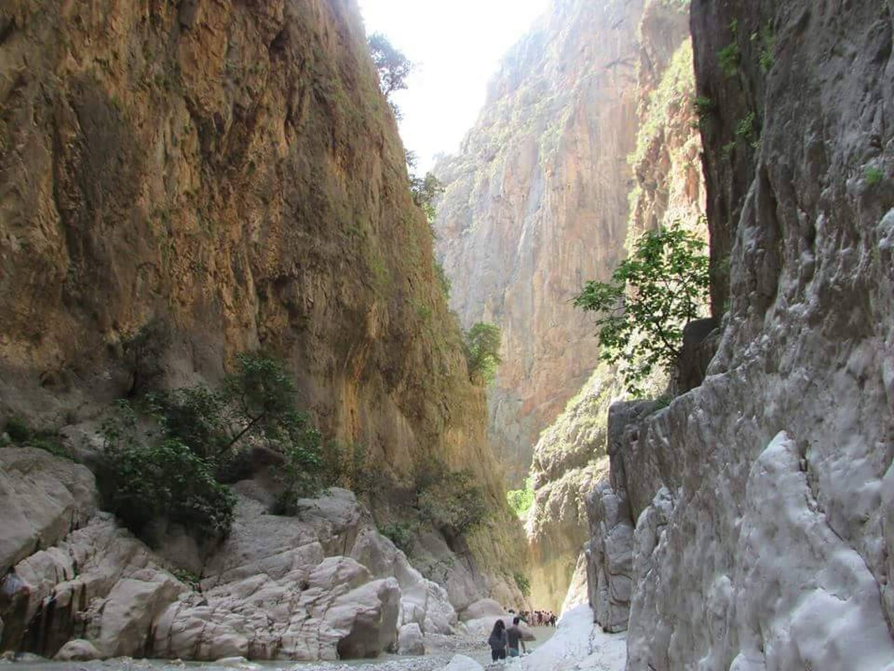
Saklıkent Kanyonu is a water-shaped gorge in Seydikemer, Muğla, beside the Antalya provincial border. Its documented length is about 18 kilometres, with canyon height varying roughly from 200 to 600 metres. A visit is organised around the entrance and the cold Karaçay, a branch of the Eşen River, rather than a conventional overlook. You leave your vehicle at the entrance, orient yourself there, and continue into a shaded, rocky landscape where water is part of the route. That combination of scale, running water and enclosed rock makes this a distinctly active canyon visit. Muğla’nın Seydikemer ilçesinde, Antalya il sınırında yer alır. Kanyon yaklaşık 18 kilometre uzunluğundadır. Kanyonun yüksekliği yaklaşık 200 ile 600 metre arasında değişir. Kanyonun girişinde Eşen Çayı’nın kolu olan Karaçay’ın soğuk suyu bulunur ve ziyaretçiler su içinde yürür.
Checked 2026-09-02 · Source
Karaçay’s cold water defines the opening section: visitors walk through the stream before continuing along wooden stairs, bridges and an approximately 2-kilometre walking route into the gorge. Surfaces change between rock, timber and wet ground, so the experience is physical and close to the canyon rather than distant viewing. The walls and deep shade create strong changes in light as you move inward. The operator and Seydikemer District Governorate also state that rafting is possible in the canyon waters. Treat the river, footing and route conditions as active parts of the visit.
Checked 2026-09-02 · Source
Plan at least two to three hours for a focused visit. That allows time to enter the water, move carefully through the approximately 2-kilometre visitor route, pause for photographs and absorb the gorge without rushing. The canyon’s total length is about 18 kilometres, but that geological figure is not the same as the distance normally covered by a visitor. A slower pace, wet surfaces or an added rafting activity can extend the outing. Build in time before the published entry cutoff, because arriving near the end of the day leaves less room for the water section and return.
Checked 2026-09-02 · Source
The operator lists daily hours: Monday to Friday 08:00–18:00, Saturday 08:00–17:00 and Sunday 08:30–17:00. It separately gives entry hours of 08:45–17:35, so the site’s closing time and the latest stated entry time are not identical. Earlier arrival leaves more daylight and more margin for the water route. The cold stream, wet ground and shaded gorge are central conditions of the visit.
Checked 2026-09-02 · Source
The operator’s ticket page lists general adult admission at 23 Turkish lira and student admission at 12 Turkish lira. The same operator information says that credit cards and the Müze Kart are not valid for this admission. No separate vehicle charge or free-admission category is recorded in that source. The ticket page is therefore the source for the prices and payment restrictions, while the main operator site supplies the opening schedule.
Checked 2026-09-02 · Source
Approach via the Fethiye–Antalya highway and take the turn towards Kemer. Seydikemer District Governorate places Tlos about 13 kilometres from the junction and Saklıkent about 21 kilometres away. Continue past Kayadibi village to reach the canyon entrance. The official access guidance says to leave the vehicle at the entrance and proceed on foot, making that point the practical handover between the road and the canyon route. These distances describe the approach from the turn, not a journey from Fethiye or Antalya, so use the government directions for the final access sequence.
Checked 2026-09-02 · Source
The physical route includes cold flowing water, wooden stairs, a bridge and approximately 2 kilometres of walking. Wear footwear suited to wet, uneven ground, protect phones and cameras from splashes, and keep your hands available on crossings. Water conditions can affect difficulty. The entrance is not the whole experience: beyond it, the route requires preparation for changing surfaces and immersion.
Checked 2026-09-02 · Source
Use the entrance for brighter views of the approach, then photograph the contrast between the gorge’s shaded interior and its pale, water-worn rock. Wooden stairs and bridges provide strong lines, while Karaçay adds movement and reflections around the lower route. Protect equipment before entering the stream and keep both hands free where the surface is wet or uneven. The canyon walls are most persuasive when a person or bridge gives them scale. Morning is useful for entrance light, but the interior remains naturally darker, so pause in safe areas rather than stopping in flowing water or on a narrow crossing.
Checked 2026-09-02 · Source
Saklıkent Canyon is in Seydikemer district of Muğla, on the Antalya provincial border.
The canyon is approximately 18 kilometres long.
Its height varies by approximately 200 to 600 metres.
Yes. Cold water from Karaçay, a branch of the Eşen River, runs at the entrance, and visitors walk through the water.
Yes. The operator and Seydikemer District Governorate state that rafting is possible in the canyon waters.
You leave your vehicle at the canyon entrance and continue on foot.
Loading the interactive map…
The interactive map could not be loaded.

Last updated:
Source: OpenStreetMap contributors ·