68 min walk
Sidyma
- Must see
- Historic monument
Language · 11 published
Historic monument · Muğla
Asaardi Yolu is a named rural junction on the Lycian Way in Muğla Province, where an outdoor road connection meets a long-distance walking route. Its identity comes from movement through the landscape rather than a building, collection or staffed attraction. The point belongs to the route environment associated with the Alınca, Sidyma, Gey and Bel section. For a traveller, it is a navigation reference and a pause within a wider coastal-hills walk, not a standalone sightseeing complex. The name is therefore most useful when planning an approach or identifying a change in direction on the trail.
Checked 2026-09-02 · Source
The point has no reported indoor exhibition or enclosed visitor facility. What you encounter is the junction, the route approach and the surrounding Lycian Way terrain. The official route description places Kalabantia archaeological remains along this broader walking section and connects the path with Gey, Yediburunlar and Bel. Expect an experience built around trail decisions, rural views and changing ground conditions. Facilities are associated with settlements along the route, so Asaardi Yolu should be treated as a self-guided waypoint within a larger itinerary. The interest lies in understanding how the route links places, not in collecting a list of displays or rooms.
Checked 2026-09-02 · Source
A short orientation stop can take around 20 to 30 minutes if you are locating the junction, checking the next direction and taking a few photographs. That is only time at the waypoint, not the duration of the surrounding Lycian Way section. Continuing toward Gey, Yediburunlar, Bel or the Kalabantia area turns the visit into a hike whose length depends on the chosen approach, elevation changes, heat, route-finding and ground conditions. Leave a generous margin for slow progress on rocky or narrow trail. A longer visit should be planned as part of a complete walking day, with the return or onward connection considered before setting out.
Checked 2026-09-02 · Source
No operator-published opening schedule or closure information is recorded for Asaardi Yolu. Plan around daylight, weather and trail conditions rather than treating the junction as a venue with guaranteed staffed access. Spring and autumn can be more comfortable for walking than the hottest summer period, while rain, wind, poor visibility and heat may make rocky slopes or narrow paths significantly harder. Check the day’s conditions before departure and choose a route pace that matches the exposed rural setting. Starting early also gives a walking group more daylight for route-finding and leaves greater flexibility if progress is slower than expected.
Checked 2026-09-02 · Source
No operator or responsible public-body admission price is recorded for Asaardi Yolu, and no supported ticket information is available for this rural junction. Do not present it as a ticketed attraction or promise free admission. Your practical costs belong to the wider outing: transport, food, water, footwear, navigation, accommodation or a guide if your route requires them. Any archaeological site or separately managed destination encountered elsewhere along the Lycian Way may have its own rules, which are outside this waypoint’s recorded practical data. Treat the junction as one element of a route plan, not as an admission-controlled destination with services included.
Checked 2026-09-02 · Source
The Ministry of Culture and Tourism describes a dolmuş corridor from Ölüdeniz through Faralya to Uzunyurt and Kabak. Use that corridor as the public-transport starting point, then continue toward the Asaardi junction by road or along the Lycian Way. The final approach is not a paved urban street, so allow for unpaved road and marked trail sections. The exact drop-off and onward walking line should be established locally with the driver and route information. Carry navigation details that remain usable when mobile reception is unreliable. Because Asaardi is a rural waypoint, the last part of the journey should be treated as an approach walk rather than a short transfer from a formal stop.
Checked 2026-09-02 · Source
Treat Asaardi Yolu as a rural hiking waypoint, not as a serviced access facility. The official route material describes unpaved sections, rocky paths, slopes and narrow trails; these conditions can be difficult for wheelchair users and for anyone with limited mobility. Wear secure footwear, carry supplies from a settlement and allow extra time for navigation. The Ministry identifies water and supply points in places such as Faralya but also advises caution about some route-side water sources. No amenity at the junction itself is recorded. Groups should agree on a meeting and turnaround plan before entering the rougher sections, especially when different walkers have different levels of trail experience.
Checked 2026-09-02 · Source
Photography works best as part of the walk, using the junction to document route context, trail direction and the surrounding Lycian Way landscape. Take care on uneven ground and stop clear of any track before handling a camera or phone. Early or late daylight may give the terrain stronger definition and reduce harsh heat, but conditions should guide your timing. Offline route information is useful when coverage is uncertain. Photograph trail markings and junction details without obstructing walkers, vehicles or the movement of others. A sequence showing the approach, the junction and the continuing landscape can be more useful than a single isolated view because it preserves the place’s role within the route.
Checked 2026-09-02 · Source
Asaardi Yolu is a rural road junction and Lycian Way access point in Muğla Province. It functions as a navigation waypoint within the route landscape, rather than as a staffed attraction with an enclosed visitor building.
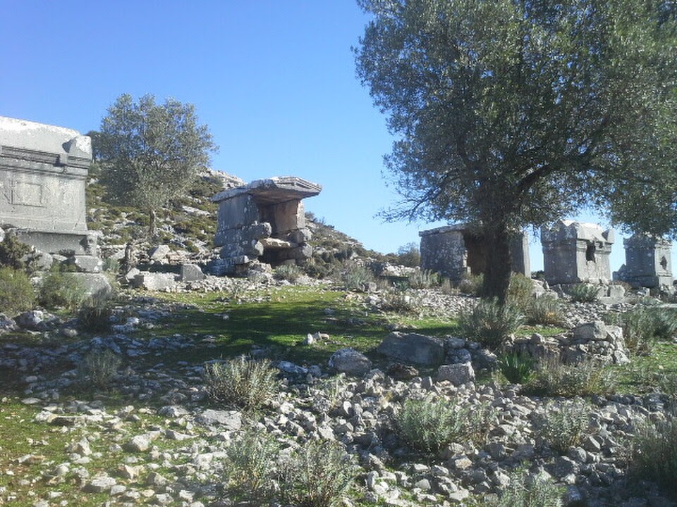
The Ministry’s official Lycian Way route description identifies the Kalabantia archaeological settlement along this broader route section. It is part of the surrounding walking context, not a claim that the junction itself is the archaeological site.
The official route material describes the walking line continuing through Gey and Yediburunlar toward Bel, within the broader section associated with Alınca and Sidyma. These names help place Asaardi Yolu in its regional trail context.
The Ministry states that a dolmuş from Ölüdeniz passes through Faralya and continues to Uzunyurt and Kabak. From that corridor, the final approach toward Asaardi is by road or Lycian Way trail rather than a dedicated visitor entrance.
The route includes unpaved sections, rocky paths, slopes and narrow trails. Those conditions make Asaardi Yolu a hiking waypoint requiring secure footwear, careful pacing and realistic preparation for uneven rural ground.
The Ministry identifies water and supply points in settlements such as Faralya and advises caution about some route-side sources. No operator or responsible public-body source records a drinking-water facility at Asaardi Yolu itself.
Loading the interactive map…
The interactive map could not be loaded.


Last updated:
Source: OpenStreetMap contributors ·