
2 min walk
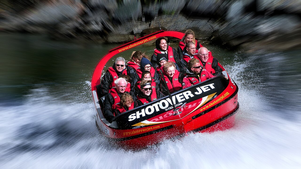
Shotover Jet
- Must see
- Market
Language · 11 published
Activity · Queenstown

Edith Cavell Bridge is a road bridge at Arthurs Point near Queenstown, crossing the Shotover River on the route toward Coronet Peak. It places travelers beside a dramatic gorge landscape of rocky walls and river channels. The bridge is most rewarding as a brief scenic and engineering stop during a drive through this part of the region. Edith Cavell Bridge is a historic bridge located near Queenstown, New Zealand. The structure spans the Shotover River in the Arthurs Point area, positioned along the route between Queenstown and the Coronet Peak ski field. The bridge carries road traffic and serves as a crossing point over the dramatic canyon landscape that characterises this part of the Otago region. The surrounding area features the distinctive terrain of the Shotover River gorge, with steep rocky cliffs and the braided river channel below.
Checked 2026-08-26 · Source
The main feature is the steel truss bridge carrying road traffic over the Shotover River. From the surrounding area, travelers can take in the narrow canyon, steep rocky sides, vegetation, and river below. The Shotover Jet operates in the nearby canyon, adding an active Queenstown experience to the landscape, although the bridge itself is not an attraction with staffed facilities. The bridge itself is a steel truss structure providing vehicular passage across the Shotover River. The immediate vicinity includes viewpoints of the river canyon and the rocky gorge walls. The Arthurs Point area around the bridge contains limited visitor facilities. The Shotover Jet operation, a well-known Queenstown adventure activity, operates in the river canyon near this location. The landscape comprises native and introduced vegetation on the gorge slopes, with the river flowing through the narrow canyon passage beneath the bridge deck.
Checked 2026-08-26 · Source
Plan a short stop for the bridge and gorge views. Crossing takes only moments by vehicle, while photography and looking into the canyon add time. Extend the visit only if the surrounding stopping conditions allow it safely. The bridge has no structured tour sequence, so it works best as a scenic pause within a wider Arthurs Point, Coronet Peak, or Shotover itinerary. A visit to Edith Cavell Bridge typically requires a brief stop of fifteen to thirty minutes for viewing and photography. The crossing by vehicle takes only a few moments. Those wishing to explore the immediate surroundings or observe the canyon landscape may allocate additional time. The duration depends on individual interest in the engineering structure and the scenic gorge environment. No guided tours or structured visits are associated with the bridge itself, so visitors determine their own pace and length of stay at this location.
Checked 2026-08-26 · Source
The bridge functions as a public road crossing throughout the year, while the surrounding experience changes with season and weather. Summer gives longer daylight for the drive and photographs. Winter can bring snow or ice on nearby approaches, especially toward higher ground. Morning and afternoon light reach the gorge differently, so choose the time that suits your route and visibility.
Checked 2026-08-26 · Source
Crossing and viewing Edith Cavell Bridge form part of the public road journey and do not require a sightseeing ticket. Any paid experience nearby, including Shotover Jet, is a separate activity with its own arrangements. Think of the bridge as a free landscape stop during a drive, while reserving time and spending decisions for the commercial attractions you choose around Arthurs Point.
Checked 2026-08-26 · Source
Drive from central Queenstown toward Arthurs Point along Arthurs Point Road, following the route toward Coronet Peak. The journey takes about fifteen minutes from central Queenstown under ordinary conditions. The bridge also lies near the Shotover Jet area, making it easy to combine with a pre-booked adventure. Winter drivers should allow for changing mountain-road conditions.
Checked 2026-08-26 · Source
Traffic uses the bridge in both directions, and pedestrian separation is limited. Do not stand in the roadway for photographs; use a safe pull-off or ground area where available. The gorge has steep edges and the Shotover River has hazardous currents. Snow, ice, rain, and unstable footing can add risk, so keep well back from the canyon edge and watch passing vehicles.
Checked 2026-08-26 · Source
Frame the steel truss against the Shotover River gorge, using the bridge and rocky canyon walls to show scale. The narrow setting creates strong contrasts between bright sky and shadowed rock. A wide view records the landscape, while a closer composition emphasizes structure. Keep your position stable and away from traffic and unprotected gorge edges when taking photographs.
Checked 2026-08-26 · Source
It is on Arthurs Point Road near Queenstown, on the route toward Coronet Peak and the Shotover Jet area.
The bridge crosses the Shotover River, which runs through the narrow, rocky gorge at Arthurs Point.
The drive from central Queenstown takes approximately fifteen minutes under ordinary road conditions.
Yes. Shotover Jet operates in the nearby canyon, so the bridge can be included in an Arthurs Point outing alongside that separate adventure activity.
Yes. The steel structure, Shotover River, rocky gorge walls, and changing light create strong scenic and engineering compositions.
Traffic, limited pedestrian separation, steep gorge edges, and hazardous river currents require travelers to stay off the roadway and well back from exposed edges.
Loading the interactive map…
The interactive map could not be loaded.


Last updated:
Source: OpenStreetMap contributors, Wikidata ·