.jpg)
50 min walk
Skyline Queenstown
- Must see
- Activity
Language · 11 published
Activity · Queenstown
Read from the OpenStreetMap access tags; anything not listed has no tag recorded.
Set the group type to family in the planner and the day window contracts to about three quarters of a solo day.
Ben Lomond Track is a prominent tramping route near Queenstown, ascending from the town centre vicinity toward the Ben Lomond summit. The track forms part of Queenstown's accessible backcountry offering, with trailheads reachable without vehicle transport. It features in regional destination marketing and independent travel media as a signature alpine hike. The route traverses beech forest, tussock slopes, and exposed ridgeline terrain. Wikipedia and tourism sources note its status as a well-known Queenstown outdoor activity. The lower sections may suit fit walkers, but the full summit route involves demanding alpine terrain. Fitness, experience, and equipment adequacy should be honestly assessed. Verify current arrangements with the Department of Conservation before visiting.
Checked 2026-08-26 · Source
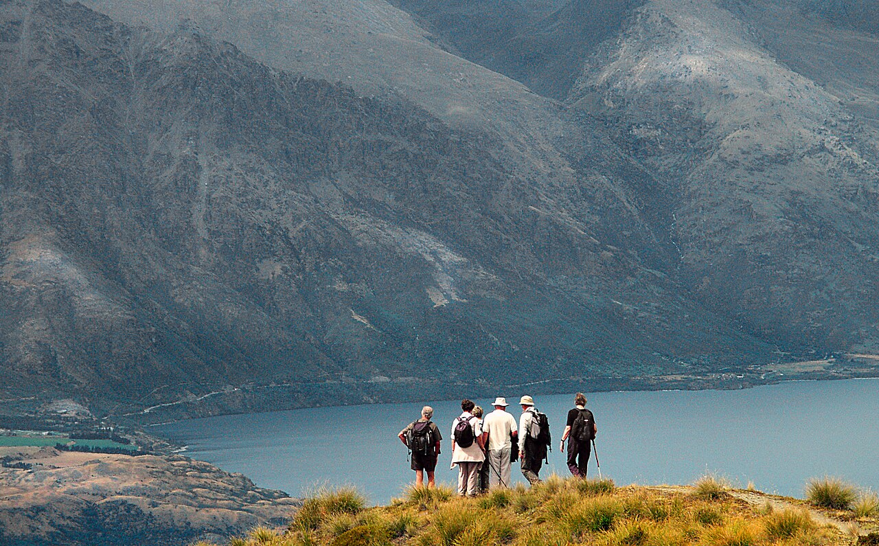
The track environment transitions through multiple ecological zones. Lower sections pass through beech forest with associated understory vegetation. Middle elevations open into tussock grasslands characteristic of the region's montane landscapes. The upper route and summit area present exposed alpine terrain with scree and rocky outcrops. Views from higher elevations encompass Lake Wakatipu, the Remarkables range, and surrounding Southern Alps peaks. The track does not contain maintained visitor facilities, interpretive installations, or commercial structures along its length. Hikers should anticipate natural terrain without boardwalks, viewing platforms, or shelter infrastructure beyond what the Department of Conservation may maintain at access points.
Checked 2026-08-26 · Source
Track duration varies substantially with fitness, conditions, and chosen turnaround point. Sources describe options ranging from partial day walks to full summit attempts requiring extended commitment. The complete return trip to Ben Lomond summit represents a demanding full-day undertaking for most hikers. Shorter variants terminating at intermediate viewpoints reduce time requirements. Seasonal conditions, particularly snow and ice on upper sections, extend travel times and technical difficulty. Individual pace assessment and realistic turnaround planning are essential. Visitors should consult current Department of Conservation guidance for route-specific duration estimates before departure.
Checked 2026-08-26 · Source
Seasonal accessibility depends on alpine weather patterns and snow conditions. Summer months generally offer the most reliable access to upper sections, though weather changes rapidly in exposed terrain. Winter and spring typically present snow and ice hazards on the summit route, requiring appropriate equipment and experience. The Department of Conservation manages the track, and current conditions should be verified through official channels before any visit. Self-sufficient decision-making regarding weather windows remains necessary regardless of season, as alpine conditions can deteriorate without warning.
Checked 2026-08-26 · Source
The Ben Lomond Track operates as a public conservation access route. No fee structures, concession requirements, or payment methods are documented in the available context. Some adjacent Queenstown activities operate commercial booking systems, but this does not apply to the track itself. Visitors should verify current access arrangements through the Department of Conservation, as management frameworks may change. Any guided commercial services using the track would operate under separate arrangements not covered by this production's source materials.
Checked 2026-08-26 · Source
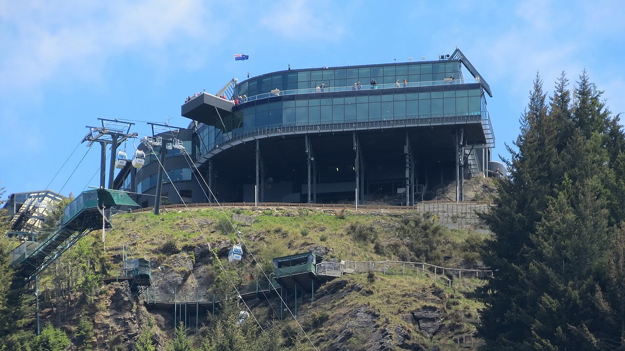
The track is accessible from Queenstown without private vehicle requirement, distinguishing it from more remote regional tramps. Trailheads connect via walking routes from the town centre and surrounding accommodation areas. The Skyline Gondola base provides one recognised access point, with options to ride or walk from the lower terminal. Alternative approaches exist via suburban streets and established walking networks. The track's proximity to Queenstown's urban area makes it feasible for visitors without rental car arrangements.
Checked 2026-08-26 · Source
Alpine hazards present the primary safety consideration. Exposed upper sections lack natural protection from weather events. Snow and ice create fall risks outside summer months. The track crosses terrain with potential for disorientation in poor visibility. No emergency shelter exists along the route. River crossings, though not prominent on this track, require assessment after rainfall. Mobile phone coverage cannot be assumed in valleys or behind terrain features. Appropriate clothing, navigation capability, and emergency provisions are essential regardless of apparent conditions at departure. Solo hiking on exposed alpine routes carries elevated risk. Informing others of intended route and return time represents basic safety practice.
Checked 2026-08-26 · Source
The track offers varied photographic subjects across its elevation range. Lower forest sections provide filtered light and native vegetation detail. Tussock slopes yield textural landscape elements and foreground interest. The summit ridgeline and approaches present panoramic opportunities encompassing Lake Wakatipu, Queenstown settlement, and mountain ranges. Early and late day lighting enhances depth and colour saturation on the alpine terrain. Weather dynamics, including cloud movement and atmospheric perspective, contribute to variable conditions. No specifically designated viewpoints or photography infrastructure exists. Tripod use requires stability assessment in exposed wind conditions.
Checked 2026-08-26 · Source
The lower sections may suit fit walkers, but the full summit route involves demanding alpine terrain. Fitness, experience, and equipment adequacy should be honestly assessed.
Verify current arrangements with the Department of Conservation before visiting.
Yes, trailheads are accessible by walking from the town centre, including via the Skyline Gondola base area.
Physical access exists year-round, but winter and spring upper sections typically require snow and ice equipment and skills. Conditions vary annually.
Self-sufficient preparation for the full intended duration is necessary.
Turn back before conditions become critical. The exposed upper route offers no shelter. Pre-planned turnaround times and conservative decision-making are essential safety practices.
Loading the interactive map…
The interactive map could not be loaded.

Last updated:
Source: OpenStreetMap contributors ·