Aktivität · Queenstown
Edith Cavell Bridge
Foto


- Heute
- Öffnungszeiten nicht erfasst
- Besuchsdauer
- 2 Stunden
- Barrierefreiheit
- Nicht erfasst
- Preis
- Nicht erfasst
- Einordnung
- Muss man gesehen haben
- Rang
- Rang 41 von 545
Über Edith Cavell Bridge
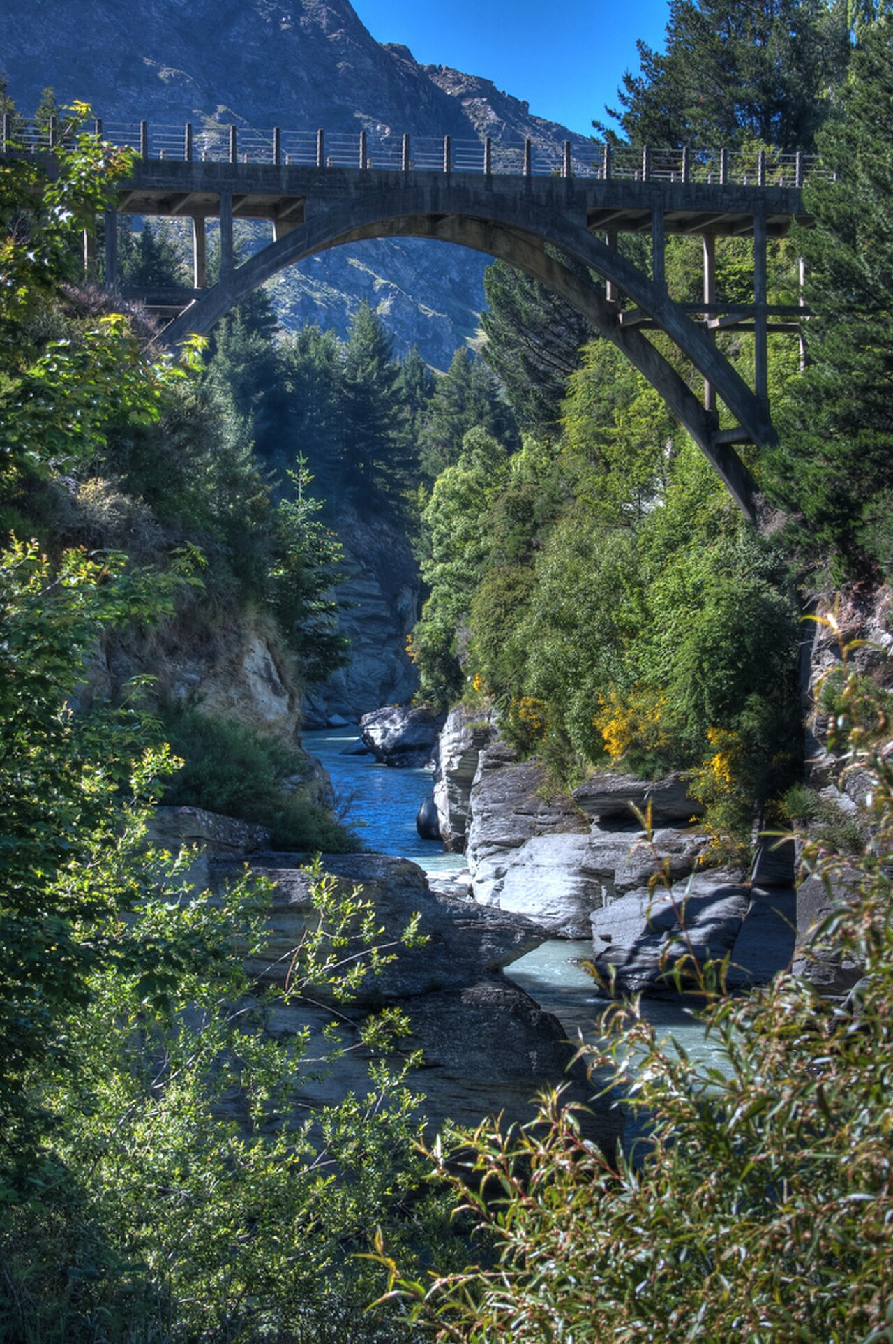
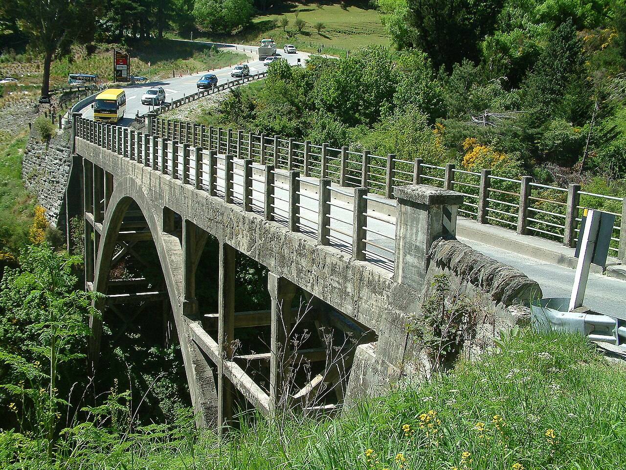
Edith Cavell Bridge is a historic bridge located near Queenstown, New Zealand. The structure spans the Shotover River in the Arthurs Point area, positioned along the route between Queenstown and the Coronet Peak ski field. The bridge carries road traffic and serves as a crossing point over the dramatic canyon landscape that characterises this part of the Otago region. The surrounding area features the distinctive terrain of the Shotover River gorge, with steep rocky cliffs and the braided river channel below. Edith Cavell Bridge also earns time in a queenstown itinerary because WIKIDATA_EDITORIAL reconciliation for the ranked entry; identity and coordinates were verified without a nearby fallback. Its value becomes clearer when the stop is compared with the surrounding streets and the other ranked places nearby.
Geprüft 2026-08-26
Was ist drin?
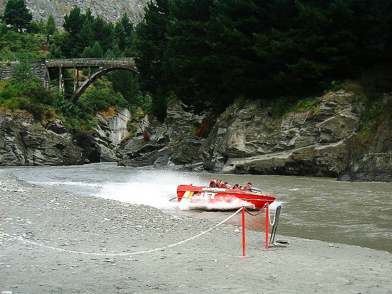
The bridge itself is a steel truss structure providing vehicular passage across the Shotover River. The immediate vicinity includes viewpoints of the river canyon and the rocky gorge walls. The Arthurs Point area around the bridge contains limited visitor facilities. The Shotover Jet operation, a well-known Queenstown adventure activity, operates in the river canyon near this location. The landscape comprises native and introduced vegetation on the gorge slopes, with the river flowing through the narrow canyon passage beneath the bridge deck.
Geprüft 2026-08-26

Empfohlene Besuchsdauer
A visit to Edith Cavell Bridge typically requires a brief stop of fifteen to thirty minutes for viewing and photography. The crossing by vehicle takes only a few moments. Those wishing to explore the immediate surroundings or observe the canyon landscape may allocate additional time. The duration depends on individual interest in the engineering structure and the scenic gorge environment. No guided tours or structured visits are associated with the bridge itself, so visitors determine their own pace and length of stay at this location.
Geprüft 2026-08-26

.jpg)
Jahreszeit und Menschenmassen
The bridge is accessible year-round as a public road crossing. Seasonal variations affect surrounding activities and visibility conditions. Winter snow may influence road conditions on approaches to higher elevation areas nearby. Summer offers longer daylight hours for viewing. Weather in the Queenstown region can change rapidly, and visitors should check current road conditions before travel. The gorge setting means afternoon shadows may affect photography depending on the season and time of day. Check the operator's own site for the travel date before relying on a schedule or fare.
Geprüft 2026-08-26
Tickets
No admission fee applies to cross or view Edith Cavell Bridge, as it functions as a public road bridge. Parking in the immediate vicinity may be limited and subject to local restrictions. Nearby commercial activities such as jet boating operate independently with their own pricing structures. Visitors should not expect visitor centre facilities, interpretive displays, or staffed services at the bridge location. Any costs associated with a visit would relate to transport to reach the site rather than access to the bridge itself.
Geprüft 2026-08-26

Ankommen
Edith Cavell Bridge lies on Arthurs Point Road, accessible by private vehicle from central Queenstown. The drive takes approximately fifteen minutes following the main road toward Coronet Peak. Public transport options to this specific location appear limited based on available information. The bridge forms part of the route used by visitors heading to ski fields or the Shotover Jet departure point. Self-driving provides the most reliable access. Road conditions vary seasonally, and winter travellers should carry appropriate equipment for mountain driving conditions in the region.
Geprüft 2026-08-26


Worauf Sie achten sollten
Traffic on the bridge moves in both directions with limited pedestrian separation. Visitors stopping for photographs should use designated pull-off areas rather than the roadway itself. The gorge edges near the bridge present steep drops without protective barriers in all locations. Weather conditions can deteriorate quickly in this mountainous terrain. The Shotover River below flows through a narrow canyon with hazardous currents. Winter ice and snow may create slippery surfaces. Visitors should exercise standard caution appropriate for a road bridge in a rugged natural environment without dedicated tourist infrastructure or safety provisions.
Geprüft 2026-08-26
.jpg)
Fotografie
The bridge offers views of the Shotover River canyon and the steel structure against the rocky gorge walls. The narrow canyon creates challenging lighting conditions with shadowed cliffs and bright sky. A wide-angle lens captures the scale of the gorge and bridge together. Morning light may illuminate the canyon differently than afternoon conditions. The surrounding terrain provides context shots of the river and vegetation. No dedicated viewing platforms exist, so photographers work from the road edges or nearby ground. Tripod use requires awareness of passing vehicles and limited stable footing near the gorge edge.
Geprüft 2026-08-26
Häufige Fragen
Is Edith Cavell Bridge open to pedestrians for Edith Cavell Bridge in Queenstown?
The bridge functions primarily as a road bridge for vehicles. Pedestrian access is not separately provided, and visitors should exercise caution due to traffic and limited walkway separation.
Does the bridge have historical significance for Edith Cavell Bridge in Queenstown?
The bridge is understood to carry the name of Edith Cavell, the British nurse executed during the First World War. Specific construction dates and detailed historical background are Not recorded.
Are there toilet or food facilities at the bridge for Edith Cavell Bridge in Queenstown?
No visitor facilities including toilets or food services are located at the bridge. The nearby Arthurs Point area may offer limited services, but these are not documented in the available source.
Can I see the Shotover Jet from the bridge for Edith Cavell Bridge in Queenstown?
The Shotover Jet operates in the canyon near this location. Whether jet boats are visible from the bridge deck at any given time depends on operational schedules and river conditions, which vary.
Is the bridge accessible for wheelchairs or strollers for Edith Cavell Bridge in Queenstown?
The bridge surface is road pavement, but no dedicated pedestrian paths or accessibility features are documented. The surrounding terrain is steep and uneven, presenting challenges for mobility devices.
Do I need to book in advance to visit for Edith Cavell Bridge in Queenstown?
No booking is required as the bridge is a public road crossing without managed visitor access. No reservations system exists for stopping to view or photograph the structure.
Wo es ist
Interaktive Karte wird geladen…
Die interaktive Karte konnte nicht geladen werden.
In der Nähe
Passen Sie es in einen Plan ein
Externe Links
Zuletzt aktualisiert:
Quelle: OpenStreetMap-Mitwirkende, Wikidata ·