.jpg)

.jpg)

4 min walk
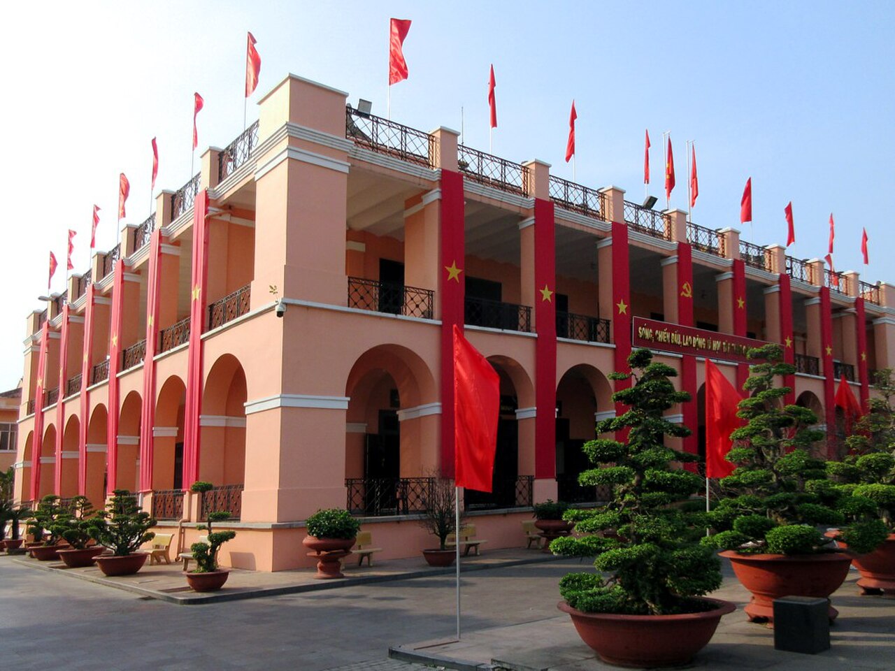
Khu Di tích Bến Nhà Rồng
- Must see
- Historic monument
Language · 11 published
Historic monument · Ho Chi Minh City
Cầu Mống

Mong Bridge is a historic bridge structure in Ho Chi Minh City, Vietnam. It spans across a waterway in the urban fabric of the city, representing part of the colonial-era infrastructure that remains within the modern metropolis. The bridge serves as a pedestrian and traffic crossing point. Its retention in visitor landmark rankings indicates recognised significance among city attractions. The structure contributes to the layered architectural heritage visible throughout Ho Chi Minh City, where French colonial constructions coexist with contemporary Vietnamese development. Visitors encounter it as a tangible connection to the city's past transportation and engineering history.
Checked 2026-08-26
The bridge itself is an open structure without enclosed interior spaces typical of buildings. Visitors experience the bridge from its deck level, observing the waterway below and surrounding urban landscape. The structural elements include railings, deck surface, and supporting framework. Adjacent areas on either bank provide context for understanding the bridge's function within the district. The immediate vicinity contains the dense commercial and residential character typical of Ho Chi Minh City central areas. No separate attractions, exhibitions, or facilities are housed within the bridge structure itself. The experience derives from traversing the crossing and observing its engineering.
Checked 2026-08-26
A visit to Mong Bridge requires minimal dedicated time. Crossing on foot takes several minutes at normal walking pace. Visitors typically incorporate the bridge into broader exploration of the surrounding district rather than treating it as a standalone destination. Those interested in architectural observation or photography may spend fifteen to thirty minutes examining structural details and viewpoints. The bridge functions practically as a thoroughfare for local commuters, suggesting brief transit use. Travellers combining multiple nearby landmarks might allocate half a day to the general area. Extended stays depend entirely on individual interest in urban infrastructure and surrounding neighbourhood exploration.
Checked 2026-08-26

Ho Chi Minh City experiences tropical climate conditions with distinct wet and dry seasons. The dry season from December to April generally offers more predictable conditions for outdoor walking and photography. Morning and evening hours may provide more comfortable temperatures and atmospheric lighting for observation. Operator-confirmed hours are Not recorded pending review. The bridge remains accessible as a public thoroughfare, though specific maintenance schedules or temporary closures are not documented. Visitors should observe local conditions upon arrival. Seasonal rainfall between May and November can affect comfort and visibility. No special events or seasonal programmes associated with the bridge are recorded.
Checked 2026-08-26
Mong Bridge operates as public infrastructure without admission controls. No entry fee is required for crossing. Operator-confirmed prices are Not recorded pending review. The bridge functions as a free-access thoroughfare integrated into the city's transportation network. Visitors encounter no ticket offices, turnstiles, or payment requirements. Any future changes to access arrangements would require official notification. Photography from public vantage points incurs no charge. Commercial filming or organised activities might require permits from relevant municipal authorities, though specific procedures are not documented. Travellers should carry standard urban exploration supplies and budget for surrounding area expenses rather than bridge-specific costs.
Checked 2026-08-26

Mong Bridge occupies a position within Ho Chi Minh City's dense urban core. The surrounding district features the characteristic narrow streets and mixed development patterns of central areas. Visitors typically reach the vicinity by taxi, ride-hailing services, or motorbike, the predominant transportation modes in the city. Walking from nearby accommodations or other attractions in the central districts represents a practical approach. Public bus routes serve the broader area, though specific stop proximity requires local verification. The bridge's precise coordinates within the street network should be confirmed through current mapping services. Signage in the immediate area may be limited or primarily in Vietnamese.
Checked 2026-08-26
Traffic conditions on and around Mong Bridge demand constant awareness. Motorbikes constitute the dominant vehicle type in Ho Chi Minh City, with dense flows and unpredictable movements. Pedestrians should exercise caution when accessing and crossing the bridge deck. Surface conditions may vary, with potential unevenness or debris requiring attention. The tropical climate necessitates hydration and sun protection for exposed walking. No specific security concerns are documented, though standard urban vigilance applies to personal belongings. The waterway below presents a hazard requiring appropriate caution, particularly for photography positioning. Nighttime visibility depends on functional lighting, which should be verified rather than assumed operational.
Checked 2026-08-26
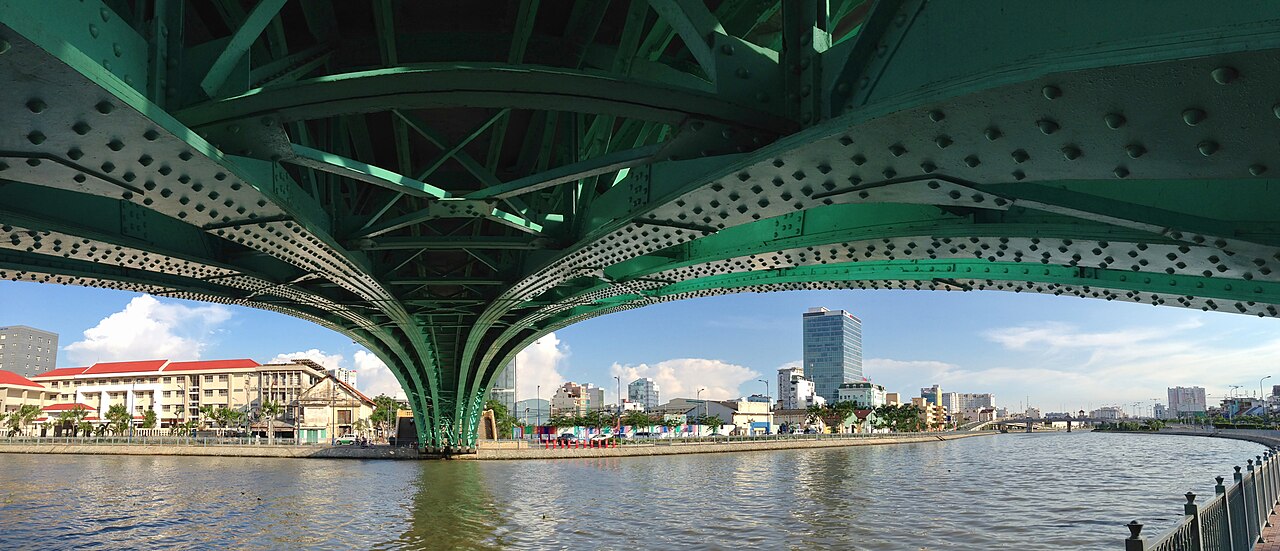
Mong Bridge offers perspectives of waterway traffic and adjacent urban architecture. The structural lines of the bridge itself provide compositional elements for photographers interested in infrastructure subjects. Morning and late afternoon light may enhance visual qualities, though tropical haze can affect clarity. Viewpoints from the deck capture the vertical relationship between bridge and waterway. Surrounding buildings create backdrop density characteristic of the city centre. No photography restrictions are documented for public areas, though tripod use in traffic pathways would impede flow. Drone operation would require compliance with Vietnamese aviation regulations. The aged patina of structural materials may interest those documenting urban heritage conditions.
Checked 2026-08-26
The bridge functions as public infrastructure. Specific operational schedules or maintenance closures are not recorded.
Construction dates and exact age are not recorded in available sources.
The bridge serves traffic functions, though specific vehicle restrictions or weight limits are not recorded.
No visitor information facilities or interpretive displays are recorded at this location.
The bridge structure contains no commercial establishments. Surrounding streets feature typical urban commerce.
Accessibility features and ramp provisions are not recorded pending review.
Loading the interactive map…
The interactive map could not be loaded.

Last updated:
Source: OpenStreetMap contributors, Wikidata ·