
33 min walk
Nevşehir Castle
- Must see
- Historic monument
Language · 11 published
Historic monument · Nevşehir
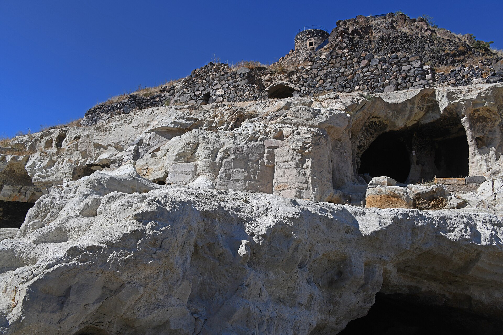
Göre Açık Hava Müzesi is a rock-settlement heritage area within Göre, in Nevşehir Central District. Its defining sights are spaces cut directly into soft volcanic rock: former homes, openings and animal shelters shaped around everyday domestic and agricultural needs. The remains sit within a living settlement rather than behind a separate museum forecourt. Around Kasapoğlu and Kanuni Sokak, visitors encounter carved rock faces and traces of habitation alongside local streets, giving the visit a close connection with Göre’s continuing community. Göre Açık Hava Müzesi is a rock-settlement heritage area inside Göre, in Nevşehir Central District. Its defining feature is not a museum building but surviving spaces cut into soft volcanic rock: former homes and animal shelters shaped directly from the landscape. Göre’s remains show a practical Cappadocian response to workable tuff, where everyday domestic and agricultural needs were accommodated in excavated cavities. The site is encountered within a living settlement, so its character comes from seeing carved openings, rock faces and traces of habitation alongside local streets rather than following a gallery sequence. It is in Göre, within Nevşehir Central District, around Kasapoğlu and Kanuni Sokak. The remains are part of the settlement rather than a separate museum campus.
Checked 2026-09-02 · Source
The main subjects are the rock-cut remains themselves: dwellings, cavities, entrances and spaces linked with barns or animal shelters. There is no gallery sequence to follow, so read the site through its physical details. Notice how a room opens into the rock, how domestic and livestock areas relate, and how the carved levels follow uneven ground. The historic fabric forms part of Göre around Kasapoğlu and Kanuni Sokak. Look closely while leaving stones, surfaces and fragile edges undisturbed.
Checked 2026-09-02 · Source
Plan about 45 to 75 minutes for a focused first visit. A shorter stop suits visitors viewing selected remains from stable edges, while a longer visit allows time to compare openings, façades and the relationship between old rock spaces and modern Göre. Uneven ground can slow movement, especially when visitors pause for photographs or choose careful viewpoints. The site fits well into a wider Nevşehir itinerary and can be paired with other Göre stops or a countryside outing.
Checked 2026-09-02 · Source
Visit in daylight, when natural light reveals the volcanic tuff, carved openings and changes in level. Morning and late afternoon provide stronger relief for the rock and comfortable conditions for photography, while midday can feel more exposed. After rain or frost, take extra care on rough ground. This is an outdoor ruin within Göre, not an illuminated evening attraction. Cooler parts of the day are especially useful during warm weather because the route offers an open-air experience.
Checked 2026-09-02 · Source
Göre Açık Hava Müzesi is experienced as an outdoor rock-settlement area within the village rather than a conventional staffed gallery. The supplied description establishes the character of the place, not a standard admission arrangement. On arrival, follow any access or conservation instructions displayed by the responsible authority. Stay away from unstable rock, restricted cavities and fragile edges. The setting rewards close observation of the landscape and carved spaces without requiring a formal indoor exhibition route.
Checked 2026-09-02 · Source
From Nevşehir city centre, travel towards Göre using local transport, then continue on foot through the settlement. The remains lie around Kasapoğlu and Kanuni Sokak, so the final approach follows local streets rather than a dedicated museum campus. Allow time to locate the rock-cut spaces after leaving transport. Sturdy shoes are more useful than wheeled luggage once the route reaches uneven terrain. Keep residential streets clear and treat the walk as part of the heritage experience.
Checked 2026-09-02 · Source
Expect irregular outdoor ground and rock-cut structures rather than a level contemporary visitor path. Choose viewpoints carefully, especially after rain, frost or intense heat. Do not climb unstable-looking rock, chip or unnecessarily touch historic surfaces, move stones, or enter spaces that are restricted or unsafe. Plan around your own mobility needs because the route is not presented as continuously step-free. There may be no convenient shade, seating or visitor facilities, so keep the visit focused when conditions become uncomfortable.
Checked 2026-09-02 · Source
Photograph the contrast between Göre’s worked volcanic rock and the surrounding settlement. Wide views can show how the remains sit around Kasapoğlu and Kanuni Sokak, while close frames reveal rough tuff, thresholds and the depth of carved openings. Daylight is essential for texture, with morning and late afternoon offering stronger relief. Establish a stable position before composing because the ground is uneven. Do not move stones, enter unsafe-looking cavities or photograph residents and visitors closely without permission.
Checked 2026-09-02 · Source
It is in Göre, within Nevşehir Central District, around Kasapoğlu and Kanuni Sokak. The remains form part of the settlement rather than a separate museum campus.
Visitors see rock-cut dwellings, openings and spaces associated with barns or animal shelters, all shaped directly from Göre’s soft volcanic rock.
Allow roughly 45 to 75 minutes, depending on how far you walk, how carefully you study the carved spaces and how often you stop for photographs.
Daylight is the practical choice. Morning and late afternoon reveal the rock texture well, while wet or frosty conditions require extra care on uneven ground.
The remains occupy uneven ruin terrain, so visitors should not plan on uninterrupted wheelchair or pushchair access across the area.
The area has been used for cross-country training by national athletes in Nevşehir, reinforcing its rough outdoor character rather than a level museum-path experience.
Loading the interactive map…
The interactive map could not be loaded.

Last updated:
Source: OpenStreetMap contributors ·