


20 min walk · Nevşehir Merkez
Göreme Valley
- Must see
- Historic monument
Language · 11 published
Historic monument · Nevşehir Merkez, Nevşehir
Uçhisar Kalesi
Read from the OpenStreetMap access tags; anything not listed has no tag recorded.
Set the group type to family in the planner and the day window contracts to about three quarters of a solo day.
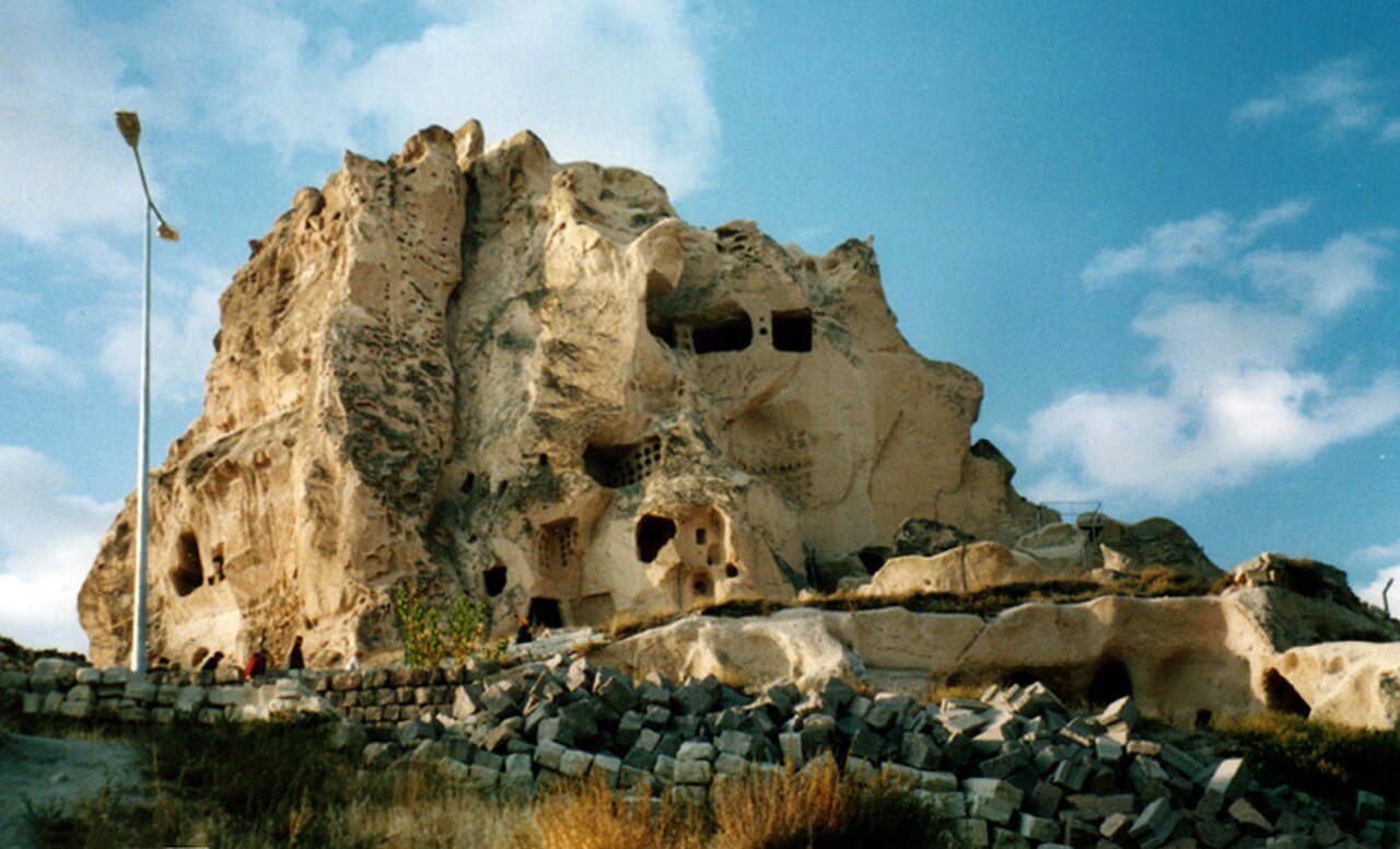
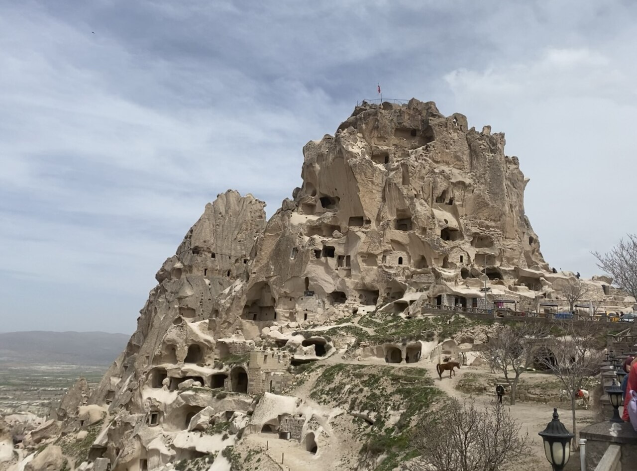
Uçhisar Castle is a massive volcanic tuff formation rising from the centre of Uçhisar village in Cappadocia. It is not a separate masonry building: rooms, tunnels, stairways and lookout spaces were carved directly into the soft rock. The municipality identifies two connected formations as Ağa’nın Kalesi and Çavuş’un Kalesi. This combination of geology, domestic space and defensive positioning makes the castle the visual centre of Uçhisar and a particularly clear example of Cappadocia’s rock-cut habitation. Its height also explains why the landmark remains visible across the surrounding village and valleys. Residents lived in and around its rock-cut homes until the 1950s and 1960s, linking the monument to a much longer inhabited landscape.
Checked 2026-09-02 · Source
Inside Uçhisar Castle, visitors encounter a compact maze of rock-cut rooms, passages, steps and lookout spaces rather than finished halls or a conventional courtyard castle. Volcanic tuff was hollowed out to create usable rooms and connected routes within the formation. Walls, ceilings and openings remain part of the natural rock, so the character changes constantly as the route narrows or opens. The municipality includes the connected Ağa’nın Kalesi and Çavuş’un Kalesi formations in its description. Look for the way domestic and defensive spaces are layered vertically through the outcrop. The route is best understood as a sequence of carved spaces, not as a single interior chamber or museum display.
Checked 2026-09-02 · Source
Allow about 45 to 60 minutes for a focused visit to the climbable parts of Uçhisar Castle. The pace depends on stops, crowding and how carefully you manage the uneven rock steps and narrow passages. Add approximately 20 to 30 minutes on village-level streets and terraces if you want exterior photographs without completing the ascent. Because rooms, tunnels, stairways and views appear at different heights, the castle rewards a measured pace. Visitors combining the climb with photography should allow roughly 90 minutes overall. Build in a little extra time if you are travelling with children, pausing frequently, or waiting for other visitors in confined sections.
Checked 2026-09-02 · Source
Plan Uçhisar Castle for daylight. The municipality’s current castle page describes daylight access but publishes no fixed clock times. The checked page also states no closure day, so no weekly closing day is recorded. Early or late daylight brings out the texture of the carved tuff and softens the wider landscape, while midday may be brighter and busier. Leave time before dusk for the descent: steep, uneven steps and narrow passages require visibility and secure footing. The practical status is variable daylight access, not a fixed daily timetable. Morning is useful for a quieter climb, while late afternoon suits photographs of the relief, provided there is ample light remaining for the return.
Checked 2026-09-02 · Source
The recorded charge is zero Turkish lira per person. Free entry does not make the summit route physically easy: reaching the top requires steep, uneven rock steps and narrow passages. Visitors who do not want to climb, or who cannot safely manage the route, can still experience the landmark from village-level streets and terraces. Those lower viewpoints show the complete rock mass and allow photography without entering the summit route. Treat the free admission as an entry fact, while planning separately for the physical demands of the ascent and descent.
Checked 2026-09-02 · Source
Uçhisar Castle stands in the centre of Uçhisar village, which is the practical arrival point. The Uçhisar–Nevşehir municipal bus serves the route with departures every 30 minutes. Listed departures from Nevşehir run from 07:30 to 18:00, while departures from Uçhisar run from 07:00 to 17:30. An additional late service is listed from Uçhisar at 21:30 and from Nevşehir at 22:00. From the village centre, continue on foot toward the castle and surrounding terraces. If the final bus matters, use the local timetable when planning. Arriving by bus places you within the village setting, so the approach itself quickly reveals how the castle rises above everyday streets and viewpoints.
Checked 2026-09-02 · Source

Treat the summit route as a demanding climb through carved volcanic rock. Steep, uneven steps, narrow passages and changing surfaces make secure footwear important, and the descent deserves as much attention as the ascent. Wheelchair users and visitors needing step-free movement should use village-level streets and terraces instead. Pushchairs are unsuitable for the climb. Keep children close in confined sections, especially when people move in both directions, and take care around doorways, turns and exposed lookout areas. Expect irregular heights, low sections and limited room to pass. If the route becomes uncomfortable, the lower viewpoints still provide a complete and worthwhile experience of the formation.
Checked 2026-09-02 · Source
The summit’s main reward is a 360-degree panorama towards Güvercinlik Valley, Göreme, Avanos and Mount Erciyes. Photograph the horizon together with rock-cut details such as doorways, tunnels, steps and lookout spaces. From village-level streets and terraces, frame the complete formation against Cappadocia’s open landscape; these positions are also the practical alternative for visitors unable to use the summit route. Daylight is essential because municipal information records daylight access rather than fixed evening hours. A late-day viewpoint session can reveal the formation’s relief while leaving enough light for a careful descent.
Checked 2026-09-02 · Source
It is a massive volcanic tuff rock formation carved into rooms, tunnels, stairways and lookout spaces.
The municipality identifies the connected formations as Ağa’nın Kalesi and Çavuş’un Kalesi.
The summit provides a 360-degree panorama towards Güvercinlik Valley, Göreme, Avanos and Mount Erciyes.
Residents lived in and around the castle’s rock-cut homes until the 1950s and 1960s.
The Uçhisar–Nevşehir municipal bus serves the route, with reciprocal departures every 30 minutes.
No. The summit route has steep, uneven steps and narrow passages; village-level viewpoints remain available.
Loading the interactive map…
The interactive map could not be loaded.


Last updated:
Source: OpenStreetMap contributors, Wikidata ·