
103 min walk · Nevşehir Merkez
Love Valley
- Must see
- Historic monument
Language · 11 published
Historic monument · Nevşehir Merkez, Nevşehir
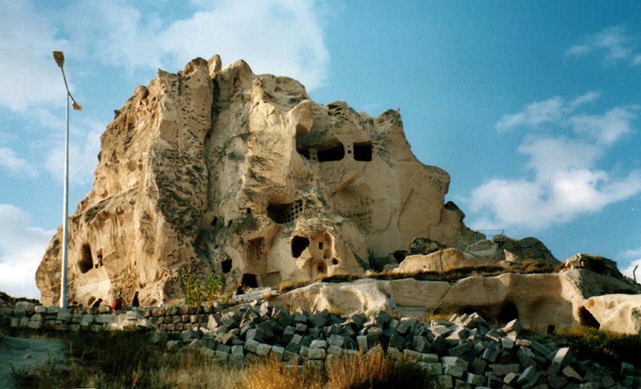
Çeç is a large stone-covered tumulus rising from Çeç Tepesi in the countryside between Avanos and Özkonak. Its broad artificial profile makes it a landmark across the surrounding Cappadocian landscape, including views from the Avanos area. The Cultural Inventory identifies it as a tumulus thought to belong to the Roman period. Çeç is not a cave church, valley trail or museum building; the mound itself is the monument. Its isolated position gives the visit a distinctly rural character, focused on archaeology, terrain and long views rather than interpretation or indoor collections.
Checked 2026-09-02 · Source
The visible monument is a stone-covered artificial hill rather than an interior exhibition. Published descriptions give different dimensions: the Cultural Inventory records approximately 50 metres in diameter and 20 metres in height, while the Cappadocia Geopark describes the hill as about 32 metres high. On the eastern side, visitors may notice traces of steps. Hollows near the summit are associated with illicit digging, and a substantial depression marks the western side. These surface features belong to the mound’s present condition, not arranged archaeological displays. The visit is therefore an encounter with an exposed earthwork and its surviving details.
Checked 2026-09-02 · Source
Allow about 45 to 75 minutes for a focused visit, depending on where you leave the road, the climb across the slope and the time spent looking at the mound’s surface features. A lower-ground viewing stop can be brief, while a careful circuit may take longer. This is a practical planning estimate for an unstaffed outdoor landform. Add time if you want to photograph Çeç from several viewpoints, compare its profile with the surrounding hills or pause to understand how the mound dominates Çeç Tepesi.
Checked 2026-09-02 · Source
Plan Çeç for daylight, when the mound’s outline, loose stones, eastern step traces and ground depressions are easiest to distinguish. Rain, snow and strong wind can make the exposed slope harder to read and cross safely. Morning and late-afternoon light can bring out the tumulus’s texture, while clear conditions help preserve broad views across the Avanos-side countryside. Avoid treating poor weather as a minor inconvenience on this open, uneven hill, because changing ground conditions affect both visibility and footing during the approach and climb.
Checked 2026-09-02 · Source
Çeç is an open-air archaeological landform in a rural setting, so the visit is centred on observing the mound, its stone covering and its surrounding landscape. It fits naturally into a day focused on the countryside between Avanos and Özkonak, alongside other stops reached by road. Allow time for the approach and climb rather than planning it like an indoor museum visit with galleries, exhibits or a timed route. The main experience is the scale, surface condition and isolated position of Çeç on its hill.
Checked 2026-09-02 · Source
Çeç stands on Çeç Tepesi in the Göreme Municipality area, between Avanos and Özkonak, within the wider Göreme–Avanos–Nevşehir triangle. Avanos Municipality notes that the tumulus is visible from Avanos, making its mound a useful rural landmark. Approach the hill by road, then expect to walk across sloping natural ground for the final stretch. Arrange navigation before leaving the main road: this is countryside rather than a developed attraction with a clearly described visitor approach. The visible mound helps orient the final approach, but it does not replace careful route planning.
Checked 2026-09-02 · Source
The mound is high, exposed, sloping and naturally stony, with no maintained staircase described in the available information. Wear shoes with reliable grip and take care around the incomplete eastern step traces, summit hollows and western depression. Do not enter cavities, climb unstable sections or disturb stones and archaeological traces. Wet, snowy or windy conditions can change the footing quickly. Keep the visit observational: Çeç has no curated route or prepared museum environment to structure movement across the hill. Treat the visible remains as archaeological features rather than objects to explore physically.
Checked 2026-09-02 · Source
Photograph Çeç first as a landform, using lower ground to show the stone-covered mound against the open countryside and explain its visibility from the Avanos area. Closer compositions can emphasize the rough stone surface and eastern step traces, while wider frames place the artificial hill within the Cappadocian landscape. Photograph summit hollows and the western depression only from stable ground. Daylight reveals texture best, and a longer lens can produce useful views without requiring a risky climb over loose or steep sections. A broad frame from below also conveys the mound’s unusual scale and isolation on Çeç Tepesi.
Checked 2026-09-02 · Source
Çeç is a large stone-covered tumulus on Çeç Tepesi between Avanos and Özkonak. Its artificial hill is a prominent rural landmark, and the Cultural Inventory considers it one of the region’s tumuli thought to date from the Roman period.
The Cultural Inventory says Çeç is thought to be one of the Roman-period tumuli found widely across the region. That attribution does not mean the mound has been fully excavated or turned into an indoor archaeological exhibition.
Published descriptions differ. The Cultural Inventory gives approximately 50 metres in diameter and 20 metres in height, while the Cappadocia Geopark describes the artificial hill as about 32 metres high, reflecting different descriptions or measurement conventions.
It is on Çeç Tepesi in the Göreme Municipality area, in the countryside between Avanos and Özkonak. Avanos Municipality notes that the mound can be seen from Avanos, within the wider Göreme–Avanos–Nevşehir triangle.
The stone-covered mound has traces of steps on its eastern side, hollows associated with illicit digging near the summit and a large depression on the west. These are visible site features, not arranged exhibits, so observe them without entering or disturbing them.
No. The mound is high, sloping and naturally stony, with incomplete step traces rather than a maintained staircase. The available site information names no public-transport stop or direct service, so the final approach involves walking across natural ground.
Loading the interactive map…
The interactive map could not be loaded.

Last updated:
Source: OpenStreetMap contributors ·