

.jpg)


124 min walk
Robben Island Museum
- Must see
- Museum
Language · 11 published
Nature site · Cape Town
Blaauwberg Nature Reserve
Reviewed by Elena Voss · SSMTour Travel Editor
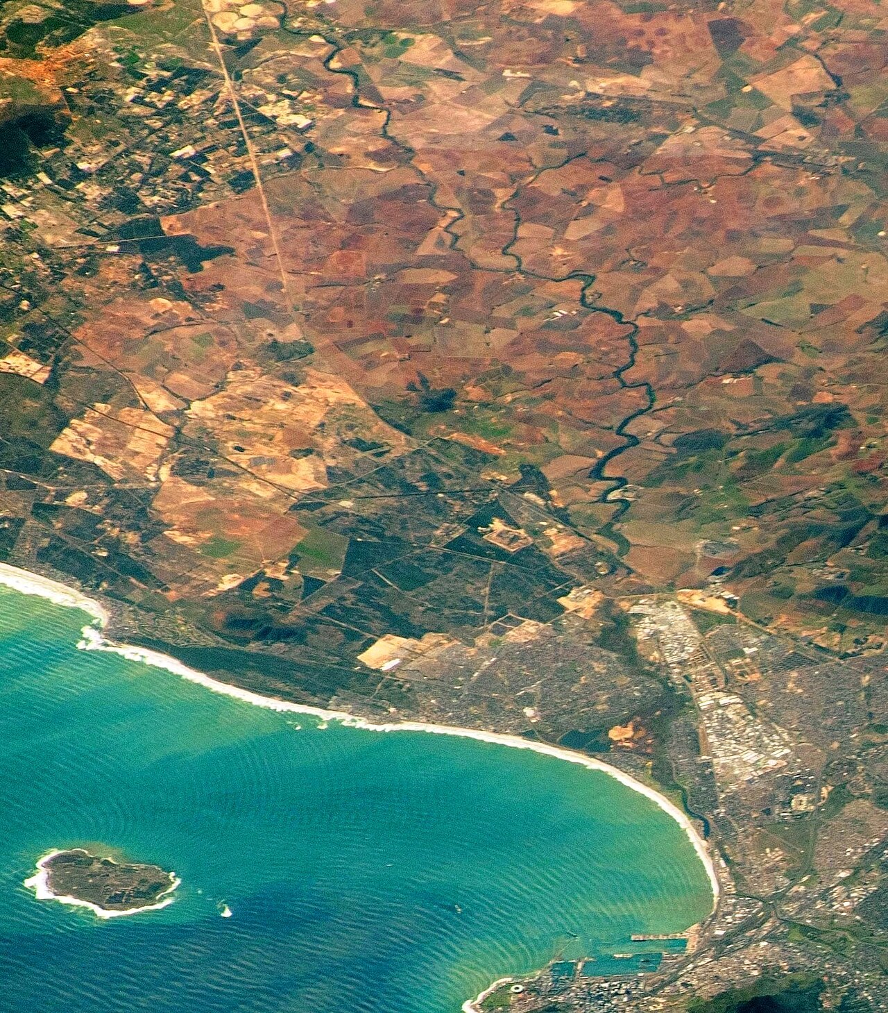
Blaauwberg Nature Reserve is a protected coastal landscape in the northern Cape Town metropolitan area. It brings together Atlantic shoreline dunes and lowland Cape fynbos, creating a distinctly open setting close to the city. The elevated ground gives visitors broad views across Table Bay, including Table Mountain and Robben Island. This is a nature-focused stop suited to landscape appreciation, quiet walking, and photography rather than intensive urban entertainment. Blaauwberg Nature Reserve is a coastal nature reserve in the northern reaches of the Cape Town metropolitan area. It protects a transition zone where Atlantic shoreline dunes meet endangered Cape fynbos vegetation. The reserve occupies elevated terrain that affords exceptionally clear sightlines across Table Bay, making it one of the most photographically celebrated vantage points for simultaneous views of Table Mountain and Robben Island within the metro. The City of Cape Town manages this public conservation area as part of its broader environmental heritage portfolio. Bloubergstrand refers to a broader coastal suburban area and public beach zone, while Blaauwberg Nature Reserve designates a specific protected area with conservation status. You can see Atlantic coastal dunes, lowland Cape fynbos, Table Bay, Table Mountain, and Robben Island from elevated parts of the reserve.
Checked 2026-08-26 · Source
The reserve’s character comes from two connected habitats: mobile and semi-stabilised coastal dunes, together with patches of lowland fynbos. The plants are adapted to sandy, nutrient-poor ground and salt-bearing coastal winds. Visitors encounter a largely undeveloped landscape where the terrain and vegetation provide the main experience. The elevated areas are especially rewarding for wide seascape views, while the dune environment gives the visit texture and a strong sense of place. The reserve contains two primary habitat types: mobile and semi-stabilised coastal dunes, and patches of lowland fynbos characteristic of the Cape Floristic Region. These ecosystems support endemic plant species adapted to nutrient-poor sandy soils and salt-laden winds. The terrain rises sufficiently above sea level to create unobstructed panoramic views.
Checked 2026-08-26 · Source
Allow around thirty minutes for a brief viewpoint stop and a quick appreciation of the coastal setting. A slower visit with walking, plant observation, and landscape photography can occupy two or three hours. Sandy and uneven ground naturally makes the pace more measured than a paved urban attraction. The reserve works well as a focused morning outing or as a shorter northern Cape Town stop alongside other coastal plans.
Checked 2026-08-26 · Source

Morning is a useful time for a comfortable visit and clear landscape photography, particularly before coastal winds strengthen. Summer afternoons can bring strong southeasterly winds, making exposed dunes less comfortable and reducing visibility. Winter rain can make sandy ground harder to walk across. Weather therefore affects the experience more than seasonal events do: choose a calmer period when possible and leave room for changing coastal conditions.
Checked 2026-08-26 · Source
The reserve is presented as public conservation space managed within Cape Town’s municipal environmental portfolio. Its value is the protected dune-and-fynbos landscape and the elevated outlook across Table Bay. Build the visit around scenery, walking, and observation rather than a ticketed exhibition or structured attraction. The coastal reserve earns its place in a Cape Town itinerary because it offers a quieter, open-air contrast to the city’s built heritage and waterfront districts.
Checked 2026-08-26 · Source

Blaauwberg Nature Reserve lies in Cape Town’s northern coastal zone, in the wider vicinity of Bloubergstrand. A private vehicle is the practical choice for reaching this open conservation landscape, especially when carrying water and protective clothing. Approach routes and access points can be confusing because coastal development sits beside informal paths and undeveloped ground. Plan the final approach carefully and allow extra time for locating the reserve entrance area.
Checked 2026-08-26 · Source
Expect exposure to wind, sun, and loose sand. Strong gusts can blow sand across paths, while unstable dune faces make steep edges unsuitable for climbing. Wear secure footwear, carry water, and bring sun and wind protection. The reserve is predominantly undeveloped, so prepare for a self-directed outdoor visit rather than a serviced attraction. Stay on appropriate ground, avoid damaging fynbos, and take extra care near the urban edge and unfamiliar access paths.
Checked 2026-08-26 · Source

The reserve’s signature image is the relationship between Table Mountain, Robben Island, Table Bay, and the low dune-and-fynbos foreground. Open terrain gives the scene a broad horizon, while vegetation adds natural texture without overwhelming the view. Morning light can be especially effective for landscape work. Wind may shake a tripod or move sand across equipment, so protect cameras and choose stable ground before composing a frame.
Checked 2026-08-26 · Source
You can see Atlantic coastal dunes, lowland Cape fynbos, Table Bay, Table Mountain, and Robben Island from elevated parts of the reserve.
Allow about thirty minutes for a short viewpoint visit, or two to three hours for slower walking, nature observation, and photography.
The reserve protects mobile and semi-stabilised coastal dunes together with lowland fynbos adapted to sandy soils and salt-bearing coastal winds.
Morning visits can provide calmer conditions and clearer views before strong coastal winds make exposed dune areas less comfortable.
Bring water, sun protection, windproof clothing, and footwear suitable for sandy, uneven ground.
Its main appeal is the possibility of framing Table Mountain and Robben Island together across Table Bay, with dunes and fynbos in the foreground.
Loading the interactive map…
The interactive map could not be loaded.


Last updated:
Source: OpenStreetMap contributors, Wikidata ·