.jpg)

.jpg)

.jpg)


10 min walk
Puka Pukara
- Must see · Heritage site
- Historic monument
Language · 11 published
Historic monument · Cusco
Tampu Mach'ay

Tambomachay is an Inca archaeological site on the northern outskirts of Cusco, Peru. It functions as a ceremonial water shrine, featuring finely engineered stone channels, aqueducts, and waterfalls that demonstrate sophisticated hydraulic engineering. The site is widely interpreted as a place of water worship or a royal bathing complex. Its precise original function remains subject to scholarly discussion. Tambomachay forms part of Cusco's northern archaeological circuit alongside Sacsayhuamán, Q'enqo, and Puka Pukara. The site sits at higher elevation than central Cusco, requiring visitors to acclimatize before exertion.
Checked 2026-08-26
The complex contains terraced stone constructions with multiple water channels carved from living rock. Water flows through the site via underground springs and engineered conduits, emerging at various points. The main structures include what appear to be ceremonial fountains and bathing niches. Dry-stone walls show characteristic Inca masonry precision. The layout suggests ritual or administrative functions rather than domestic use. Visitors can observe the water management system operating as originally designed centuries ago. The surrounding terrain offers views toward the broader Cusco valley and neighboring archaeological zones.
Checked 2026-08-26
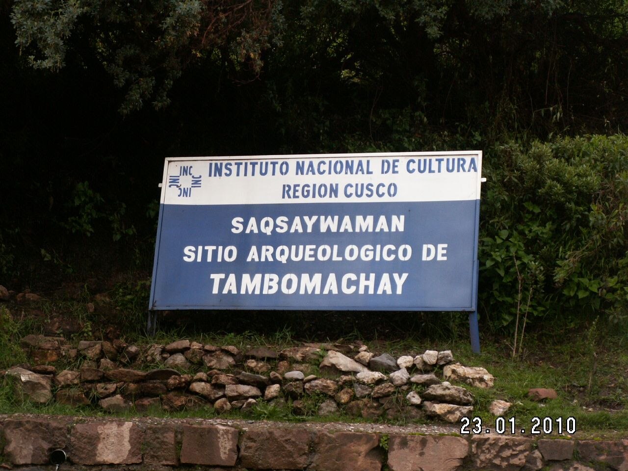
Most visitors spend approximately forty-five minutes to one hour at Tambomachay. This duration allows for examining the water channels, walking the terraces, and observing the stonework details. Those with particular interest in Inca hydraulic engineering may extend their stay. The site is typically combined with other circuit locations in a half-day or full-day itinerary. Physical exertion is moderate due to the altitude, which may slow walking pace. Visitors should factor in transit time from Cusco and between nearby archaeological sites when planning schedules.
Checked 2026-08-26

Operator-confirmed hours are Not recorded pending review. Visitors should verify current opening schedules through official channels before planning. The dry season from May to September generally offers more predictable weather for outdoor archaeological visits in the Cusco region, though rain remains possible year-round at this altitude. Morning visits may provide clearer light and fewer crowds. Afternoon conditions can bring stronger sun exposure requiring protection. Seasonal variations in water flow through the channels may affect visual interest. Local tourism patterns around Cusco holidays influence congestion levels.
Checked 2026-08-26
Operator-confirmed prices are Not recorded pending review. The site participates in Cusco's integrated archaeological circuit ticketing system, though specific current costs require verification. Visitors should consult official sources for accurate fee structures. The Cusco Tourist Ticket historically covered multiple sites including Tambomachay, but current validity and inclusions must be confirmed. Cash payment in Peruvian soles is standard practice at regional archaeological sites. International visitors typically pay differential rates from domestic visitors. Budget for potential combined circuit entry rather than individual site purchase. Tambomachay also earns time in a cusco itinerary because The finely engineered Inca water shrine is a core stop on Cusco's northern archaeological circuit; no production candidate exists. Its value becomes clearer when the stop is compared with the surrounding streets and the other ranked places nearby.
Checked 2026-08-26

Tambomachay lies approximately eight kilometers northeast of central Cusco along paved road access. Colectivo shared vans depart from designated Cusco stops toward the direction of Pisac, with passengers disembarking near the site entrance. Taxis and private transport offer direct alternatives. Organized tours commonly include Tambomachay within the northern circuit route. Walking from central Cusco involves significant elevation gain and is not recommended for unacclimatized visitors. The road passes through or near other archaeological sites, enabling sequential visits. Return transport may require waiting at roadside or pre-arranging pickup times.
Checked 2026-08-26

Altitude affects most visitors; symptoms including breathlessness and fatigue require pacing and hydration. Sun intensity is notably stronger at this elevation than sea-level visitors anticipate. Water channels create slippery stone surfaces, particularly if wet. No guardrails exist at terrace edges. Limited shelter provides minimal protection from sudden weather changes. On-site facilities are minimal or absent; carry water and sun protection. Roadside traffic when accessing or departing requires caution. Unofficial guides may approach visitors at entrances. Verify credentials if engaging services. Respect site boundaries to preserve archaeological integrity and personal safety.
Checked 2026-08-26
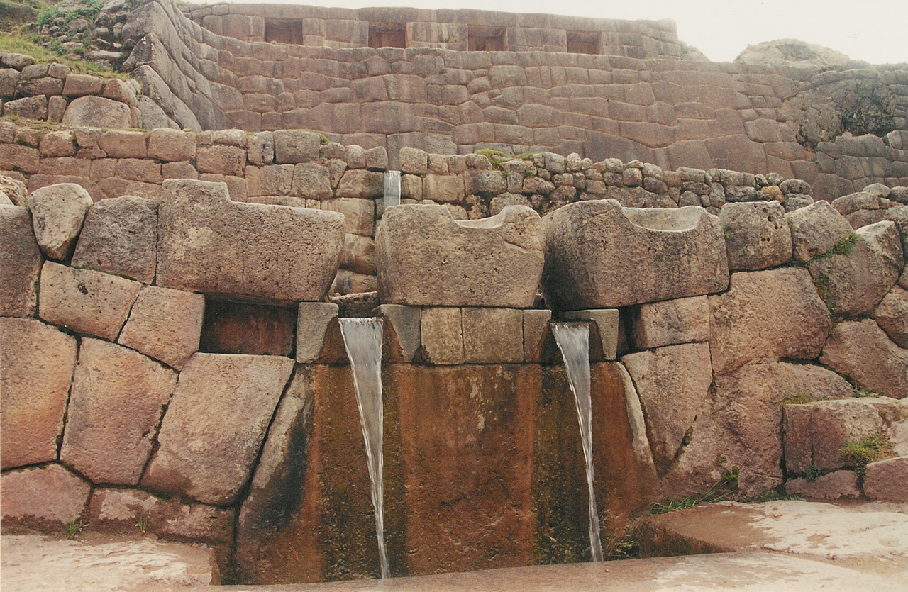
Water channels and falling water present opportunities for motion-blur or freeze-frame techniques depending on desired effect. Morning side-lighting emphasizes stone texture and channel depth. Overcast conditions reduce harsh shadows across the terraced constructions. Wide angles capture the relationship between architecture and landscape. Polarizing filters may reduce glare on wet surfaces and enhance sky saturation. Tripod use should not obstruct narrow walkways or other visitors. The flowing water element distinguishes Tambomachay from drier archaeological sites nearby. Respect any posted restrictions on commercial or drone photography without verified permits.
Checked 2026-08-26
Scholarly interpretation suggests ceremonial water worship or royal bathing functions, though definitive historical records are limited. The sophisticated hydraulic engineering indicates ritual importance.
The site has historically participated in integrated circuit ticketing, but current inclusions require verification with official sources as operator-confirmed details are Not recorded pending review.
Moderate exertion at high altitude affects most visitors. The site involves walking on uneven stone surfaces with some incline. Acclimatization in Cusco before visiting is advisable.
Independent access is possible via colectivo transport or taxi. Self-guided visitation allows flexible pacing, though interpretive signage may be limited compared to guided explanation.
The hydraulic system operates from natural springs, though seasonal variations in flow may occur. Water presence is a defining characteristic distinguishing this site.
On-site facilities appear minimal based on visitor reports. Prepare accordingly with water and necessities before arrival, as services at this archaeological location are limited.
Loading the interactive map…
The interactive map could not be loaded.
Last updated:
Source: OpenStreetMap contributors, Wikidata ·