Île d'Orléans
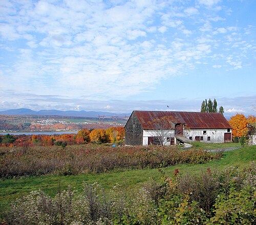
Île d'Orléans is a large island in the Saint Lawrence River, located downstream from Québec City. The island measures approximately 34 kilometres in length and 8 kilometres at its widest point.
- Must see
- Activity
Language · 11 published
City guide · Canada
Québec City is organised around a compact historic core above and below the St. Lawrence River cliffs. Old Québec divides into Upper Town and Lower Town, with the Old Port beside the river. Parliament Hill, Montcalm and Saint-Jean-Baptiste extend west from the walls, while Saint-Roch and Limoilou form lower, more local districts. Central neighbourhoods are close together; outer attractions require bus or another planned connection.
Set your days, your pace and the hours you actually want to be out. The planner works around closing days and travel time, and leaves room to eat.
Ranked by importance — sitelinks, pageviews and heritage status, not editor preference.
3 places match
Category
Typical visit duration
Interests
Île d'Orléans is a large island in the Saint Lawrence River, located downstream from Québec City. The island measures approximately 34 kilometres in length and 8 kilometres at its widest point.
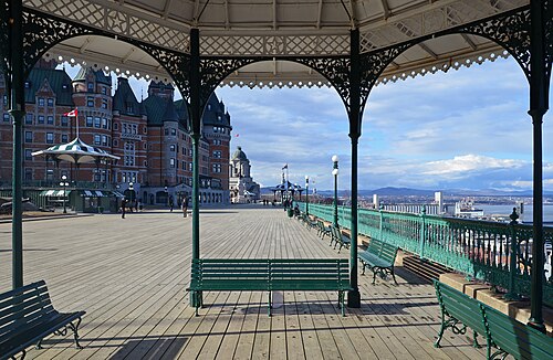
Dufferin Terrace is a historic boardwalk in Québec City's Upper Town, running alongside the Château Frontenac. This elevated promenade overlooks the St.
Source: OpenStreetMap contributors, Wikidata ·
Upper Town occupies the fortified plateau around Château Frontenac and the main gates. Lower Town sits beneath the cliff around Place Royale and the Old Port, linked by steep streets, stairs and the funicular. Parliament Hill and the Plains of Abraham are west of the walls; Saint-Jean-Baptiste and Montcalm continue beyond them. Saint-Roch lies below the escarpment, with Limoilou farther north across the Saint-Charles River.
Checked 2026-08-26
Walk between the central neighbourhoods, allowing for steep grades between Upper and Lower Town. The RTC bus network serves the city centre, central districts, suburbs, the airport and both train stations. Frequent Métrobus routes carry numbers in the 800s and are useful beyond the historic core. Use the official RTC trip planner and current notices because construction, weather and traffic can alter stops and schedules.
Checked 2026-08-26
A fixed stay length is not recorded. Plan Upper and Lower Town first, then add Parliament Hill, Montcalm, Saint-Roch or an outer excursion according to your priorities.
Yes. Its principal areas are compact, but Upper and Lower Town are separated by a steep escarpment, stairs and sloping streets.
Upper Town occupies the fortified plateau; Lower Town lies beneath it around Place Royale and the Old Port. Routes between them include steep streets, stairs and the funicular.
Use RTC buses. The network serves central neighbourhoods, suburbs, the airport and both train stations, with frequent Métrobus routes on major corridors.
No. The official visitor guide describes them as concentrated in a relatively small area, though elevation changes can make short map distances more demanding on foot.