Alcatraz Island
Alcatraz Island is a National Park Service historic site in San Francisco Bay, best known for the federal penitentiary that operated from 1934 to 1963.
- Must see
- Nature site
Language · 1 published
City guide · United States
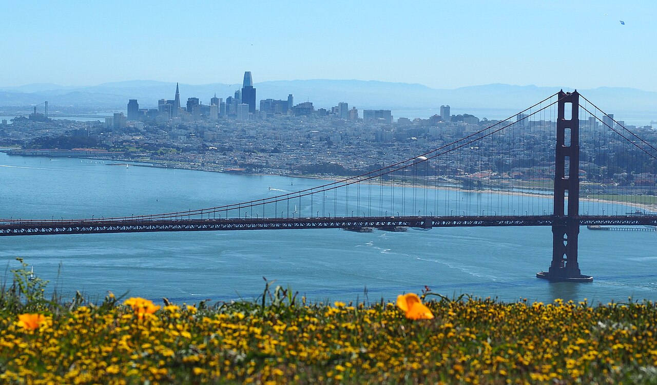
San Francisco is geographically compact but physically demanding, with steep hills separating waterfront, downtown and residential neighbourhoods. Union Square, Chinatown, North Beach, the Embarcadero and Fisherman’s Wharf can be linked carefully, while Golden Gate Park and the western districts need separate transit. Muni buses, light rail, streetcars and cable cars cover the city; BART mainly handles regional connections. Build routes around elevation as well as distance.
Ranked by importance — sitelinks, pageviews and heritage status, not editor preference.
50 places match
Category
Typical visit duration
Alcatraz Island is a National Park Service historic site in San Francisco Bay, best known for the federal penitentiary that operated from 1934 to 1963.
Golden Gate Park is a long urban landscape running from the central city toward Ocean Beach.
The Presidio of San Francisco is a vast former military post turned national park site at the Golden Gate.
Lands End is a rugged coastal park on San Francisco's northwestern shore, managed by the National Park Service as part of Golden Gate National Recreation Area.
The Japanese Tea Garden is a historic Japanese landscape garden located in San Francisco's Golden Gate Park.
San Francisco Botanical Garden is a botanical garden and arboretum located within Golden Gate Park in San Francisco, California. It occupies a significant portion of the park's western end.
Union Square is a public plaza in downtown San Francisco, California. It serves as a central gathering point in the city's core and functions as a landmark destination for shopping, hotels, and civic events.
Mission Dolores Park is a major urban park in San Francisco's Mission District. It occupies a sloped site that provides celebrated views toward the downtown skyline.
Embarcadero Plaza is a civic plaza located on San Francisco's eastern waterfront, adjacent to the historic Ferry Building.
Yerba Buena Gardens is a public garden complex in downtown San Francisco. It occupies a two-block area between Mission and Folsom Streets, adjacent to the Yerba Buena Center for the Arts and the San Francisco Museum of Modern Art.
Washington Square is a public park and civic green in San Francisco's North Beach neighborhood. The square functions as a neighborhood gathering space and recreational area for residents and visitors.
Fort Mason is a former United States Army post located in San Francisco, California. The National Park Service now manages the site as part of the Golden Gate National Recreation Area.
Marina Green is a public open space in San Francisco's Marina District. It sits directly on the bayfront, offering unobstructed views of the Golden Gate Bridge, Alcatraz Island, and the Marin Headlands.
Buena Vista Park is San Francisco's oldest public park, established in 1867. It occupies a wooded hilltop between the Castro and Haight-Ashbury neighborhoods.
Corona Heights Park is a compact public park atop a rocky hill in San Francisco, California. The park occupies a prominent outcrop of Franciscan chert, offering unusually broad panoramic views across the city.
Grandview Park is a compact elevated open space in San Francisco's Inner Sunset neighborhood. The small hilltop park offers visitors panoramic views across the city, extending to the Pacific Ocean and downtown skyline on clear days.
Mount Sutro Open Space Reserve is a 61-acre public open space located in central San Francisco, California. The reserve sits on the slopes of Mount Sutro, a hill in the city's interior.
Bernal Heights Park is a neighborhood hilltop park in San Francisco, California. It occupies the summit of Bernal Heights, a prominent hill in the city's southeastern quadrant.
Glen Canyon Park is a public park in San Francisco, California, managed by the San Francisco Recreation and Park Department.
Fort Funston is a coastal recreation area within the Golden Gate National Recreation Area in southwestern San Francisco. The site occupies elevated Pacific bluffs that were once a military installation.
Lake Merced is a large freshwater lake and recreational landscape situated at the southwest edge of San Francisco. The lake and its surrounding parkland form a significant natural amenity within the urban environment, offering open space for residents and visitors.
Presidio Tunnel Tops is a public park landscape constructed above the tunnels of Highway 101, connecting the Presidio's historic core to its waterfront.
Shakespeare Garden is a small literary planting garden located in Golden Gate Park, San Francisco. It sits near the de Young Museum and the California Academy of Sciences.
Golden Gate Park Rose Garden is a formal rose garden situated within Golden Gate Park in San Francisco. It occupies part of the park's concentrated museum and garden precinct, an area known for cultural and horticultural attractions.
Huntington Falls is a small landscaped waterfall situated on Strawberry Hill within Golden Gate Park in San Francisco.
Source: OpenStreetMap contributors, Wikidata ·
Downtown and Union Square sit east of the central hills. Chinatown and North Beach lie north, leading toward Fisherman’s Wharf and the Marina; the Embarcadero follows the eastern waterfront. The Mission and Castro extend southwest of downtown, while Haight-Ashbury and Golden Gate Park lead toward the Pacific. Presidio and Lands End occupy the northwestern edge. Neighbourhood boundaries matter because two nearby points can be separated by a steep climb or a slow cross-city connection.
Checked 2026-08-26
Use Muni buses and light rail for most city journeys, with historic streetcars and cable cars serving selected corridors. BART connects downtown with the airport and East Bay but is not the main network for neighbourhood sightseeing. Walking works within districts, provided the route accounts for hills. The SFMTA journey tools cover transit, walking and cycling; check them before crossing between the waterfront, western parks and southern neighbourhoods.
Checked 2026-08-26
Three to four days suit a first visit. Three cover the central neighbourhoods, waterfront and Golden Gate Park; a fourth makes room for Presidio, Lands End or a regional side trip.
September and October are often practical for outdoor sightseeing, with milder conditions and less persistent summer fog. Local weather varies sharply by neighbourhood, so carry an extra layer in every season.
Individual neighbourhoods are walkable, but hills can make a short map distance strenuous. Plan routes around elevation and use Muni when moving between the waterfront, central hills and western districts.
Muni is the principal city network of buses, light rail, streetcars and cable cars. BART is most useful for airport and regional travel, with fewer stops for neighbourhood sightseeing inside San Francisco.
They sit in different visitor corridors and are better planned separately. Combine Golden Gate Park with western neighbourhoods, and pair Fisherman’s Wharf with North Beach or the Embarcadero.
Set your days, your pace and the hours you actually want to be out. The planner works around closing days and travel time, and leaves room to eat.