City guide · United States
San Francisco
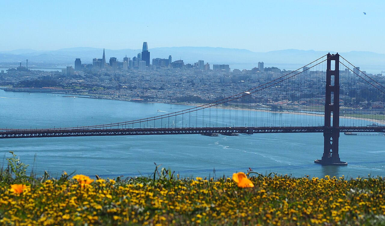

San Francisco is geographically compact but physically demanding, with steep hills separating waterfront, downtown and residential neighbourhoods. Union Square, Chinatown, North Beach, the Embarcadero and Fisherman’s Wharf can be linked carefully, while Golden Gate Park and the western districts need separate transit. Muni buses, light rail, streetcars and cable cars cover the city; BART mainly handles regional connections. Build routes around elevation as well as distance.
Practical information
Practical information
- Language spoken
- English is the principal language; no federal official language
- National practical orientation; regional and minority languages may also be used
- Dialling code
- +1
- International calling code; local area and mobile prefixes still apply
- Currency
- United States dollar (USD)
- Use the official local currency; card acceptance varies by place
- Emergency number
- 911
- Use only for an emergency; tourist assistance may use a separate number
- Plug type
- Type A and B · 120 V
- Check that chargers support the recorded voltage before using an adapter
- Tap water
- Not recorded
- Water quality is regulated locally; check the current notice for the destination
Planning a visit
- Seasonal closure recorded
- No data recorded for this month
- The current month
- Suggested stay
- 3-4 days
- Getting around
- Muni bus, light rail, streetcar, cable car and walking
- January: seasonal closure recorded
- February: seasonal closure recorded
- March: seasonal closure recorded
- April: seasonal closure recorded
- May: seasonal closure recorded
- June: no seasonality data recorded
- July: no seasonality data recorded
- August: no seasonality data recorded — this month
- September: no seasonality data recorded
- October: no seasonality data recorded
- November: seasonal closure recorded
- December: seasonal closure recorded
Top things to see
Ranked by importance — sitelinks, pageviews and heritage status, not editor preference.
Filter the list
0 places match
0 places match
Nothing in San Francisco matches all of those filters
The list is built from real place data, so an empty result means the combination genuinely has no match — not that the page failed. Loosen one filter and the ranking returns.
Clear all filtersSource: OpenStreetMap contributors, Wikidata ·
How the city is laid out
Downtown and Union Square sit east of the central hills. Chinatown and North Beach lie north, leading toward Fisherman’s Wharf and the Marina; the Embarcadero follows the eastern waterfront. The Mission and Castro extend southwest of downtown, while Haight-Ashbury and Golden Gate Park lead toward the Pacific. Presidio and Lands End occupy the northwestern edge. Neighbourhood boundaries matter because two nearby points can be separated by a steep climb or a slow cross-city connection.
Checked 2026-08-26
Getting around
Use Muni buses and light rail for most city journeys, with historic streetcars and cable cars serving selected corridors. BART connects downtown with the airport and East Bay but is not the main network for neighbourhood sightseeing. Walking works within districts, provided the route accounts for hills. The SFMTA journey tools cover transit, walking and cycling; check them before crossing between the waterfront, western parks and southern neighbourhoods.
Checked 2026-08-26
Common questions
How many days does San Francisco need?
Three to four days suit a first visit. Three cover the central neighbourhoods, waterfront and Golden Gate Park; a fourth makes room for Presidio, Lands End or a regional side trip.
When is the best time to visit San Francisco?
September and October are often practical for outdoor sightseeing, with milder conditions and less persistent summer fog. Local weather varies sharply by neighbourhood, so carry an extra layer in every season.
Is San Francisco easy to explore on foot?
Individual neighbourhoods are walkable, but hills can make a short map distance strenuous. Plan routes around elevation and use Muni when moving between the waterfront, central hills and western districts.
What is the difference between Muni and BART?
Muni is the principal city network of buses, light rail, streetcars and cable cars. BART is most useful for airport and regional travel, with fewer stops for neighbourhood sightseeing inside San Francisco.
Should Golden Gate Park be combined with Fisherman’s Wharf?
They sit in different visitor corridors and are better planned separately. Combine Golden Gate Park with western neighbourhoods, and pair Fisherman’s Wharf with North Beach or the Embarcadero.
Turn this list into a plan
Set your days, your pace and the hours you actually want to be out. The planner works around closing days and travel time, and leaves room to eat.