
311 min walk
Alagöz Karargâh Museum
- High
- Museum
Language · 11 published
Historic monument · Ankara
Gavur Kalesi
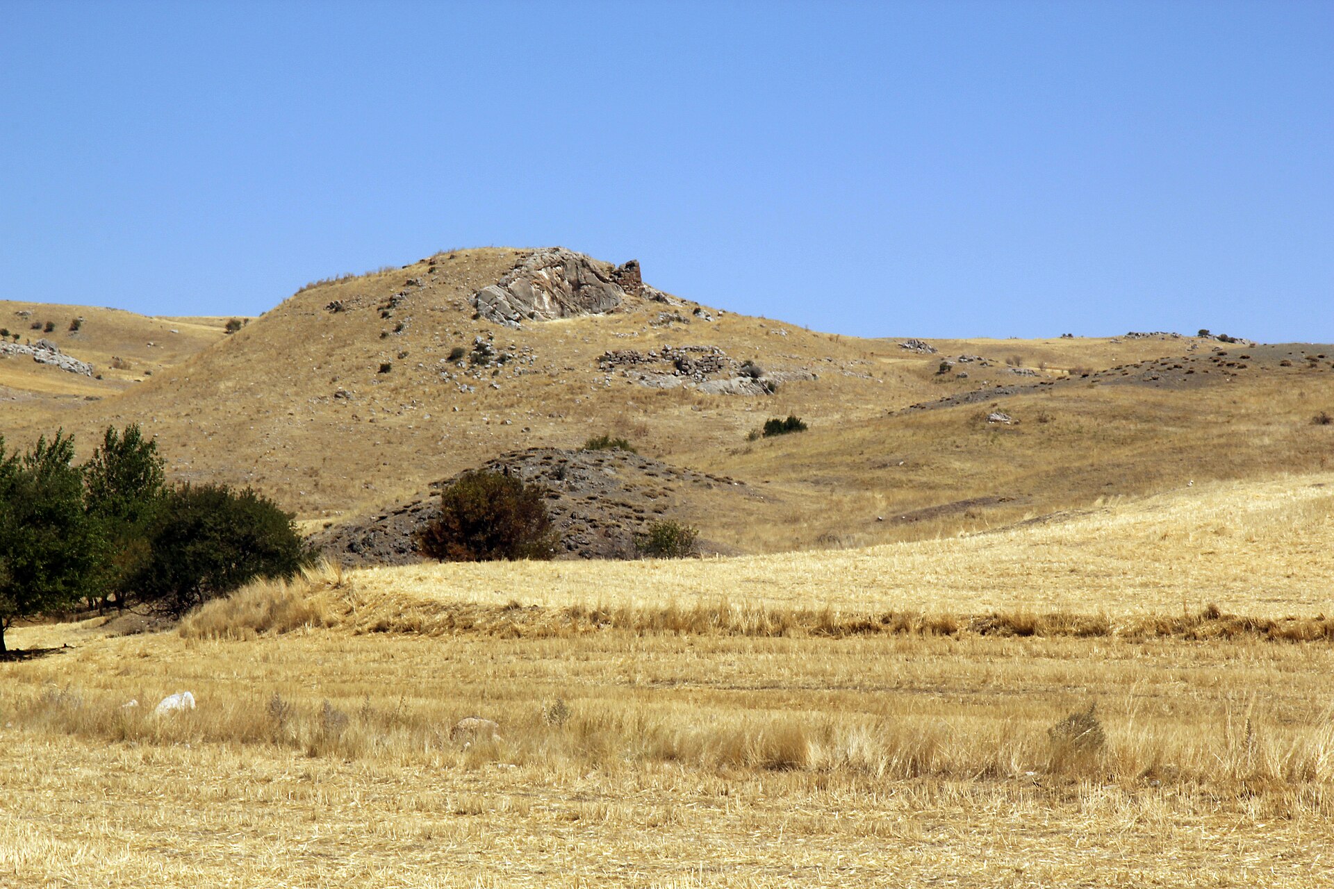
Gavurkale Hill is a rocky archaeological landmark near Dereköy in Haymana district, roughly 60 kilometres southwest of Ankara. Its identity rests on a south-facing Hittite relief scene and the remains of a hilltop fortification, not on a preserved building or museum collection. The site also carries evidence of later occupation: official Haymana history records Phrygian settlement traces alongside the better-known Hittite remains. The name therefore describes a landscape monument whose historical interest is inseparable from its exposed rock, summit and rural setting. Its isolated position gives the visit a distinctly archaeological and countryside character. Haymana ilçesinde, Ankara’nın yaklaşık 60 km güneybatısında ve Dereköy yakınındadır. Güneye bakan kaya yüzeyinde oturan bir tanrıça ile karşısında duran iki tanrı kabartması görülebilir. Zirvede kiklopik taşlarla örülmüş sur kalıntıları ve bir oda kalıntısı bulunur. Alan Hitit dönemine ait kaya kabartmaları ve yerleşim izleriyle tanınır; Haymana’daki resmî kaynaklar Frig yerleşim izlerini de belirtir.
Checked 2026-09-02 · Source
Above, the summit preserves remnants of a fortification made with cyclopean stones and the remains of a room. On the northern side of the level ground is the remnant of an underground chamber measuring about 3 by 4 metres and covered with a false vault. These are separate archaeological features across uneven terrain, so the visit involves reading the hillside as a sequence of remains rather than following a marked indoor exhibition route.
Checked 2026-09-02 · Source
Plan about 60 to 90 minutes for a focused visit. That allowance covers walking from the approach road, finding and examining the reliefs, and climbing towards the summit remains. The archaeological footprint is compact, but the features are distributed around a rocky hill rather than gathered in one accessible room. Visitors who want landscape photographs or a slower historical reading should allow more time. Groups with children or anyone who moves cautiously on uneven ground may need the longer end of the range for the ascent and return.
Checked 2026-09-02 · Source
Plan this as a daytime outdoor stop, when natural light makes the rock reliefs and summit masonry easier to distinguish. Spring and autumn are usually more comfortable seasons for walking across an exposed, rocky hill than the hottest summer weeks, while clear conditions improve views and photography. Shade and shelter may be limited because the attraction is a natural archaeological landscape rather than an enclosed museum. Weather matters to the experience: wet or poor-visibility conditions can make the approach and the separation between the features harder to negotiate safely.
Checked 2026-09-02 · Source
The municipal Haymana travel guide is useful contextual material, but it does not provide a place-specific admission record that can support a practical ticket statement. Accordingly, this guide makes no claim about tickets, charges or free admission. The archaeological setting can be described accurately without turning a general destination guide into evidence for the site’s current payment arrangements.
Checked 2026-09-02 · Source
Gavurkale Hill is near Dereköy in Haymana district, approximately 60 kilometres southwest of Ankara. The official Ankara culture and tourism page describes the road approach via the Gölbaşı–Haymana route, followed by the turn towards Dereköy. It identifies bus route 158 as the line used towards Dereköy. From the final approach, reaching the rocky archaeological area requires walking, so this is best planned as a rural excursion rather than a city-centre sightseeing stop. Allow time for both the road journey and the last uneven section on foot.
Checked 2026-09-02 · Source
Gavurkale is a natural rocky hill with archaeological remains spread across changing ground levels. Wear footwear with a secure grip and take care on the ascent, particularly after rain or when visibility is poor. Keep clear of the carved rock, summit masonry and chamber remains, and avoid climbing on fragile heritage fabric. Because this is an exposed outdoor setting, bring the personal supplies needed for the visit and stay attentive to the ground beneath you.
Checked 2026-09-02 · Source
Start with the south-facing rock surface, where the seated goddess and two opposing standing gods form Gavurkale’s most distinctive subject. Then make separate wider images of the cyclopean summit masonry, the room remains and the surrounding Haymana landscape. The hill’s uneven approach makes light equipment easier to handle safely. Photograph the relief and walls from a respectful distance, without touching, climbing or placing gear against the remains. A contextual frame showing the carved surface within the rocky hillside can communicate why this monument is experienced as a landscape site rather than an indoor display.
Checked 2026-09-02 · Source
Gavurkale Hill is near Dereköy in Haymana district, approximately 60 kilometres southwest of Ankara.
The south-facing rock surface shows a seated goddess and two standing gods facing her.
The summit has remains of a fortification built with cyclopean stones and the remains of a room.
The site is known for Hittite rock reliefs and settlement traces; official Haymana sources also record Phrygian settlement traces.
H. H. von der Osten carried out the first extensive excavations in 1930–1931 at Atatürk’s request, and excavation work was also undertaken in 1998.
North of the level area is the remnant of an underground chamber measuring approximately 3 by 4 metres and covered by a false vault.
Loading the interactive map…
The interactive map could not be loaded.

Last updated:
Source: OpenStreetMap contributors, Wikidata ·