
_%E0%B8%AD%E0%B8%99%E0%B8%B8%E0%B8%AA%E0%B8%B2%E0%B8%A7%E0%B8%A3%E0%B8%B5%E0%B8%A2%E0%B9%8C%E0%B8%8A%E0%B8%B1%E0%B8%A2%E0%B8%AA%E0%B8%A1%E0%B8%A3%E0%B8%A0%E0%B8%B9%E0%B8%A1%E0%B8%B4_%E0%B9%80%E0%B8%82%E0%B8%95%E0%B8%A3%E0%B8%B2%E0%B8%8A%E0%B9%80%E0%B8%97%E0%B8%A7%E0%B8%B5_%E0%B8%81%E0%B8%A3%E0%B8%B8%E0%B8%87%E0%B9%80%E0%B8%97%E0%B8%9E%E0%B8%A1%E0%B8%AB%E0%B8%B2%E0%B8%99%E0%B8%84%E0%B8%A3_(2).jpg)
_%E0%B8%AD%E0%B8%99%E0%B8%B8%E0%B8%AA%E0%B8%B2%E0%B8%A7%E0%B8%A3%E0%B8%B5%E0%B8%A2%E0%B9%8C%E0%B8%8A%E0%B8%B1%E0%B8%A2%E0%B8%AA%E0%B8%A1%E0%B8%A3%E0%B8%A0%E0%B8%B9%E0%B8%A1%E0%B8%B4_%E0%B9%80%E0%B8%82%E0%B8%95%E0%B8%A3%E0%B8%B2%E0%B8%8A%E0%B9%80%E0%B8%97%E0%B8%A7%E0%B8%B5_%E0%B8%81%E0%B8%A3%E0%B8%B8%E0%B8%87%E0%B9%80%E0%B8%97%E0%B8%9E%E0%B8%A1%E0%B8%AB%E0%B8%B2%E0%B8%99%E0%B8%84%E0%B8%A3_(3).jpg)
_%E0%B8%AD%E0%B8%99%E0%B8%B8%E0%B8%AA%E0%B8%B2%E0%B8%A7%E0%B8%A3%E0%B8%B5%E0%B8%A2%E0%B9%8C%E0%B8%8A%E0%B8%B1%E0%B8%A2%E0%B8%AA%E0%B8%A1%E0%B8%A3%E0%B8%A0%E0%B8%B9%E0%B8%A1%E0%B8%B4_%E0%B9%80%E0%B8%82%E0%B8%95%E0%B8%A3%E0%B8%B2%E0%B8%8A%E0%B9%80%E0%B8%97%E0%B8%A7%E0%B8%B5_%E0%B8%81%E0%B8%A3%E0%B8%B8%E0%B8%87%E0%B9%80%E0%B8%97%E0%B8%9E%E0%B8%A1%E0%B8%AB%E0%B8%B2%E0%B8%99%E0%B8%84%E0%B8%A3_(4).jpg)
_%E0%B8%AD%E0%B8%99%E0%B8%B8%E0%B8%AA%E0%B8%B2%E0%B8%A7%E0%B8%A3%E0%B8%B5%E0%B8%A2%E0%B9%8C%E0%B8%8A%E0%B8%B1%E0%B8%A2%E0%B8%AA%E0%B8%A1%E0%B8%A3%E0%B8%A0%E0%B8%B9%E0%B8%A1%E0%B8%B4_%E0%B9%80%E0%B8%82%E0%B8%95%E0%B8%A3%E0%B8%B2%E0%B8%8A%E0%B9%80%E0%B8%97%E0%B8%A7%E0%B8%B5_%E0%B8%81%E0%B8%A3%E0%B8%B8%E0%B8%87%E0%B9%80%E0%B8%97%E0%B8%9E%E0%B8%A1%E0%B8%AB%E0%B8%B2%E0%B8%99%E0%B8%84%E0%B8%A3_(5).jpg)
_%E0%B8%AD%E0%B8%99%E0%B8%B8%E0%B8%AA%E0%B8%B2%E0%B8%A7%E0%B8%A3%E0%B8%B5%E0%B8%A2%E0%B9%8C%E0%B8%8A%E0%B8%B1%E0%B8%A2%E0%B8%AA%E0%B8%A1%E0%B8%A3%E0%B8%A0%E0%B8%B9%E0%B8%A1%E0%B8%B4_%E0%B9%80%E0%B8%82%E0%B8%95%E0%B8%A3%E0%B8%B2%E0%B8%8A%E0%B9%80%E0%B8%97%E0%B8%A7%E0%B8%B5_%E0%B8%81%E0%B8%A3%E0%B8%B8%E0%B8%87%E0%B9%80%E0%B8%97%E0%B8%9E%E0%B8%A1%E0%B8%AB%E0%B8%B2%E0%B8%99%E0%B8%84%E0%B8%A3.jpg)
6 min walk · เขตราชเทวี
Santiphap Park
- High
- Nature site
Language · 1 published
Historic monument · เขตราชเทวี, Bangkok
อนุสาวรีย์ชัยสมรภูมิ
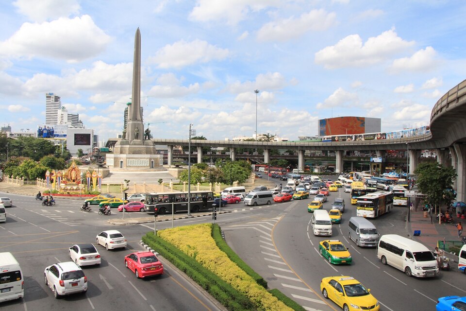
Victory Monument, in Thai Anusawari Chai Samoraphum, is a military memorial at the centre of a large traffic circle in Ratchathewi district, where Phahonyothin, Phaya Thai and Ratchawithi roads meet northeast of central Bangkok. It was erected in June 1941 to mark Thailand's claimed victory in the Franco-Thai War, the brief conflict fought against the Vichy French authorities in Indochina in December 1940 and January 1941. The design is entirely Western: a central obelisk shaped as five bayonets clasped together, ringed by five heroic figures representing the army, the navy, the air force, the police and the civilian population. The names of 656 soldiers and civilians who died in the war are inscribed on the obelisk. For most people in Bangkok, though, the monument is not a memorial at all but a place name - the city's great bus interchange, and the answer to the local saying that if you are lost in Bangkok you should start at Victory Monument.
Checked 2026-08-25 · Source
The monument has no interior; what it has is a sculptural programme and an awkward history attached to it. The five figures are the work of Corrado Feroci, the Italian sculptor who worked in Thailand under the name Silpa Bhirasri and who also made the reliefs at the Democracy Monument. Feroci disliked the way his figures were combined with the obelisk and called the result "the victory of embarrassment". The obelisk form itself is Egyptian in origin but had become a European and American convention for national and military memorials, its shape suggesting both a sword and masculine potency; the heroic treatment of the five figures is the international style of the 1940s, familiar from fascist and communist states alike. The embarrassment turned political in 1945, when the Allied victory in the Pacific War forced Thailand to return to France the territories in western Cambodia and northern and southern Laos that the war had gained, and the monument commemorated a victory that no longer existed. Many Thais have since read it as a relic of a discredited militarist regime. It remains one of the city's most recognisable landmarks.
Checked 2026-08-25 · Source
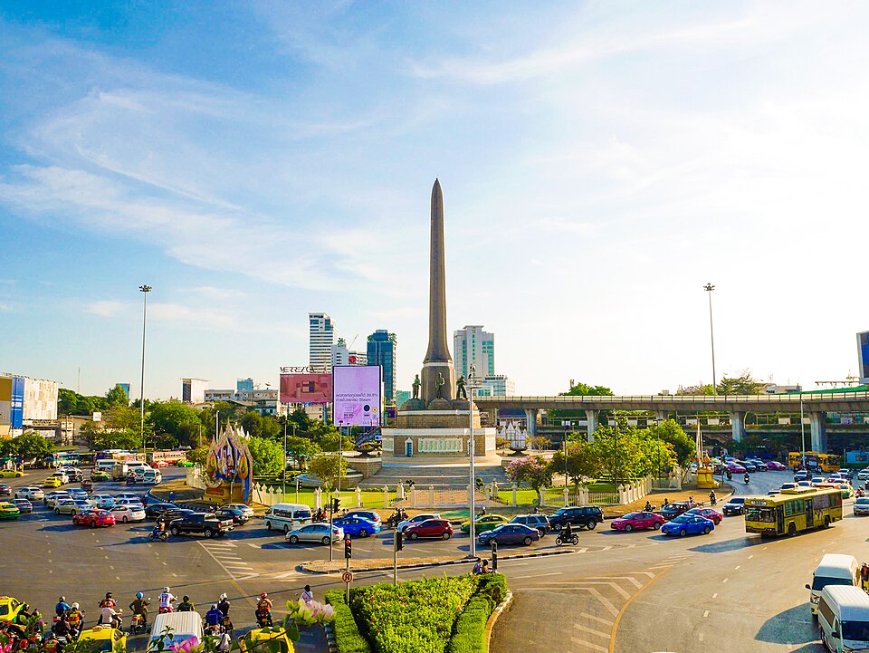
Twenty minutes is enough at Victory Monument. The monument itself is read from the elevated walkway and the pavements around the circle, and a single circuit covers the obelisk, the five figures and the inscribed names as far as they can be seen from outside the traffic. Visitors who plan to eat here - the surrounding streets are one of Bangkok's densest concentrations of boat-noodle shops - should budget separately for that. This is an editorial estimate; no operator publishes a visit duration for the monument.
Checked 2026-08-25
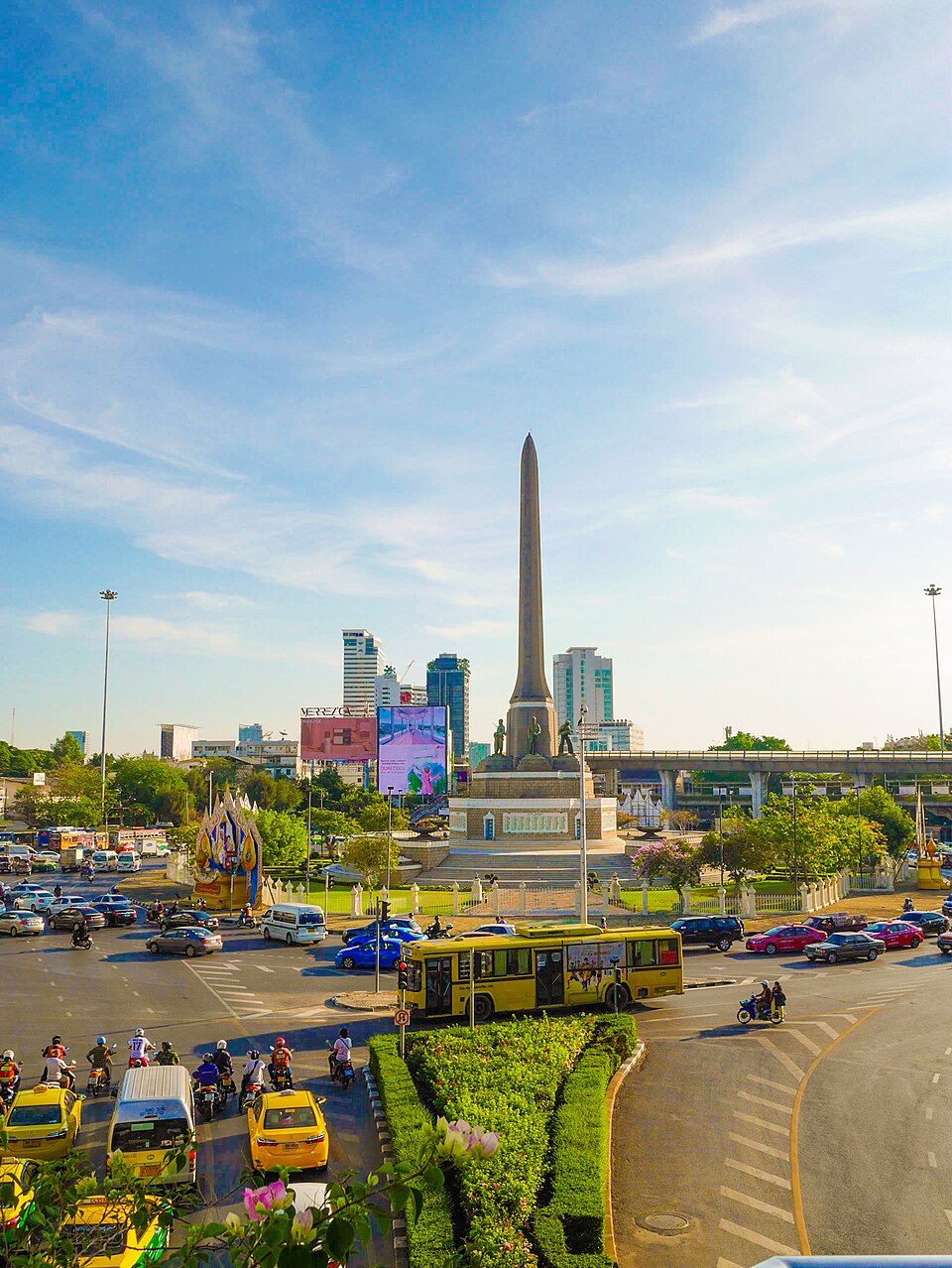
Victory Monument works best either early, before the circle fills, or in the evening, when the traffic islands and the walkway above them are busy in a way that is itself the sight. This is a transport interchange first: it functions as a transit point and as the origin or destination of many bus routes, and the crowd is a commuting crowd, heaviest at the start and end of the working day. The monument has also been a regular protest site alongside the Democracy Monument; during the 2020-2021 protests demonstrators repeatedly clashed with police around Bangkok including here, around 10,000 people gathered at the monument in October 2020 and blocked traffic, and on 7 August 2021 a nearby road was sealed off to keep protesters away. Rallies continued in 2022. Check the news if a demonstration would change your plans.
Checked 2026-08-25 · Source
ssmtour records no admission for Victory Monument, and there is no operator page to record one from. The monument is a public memorial on a public traffic circle, with no gate, no ticket office and no staff. Claude checked bangkok.go.th and finearts.go.th on 25 August 2026 and found no admission or opening-hours page for the monument. The only money a visitor is likely to spend here is on a bus fare or on boat noodles.
Checked 2026-08-25
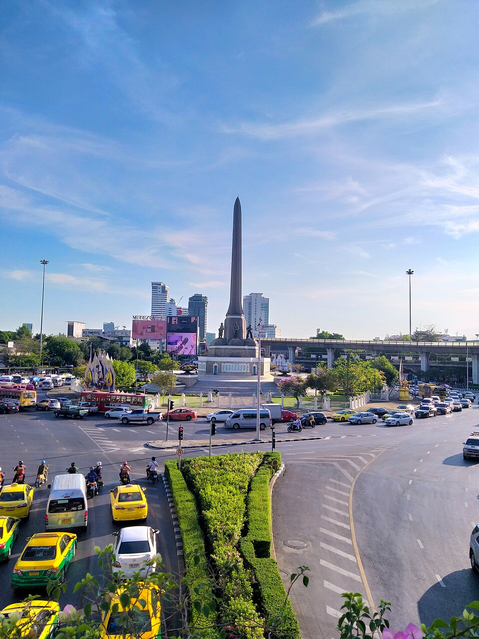
The simplest approach is the BTS Skytrain: Victory Monument station, N3 on the Sukhumvit Line, opened on 5 December 1999 and runs directly above Phaya Thai road at the circle, and its walkways deliver you onto the elevated ring around the monument without touching the traffic. Buses are the other obvious way in, and the more characteristic one - the circle is a central hub of the Bangkok bus network, serving both as an interchange and as the terminus of many routes. Three major roads meet here, Phahonyothin, Phaya Thai and Ratchawithi, so a taxi will find it easily and may then take a long time to leave it.
Checked 2026-08-25 · Source
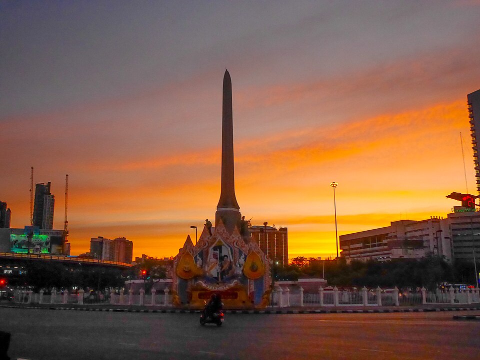
Do not try to reach the monument at road level. Five roads' worth of traffic circulates around it and the sensible route is the elevated walkway connected to the BTS station; visitors who improvise a crossing here are taking a real risk. Second, understand what this place is before judging it: it is a commuter interchange with a memorial in the middle, not a quiet memorial park, and it will be loud, hot and crowded at almost any hour. Third, the politics. The monument commemorates territorial gains that Thailand was forced to return in 1945, many Thais regard it as an inappropriate symbol of militarism, and it is an active protest site; treat both the memorial and any demonstration around it with restraint, and keep away from police lines. Finally, the area is a pickpocket-friendly environment for the same reason any dense transport interchange is - bags forward, phone away while walking.
Checked 2026-08-25 · Source
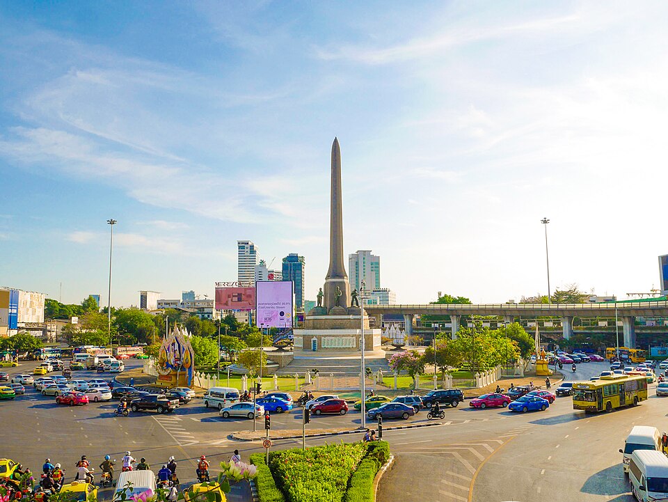
The elevated walkway is the photographer's asset here. From it, the obelisk can be framed clear of the traffic, and the five figures read against the sky rather than against buses. The five clasped bayonets are best seen from a position where the obelisk does not merge with the towers behind it, so walk the ring until the background clears rather than shooting from the first spot you reach. Blue hour is the strongest time: the traffic below turns into light trails on a long exposure with the walkway rail as a brace, and the monument holds its shape against a sky that is not yet black. During the day the surrounding streets are the better subject - the boat-noodle shops, the bus queues, the interchange working. This is editorial judgement; no published photography restriction for the monument was found.
Checked 2026-08-25
It commemorates Thailand's claimed victory in the Franco-Thai War of December 1940 and January 1941, fought against the Vichy French authorities in Indochina. The monument was erected in June 1941, and the names of 656 soldiers and civilians who died in the conflict are inscribed on the obelisk.
Two reasons. The sculptor Corrado Feroci, who worked as Silpa Bhirasri, disliked the pairing of his five figures with the obelisk and called the result "the victory of embarrassment". Politically, the Allied victory in 1945 forced Thailand to return the territories the war had won, leaving a monument to a victory that had been undone.
Take the BTS Skytrain to Victory Monument station, N3 on the Sukhumvit Line, which opened on 5 December 1999 and runs above Phaya Thai road at the circle; its walkways lead onto the elevated ring around the monument. The circle is also a central hub of the Bangkok bus network and the terminus of many routes.
No admission is recorded for Victory Monument on this site. It is a public memorial on a public traffic circle with no gate and no ticket office, and neither bangkok.go.th nor finearts.go.th publishes an admission or opening-hours page for it, as checked on 25 August 2026.
Khlong Samsen, which passes nearby, once carried hundreds of boat vendors selling kuaitiao ruea, served in small bowls because the boats had little room. Around 1985, under Bangkok governor Chamlong Srimuang, the vendors were required to move ashore for hygiene reasons, and the area became a centre of long-standing boat-noodle shops.
Reach it by the elevated walkway connected to the BTS station rather than at road level: the monument stands inside a circle where Phahonyothin, Phaya Thai and Ratchawithi roads meet, and traffic circulates around it continuously. The area is also a dense transport interchange, so ordinary crowd precautions apply.
Loading the interactive map…
The interactive map could not be loaded.
Last updated:
Source: OpenStreetMap contributors, Wikidata ·