Smart Self-Managed Tours

City guide · Israel

Jerusalem

A photograph of Jerusalem
Photograph · askii · CC BY-SA 2.0

Jerusalem’s visitor geography centres on the Old City, but major museums, markets and neighbourhoods extend far beyond its walls. The Old City is a dense walking zone divided into distinct quarters, while the modern centre follows Jaffa Road toward Mahane Yehuda. Yad Vashem, the Israel Museum, Mount Herzl and Ein Karem require separate journeys, so avoid treating every landmark as one continuous walk.

Practical information

Language spoken
Hebrew; Arabic has special status
National practical orientation; regional and minority languages may also be used
Dialling code
+972
International calling code; local area and mobile prefixes still apply
Currency
Israeli new shekel (ILS)
Use the official local currency; card acceptance varies by place
Emergency number
100 police · 101 ambulance · 102 fire
Use only for an emergency; tourist assistance may use a separate number
Plug type
Type C and H · 230 V
Check that chargers support the recorded voltage before using an adapter
Tap water
Not recorded
No verified nationwide visitor statement was recorded for this content pack

Turn this list into a plan

Set your days, your pace and the hours you actually want to be out. The planner works around closing days and travel time, and leaves room to eat.

Plan Jerusalem

Planning a visit

Suggested stay
Not recorded
Getting around
Walk, light rail and bus
  1. January: viable with meaningful trade-offs
  2. February: viable with meaningful trade-offs
  3. March: good time to visit
  4. April: best time to visit
  5. May: best time to visit
  6. June: good time to visit
  7. July: good time to visit
  8. August: good time to visit — current month
  9. September: best time to visit
  10. October: best time to visit
  11. November: good time to visit
  12. December: viable with meaningful trade-offs
  • Best time
  • Good time
  • Viable with trade-offs
  • Difficult conditions

Sources

Top things to see

Ranked by importance — sitelinks, pageviews and heritage status, not editor preference.

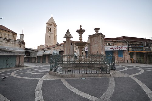
  1. Muristan Muristan
    02 45 min

    Muristan

    The Muristan is a historic complex in the Christian Quarter of Jerusalem's Old City. Its name derives from the Persian word for hospital, reflecting its origins as a medical institution founded by the Knights Hospitaller during the Crusader period.

    • Must see
    • Market
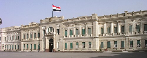
  2. Abdeen Abdeen
    12 45 min

    Abdeen

    • Notable
    • Market
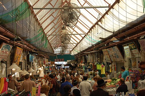
  3. Market
    14 45 min

    Market

    • Notable
    • Market
  4. UpTown
    19 45 min

    UpTown

    • Notable
    • Market

Source: OpenStreetMap contributors, Wikidata ·

How the city is laid out

The walled Old City forms the historic core, with Jaffa Gate linking it to Mamilla and the modern centre. Jaffa Road runs northwest through the city centre and Mahane Yehuda toward the main transport corridor. The Israel Museum and government precinct lie to the west, while Mount Herzl and Yad Vashem are farther out. Mount Zion and the Mount of Olives should be planned as separate elevated clusters.

Checked 2026-08-26

Getting around

Walk inside the Old City and between nearby central districts, allowing extra time for stone surfaces, slopes and security checks. Use light rail and buses for the modern centre and outer museums. The government tourist office provides maps and current public-transport guidance; consult it or the relevant operator before travel because services and access arrangements can change.

Checked 2026-08-26

Common questions

How many days should I spend in Jerusalem?

A fixed official stay length is not recorded. Build the visit around the Old City first, then add the modern centre, major museums and separate hilltop clusters according to time.

Is Jerusalem’s Old City walkable?

Yes, and walking is the practical way to explore its lanes. Expect slopes, worn stone surfaces, stairs and busy access points.

Which Jerusalem sights need public transport?

Yad Vashem, Mount Herzl, the Israel Museum and some outer neighbourhoods sit beyond the compact Old City and central walking area. Use light rail or buses where appropriate.

Where can visitors get official Jerusalem maps?

The Ministry of Tourism’s Jerusalem office provides maps, brochures and guidance on sites, tours and public transportation.

Should the Mount of Olives be combined with the Old City?

Treat it as a separate elevated cluster. Although visually close to the Old City, the terrain and approach make a dedicated route more practical.