Smart Self-Managed Tours

City guide · Egypt

Cairo

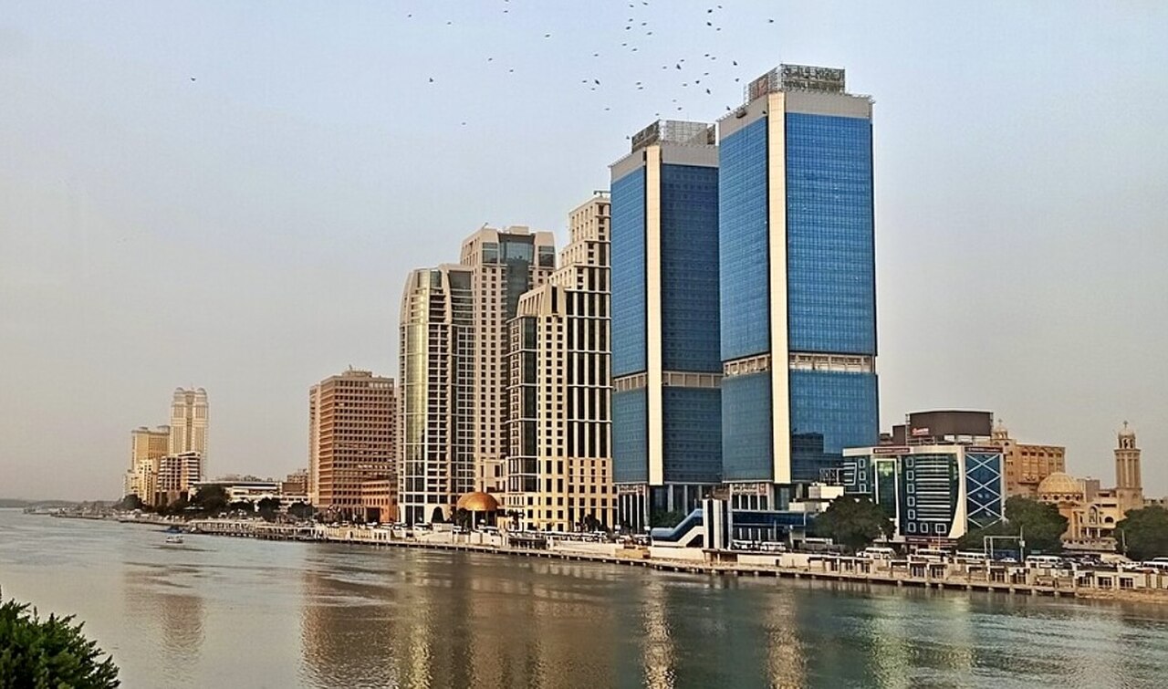
A photograph of Cairo
Photograph · Faris El-Gwely · CC BY 4.0

Cairo is a vast Nile metropolis whose visitor geography includes Downtown, Historic Cairo, Coptic Cairo, Zamalek and the Giza plateau. Downtown holds modern civic and cultural landmarks; medieval Islamic streets extend east and south; Coptic sites cluster around Old Cairo; and Giza lies across the river but forms part of the standard Greater Cairo visit. Give each area its own block and expect slow cross-city journeys.

Practical information

Language spoken
Arabic
National practical orientation; regional and minority languages may also be used
Dialling code
+20
International calling code; local area and mobile prefixes still apply
Currency
Egyptian pound (EGP)
Use the official local currency; card acceptance varies by place
Emergency number
122 police · 123 ambulance · 180 fire
Use only for an emergency; tourist assistance may use a separate number
Plug type
Type C and F · 220 V
Check that chargers support the recorded voltage before using an adapter
Tap water
Not recorded
No verified nationwide visitor drinking-water statement was recorded

Turn this list into a plan

Set your days, your pace and the hours you actually want to be out. The planner works around closing days and travel time, and leaves room to eat.

Plan Cairo

Planning a visit

Suggested stay
Not recorded
Getting around
Metro, bus, metered taxi and ride-hailing
  1. January: best time to visit
  2. February: best time to visit
  3. March: viable with meaningful trade-offs
  4. April: viable with meaningful trade-offs
  5. May: viable with meaningful trade-offs
  6. June: recurring difficult conditions
  7. July: recurring difficult conditions
  8. August: recurring difficult conditions — current month
  9. September: viable with meaningful trade-offs
  10. October: viable with meaningful trade-offs
  11. November: viable with meaningful trade-offs
  12. December: best time to visit
  • Best time
  • Good time
  • Viable with trade-offs
  • Difficult conditions

Sources

Top things to see

Ranked by importance — sitelinks, pageviews and heritage status, not editor preference.

  1. Maadi Island
    03 1 hour

    Maadi Island

    جزيرة المعادى

    • High
    • Nature site
  2. Al Buayrat
    05 20 min

    Al Buayrat

    البعيرات

    • Notable
    • Viewpoint
  3. Al Halawinah
    07 20 min

    Al Halawinah

    الحلاونة

    • Notable
    • Viewpoint
  4. Al Nahdein
    08 20 min

    Al Nahdein

    النهدين

    • Notable
    • Viewpoint
  5. Bab Al-Nasr
    10 20 min

    Bab Al-Nasr

    باب النصر

    • Notable
    • Viewpoint
  6. Brezzer
    11 20 min

    Brezzer

    بريزر

    • Notable
    • Viewpoint
  7. Gebel Gibw
    14 20 min

    Gebel Gibw

    جبل جبو

    • Notable
    • Viewpoint
  8. Qasr Manzil
    21 20 min

    Qasr Manzil

    قصر منزل

    • Notable
    • Viewpoint
  9. 11010
    26 1 hour

    11010

    • Notable
    • Nature site
  10. 27 1 hour

    • Notable
    • Nature site
  11. Ain Al Hayat
    31 1 hour

    Ain Al Hayat

    عين الحياة

    • Notable
    • Nature site
  12. Ain Al Hayat Lake
    32 1 hour

    Ain Al Hayat Lake

    بحيرة عين الحياة

    • Notable
    • Nature site
  13. Al Aml Garden
    33 1 hour

    Al Aml Garden

    حديقة الأمل

    • Notable
    • Nature site
  14. Al Dawwudiyya
    34 1 hour

    Al Dawwudiyya

    الداوديه

    • Notable
    • Nature site
  15. Al Urouba Park
    37 1 hour

    Al Urouba Park

    حديقة العروبة

    • Notable
    • Nature site
  16. Al Waha Park
    38 1 hour

    Al Waha Park

    حديقة الواحة

    • Notable
    • Nature site
  17. Andalusian Garden
    40 1 hour

    Andalusian Garden

    الحديقة الاندلسية

    • Notable
    • Nature site
  18. AUC Gardens
    41 1 hour

    AUC Gardens

    حدائق الجامعة الأمريكية بالقاهرة

    • Notable
    • Nature site
  19. Badr Garden
    43 1 hour

    Badr Garden

    حديقة بدر

    • Notable
    • Nature site
  20. Bir Mousa
    44 1 hour

    Bir Mousa

    بئر موسى

    • Notable
    • Nature site

Source: OpenStreetMap contributors, Wikidata ·

How the city is laid out

Downtown centres on Tahrir Square and the nineteenth-century street grid. Zamalek occupies an island in the Nile and connects by bridge to Downtown and Giza. Historic Cairo includes Al-Muizz Street, mosques, gates and markets, while Coptic Cairo forms a separate southern cluster. The Giza pyramids and Grand Egyptian Museum lie west of the Nile. Saqqara and Memphis are farther excursions and should not be combined with a full central-city day.

Checked 2026-08-26

Getting around

Metro, buses, metered taxis and ride-hailing services cover Greater Cairo, while Nile taxis and local ferries provide selected river connections. The official tourism authority advises ensuring a taxi meter is operating. Use the Metro for suitable cross-city corridors, then allow time for the final road journey. Giza, Saqqara and airport transfers require specific planning, and access to remote archaeological areas should be confirmed through authorised operators or official guidance.

Checked 2026-08-26

Common questions

How is Cairo organised for sightseeing?

Downtown, Historic Cairo, Coptic Cairo, Zamalek and Giza are separate clusters

How many days should I spend in Cairo?

No fixed stay length is recorded; allocate time by cluster and by any archaeological excursion.

What is the easiest way to get around Cairo?

Use Metro where practical, then metered taxis, buses or ride-hailing for final connections.

Which places need a separate trip from central Cairo?

Giza lies west of the Nile and needs a dedicated road or tour connection.

What is the most practical way to plan a day in Cairo?

Selected Historic Cairo routes are walkable once you reach the area by planned transport.