
33 min walk
Parc Lacasse
- Notable
- Nature site
Language · 11 published
Activity · Montreal
Canal de Lachine

The Lachine Canal is a National Historic Site of Canada and a defining linear park that runs through southwestern Montreal. Constructed in the nineteenth century to bypass the Lachine Rapids on the Saint Lawrence River, it transformed into a recreational corridor after industrial shipping ceased. Today it serves as a waterfront greenway connecting multiple neighbourhoods, recognized for its heritage engineering and role in Montreal's industrial past. The canal and its banks form a continuous public space for active transportation and leisure.
Checked 2026-08-26
The canal corridor features a multi-use paved path running along both sides of the waterway, used by cyclists, pedestrians, and inline skaters. Green spaces, benches, and interpretive elements appear at intervals. Locks from the canal's operational past remain visible. The route passes through or near the Old Port, Saint-Henri, and Lachine, each offering distinct neighbourhood character. Pedestrian bridges cross the canal at various points. The surrounding areas include industrial heritage buildings, some repurposed, and access to waterside views throughout. Lachine Canal also earns time in a montreal itinerary because WIKIDATA_EDITORIAL reconciliation for the ranked entry; identity and coordinates were verified without a nearby fallback. Its value becomes clearer when the stop is compared with the surrounding streets and the other ranked places nearby.
Checked 2026-08-26

The full canal corridor extends approximately fourteen kilometres from the Old Port to Lake Saint-Louis in Lachine. Most visitors cover portions rather than the entire route. Cycling the complete distance at a moderate pace with minimal stops typically requires roughly one hour, though many spend longer. Walking a section demands proportionally more time. The flat terrain and paved surface suit varied fitness levels. Visitors should plan according to their chosen distance, desired stops, and whether they intend to return to their starting point.
Checked 2026-08-26
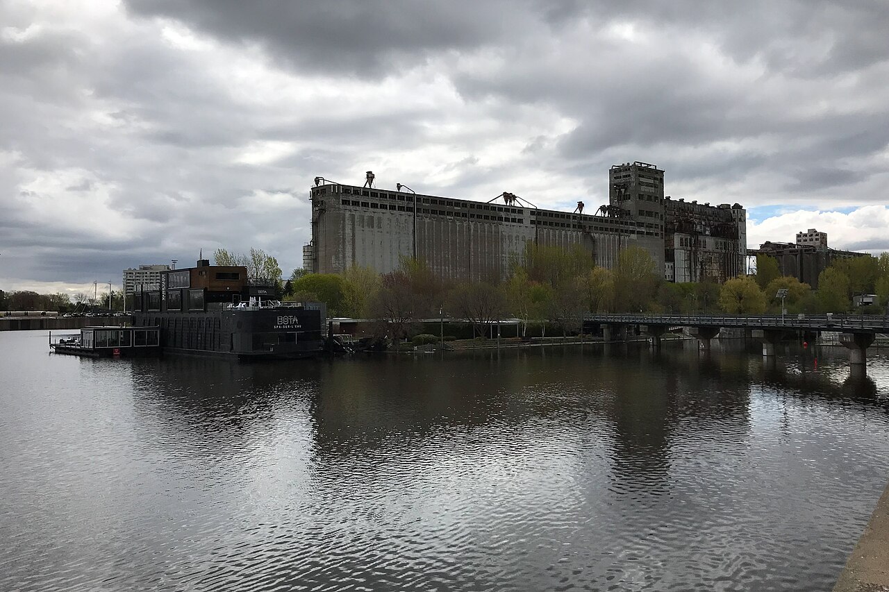
The canal operates as a seasonal corridor, with peak use during warmer months when cycling and walking conditions are most favourable. Spring and autumn offer cooler temperatures and reduced crowding. Winter conditions may limit accessibility depending on snow removal practices. Operator-confirmed hours are Not recorded pending review. Visitors should consult Parks Canada or municipal sources for current seasonal schedules, any temporary closures, and specific facility availability before planning their trip. Weather-appropriate clothing is advisable given the exposed waterfront setting. A flexible visit lets travellers connect Lachine Canal with the rest of the day without treating one room, viewpoint or photograph as the whole experience. The useful pace depends on personal interest and conditions on arrival.
Checked 2026-08-26
Access to the Lachine Canal path and surrounding park areas is generally free of charge as public space. Certain activities or special programs may involve separate fees. Equipment rentals, if available through third-party operators along the corridor, would carry their own pricing. Operator-confirmed prices are Not recorded pending review. Visitors seeking boat passage through the canal locks, heritage interpretation programs, or guided experiences should verify current costs directly with Parks Canada or authorized service providers in advance of their visit.
Checked 2026-08-26

Multiple access points exist along the canal's length. The Old Port terminus connects to Montreal's central area and public transit including metro stations. Saint-Henri offers access via the Lionel-Groulx metro station and neighbourhood streets. The Lachine end reaches suburban transit connections and parking areas. Bicycle integration with Montreal's cycling network is extensive. Visitors can enter at numerous bridges and street crossings. Selecting an access point depends on intended direction, distance, and whether visitors bring their own bicycles or walk.
Checked 2026-08-26

The multi-use path requires awareness of mixed traffic including fast-moving cyclists, pedestrians with children, and dogs. Speed differentials create collision risks at curves and bridges. The corridor lacks complete shade; sun exposure and dehydration warrant preparation. Water safety applies near the canal edge, particularly for children. Evening lighting varies by section. Visitors should secure bicycles at stops. Seasonal debris, wet leaves, or ice may affect traction. Emergency services access points are spaced along the route; carrying a charged phone is prudent.
Checked 2026-08-26
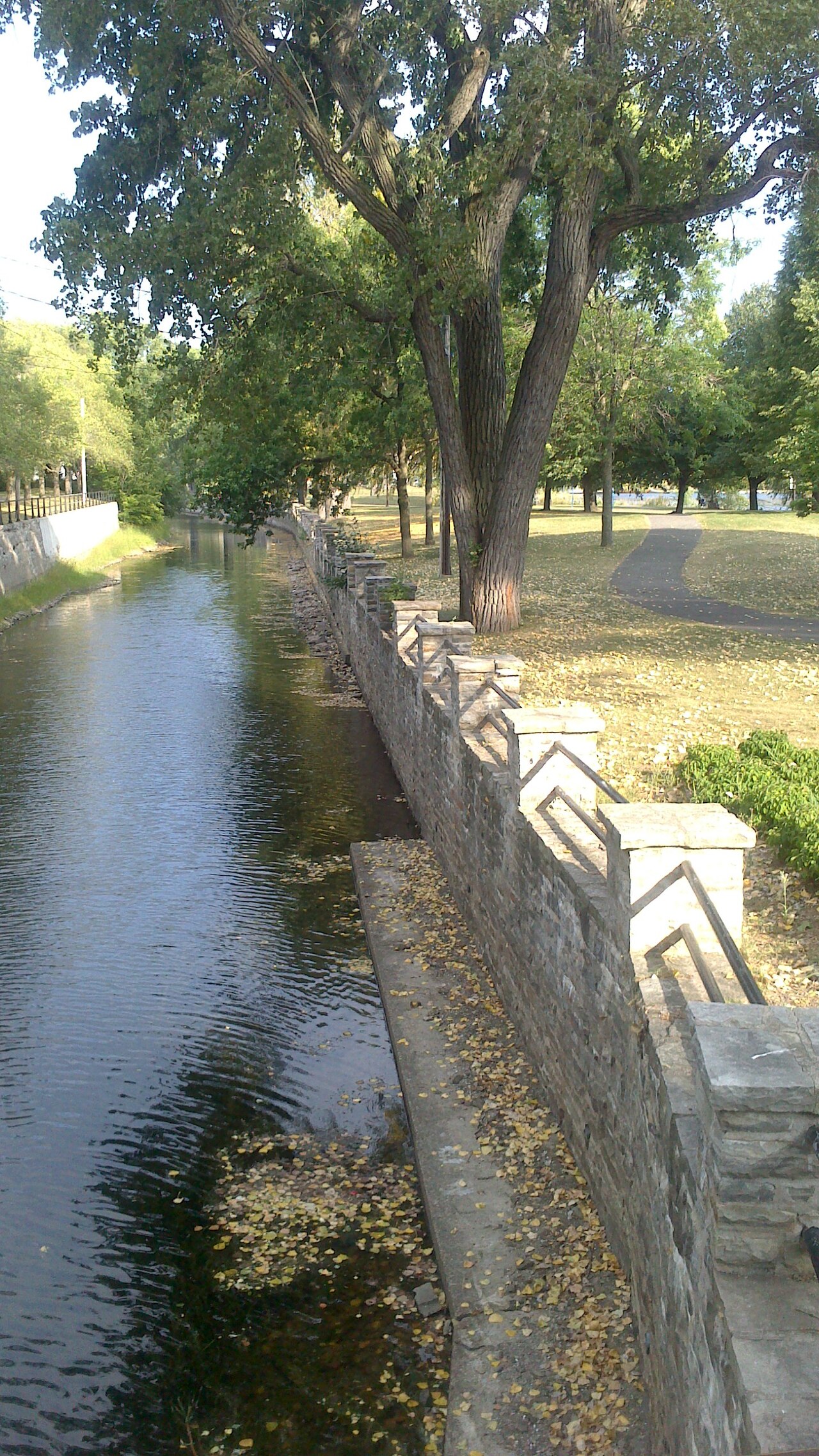
The canal offers varied photographic subjects including heritage locks, industrial architecture, waterside reflections, and neighbourhood transitions. Morning and evening light provide favourable conditions along the east-west oriented corridor. Bridges yield elevated perspectives of the waterway. The contrast between historic infrastructure and contemporary recreational use creates documentary interest. Wildlife appearances are possible but not guaranteed. Tripods may obstruct the narrow path during busy periods. Drone operation would require compliance with federal regulations and proximity to the international airport near the Lachine end.
Checked 2026-08-26
The canal functions as a seasonal corridor with peak accessibility during warmer months. Winter conditions may affect path usability. Current seasonal schedules and any closures should be verified with Parks Canada or municipal sources before visiting.
Yes, the full approximately fourteen-kilometre route is paved and suitable for cycling. Most visitors cover selected portions. The flat terrain accommodates varied fitness levels, though visitors should plan for their return trip or alternative transportation.
Boat passage through the canal locks may be available in season. Visitors should verify current offerings, schedules, and any associated costs directly with Parks Canada or authorized operators, as services are not consistently documented.
Swimming is not recommended in the canal waterway. The canal serves as a historic industrial watercourse and active recreational corridor, not a designated swimming facility. Water quality and safety conditions are not established for immersion activities.
Access points exist throughout the corridor. The Old Port offers central connectivity, Saint-Henri provides metro access, and Lachine reaches toward the lake. Choice depends on transportation method, intended distance, and neighbourhood interest.
Public facilities may be available at certain access points or nearby parks, though distribution and seasonal operation vary. Visitors should not assume continuous amenity coverage along the full fourteen-kilometre corridor and plan accordingly.
Loading the interactive map…
The interactive map could not be loaded.
Last updated:
Source: OpenStreetMap contributors, Wikidata ·

.jpg)

.jpg)


