City guide · Belgium
Brussels
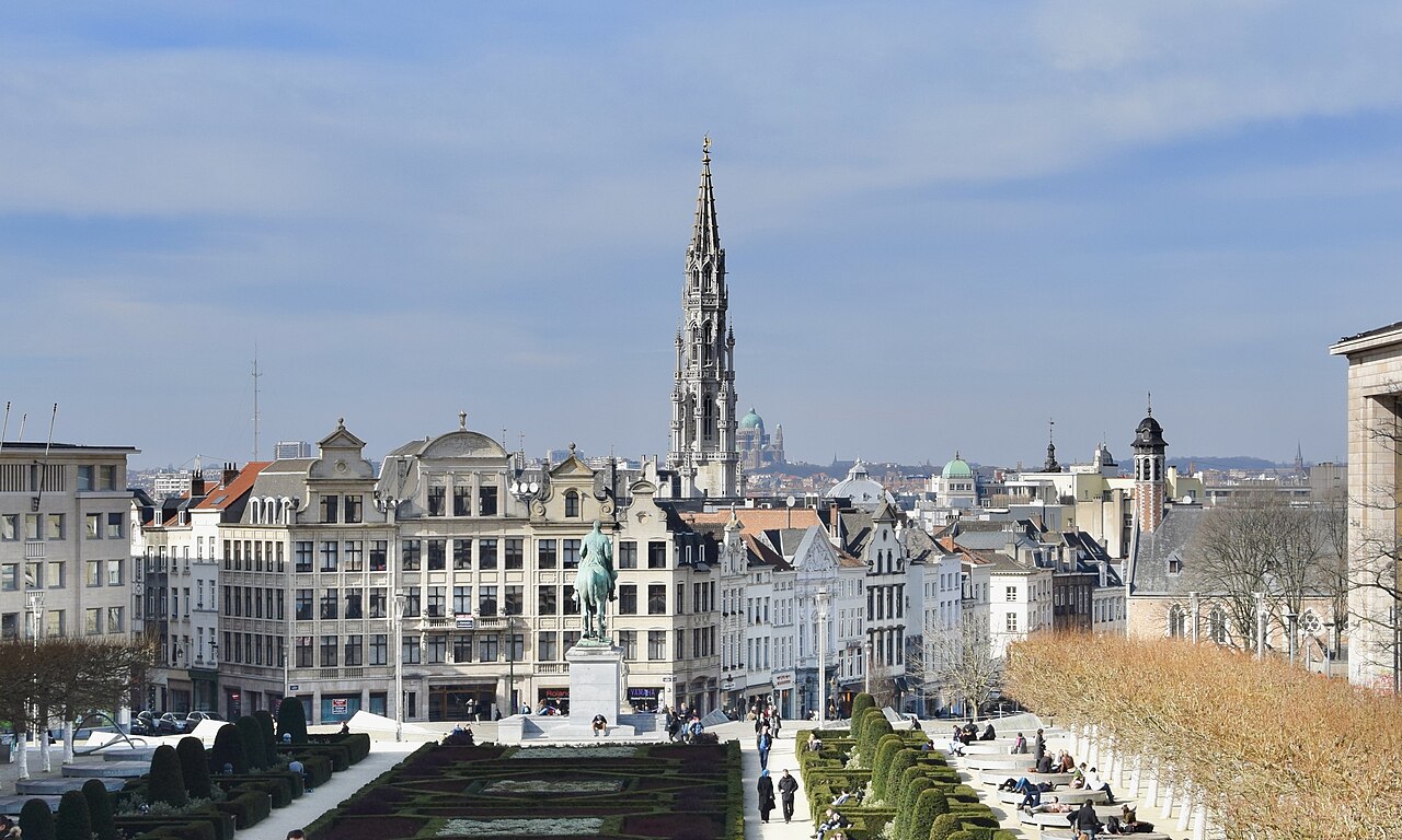
.jpg)
Brussels combines a compact historic centre with separate museum, European Quarter and Atomium districts. The lower town around Grand-Place is best explored on foot, while the upper town rises toward the royal and institutional quarters. Metro, tram, bus and urban rail make the dispersed areas manageable. Group each day by elevation and district instead of repeatedly crossing the centre’s steep north-south slope.
Practical information
Practical information
- Language spoken
- Dutch, French and German
- National practical orientation; regional and minority languages may also be used
- Dialling code
- +32
- International calling code; local area and mobile prefixes still apply
- Currency
- Euro (EUR)
- Use the official local currency; card acceptance varies by place
- Emergency number
- 112
- Use only for an emergency; tourist assistance may use a separate number
- Plug type
- Type C and E · 230 V
- Check that chargers support the recorded voltage before using an adapter
- Tap water
- Safe from the mains
- Public drinking water is regulated by Belgium's regional authorities
Planning a visit
- Seasonal closure recorded
- No data recorded for this month
- The current month
- Suggested stay
- 2-3 days
- Getting around
- Walking, metro, tram, bus and urban rail
- January: seasonal closure recorded
- February: seasonal closure recorded
- March: seasonal closure recorded
- April: seasonal closure recorded
- May: seasonal closure recorded
- June: seasonal closure recorded
- July: no seasonality data recorded
- August: no seasonality data recorded — this month
- September: seasonal closure recorded
- October: seasonal closure recorded
- November: seasonal closure recorded
- December: seasonal closure recorded
Top things to see
Ranked by importance — sitelinks, pageviews and heritage status, not editor preference.
Filter the list
0 places match
0 places match
Category
Typical visit duration
Interests
Nothing in Brussels matches all of those filters
The list is built from real place data, so an empty result means the combination genuinely has no match — not that the page failed. Loosen one filter and the ranking returns.
Clear all filtersSource: OpenStreetMap contributors, Wikidata ·
How the city is laid out
The historic lower town clusters around Grand-Place, the Bourse and Sainte-Catherine. Uphill, the Mont des Arts links the central station to the Royal Quarter, Sablon and major museums. The European Quarter lies east around Schuman and Leopold Park, while the Art Nouveau neighbourhoods extend south through Saint-Gilles and Ixelles. The Atomium and Heysel plateau are a separate northern trip. Brussels is administratively fragmented, but these visitor zones form clearer planning units than municipal boundaries.
Checked 2026-08-26
Getting around
Walk inside the central lower and upper towns, then use STIB-MIVB metro, tram and bus services between outer districts. Contactless payment is available across the operator’s network, and the official trip tools show real-time connections. Urban trains can also be useful between major stations. The Atomium, European Quarter and southern Art Nouveau districts should each be linked to the centre by transit rather than forced into one long walking route.
Checked 2026-08-26
Common questions
How many days does Brussels need?
Two to three days suit a first visit. Use one day for the historic centre and upper town, then divide the remaining time between the Atomium, European Quarter and southern neighbourhoods.
When is the best time to visit Brussels?
May, June and September usually offer useful daylight and comfortable walking conditions. Rain is possible throughout the year, so keep museums available as flexible indoor blocks.
Is central Brussels walkable?
Yes, but the elevation change between the lower town and Royal Quarter is easy to underestimate. Walk within each zone and use metro or tram when connecting to Heysel, the European Quarter or southern districts.
Can visitors pay contactless on Brussels public transport?
Yes. STIB-MIVB supports contactless payment on its buses, trams and metro network. Use the same card or device consistently and check the operator’s current conditions before travel.
Which Brussels areas should be planned separately?
Treat the Atomium and Heysel as a northern trip, the European Quarter as an eastern block, and Saint-Gilles or Ixelles as a southern route. The historic centre and Royal Quarter combine most naturally.
Turn this list into a plan
Set your days, your pace and the hours you actually want to be out. The planner works around closing days and travel time, and leaves room to eat.