


26 min walk
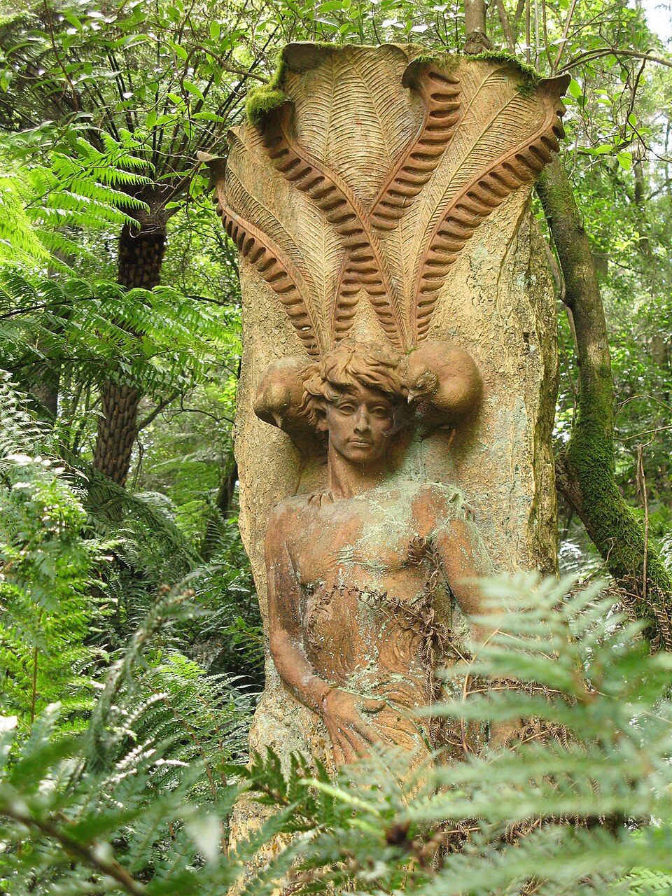
William Ricketts Sanctuary
- High
- Nature site
Language · 11 published
Nature site · Melbourne
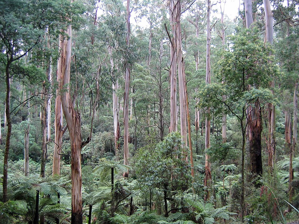
Dandenong Ranges National Park is a protected natural area located east of Melbourne. The park encompasses cool temperate rainforest, towering mountain ash forests, and dense fern gullies. It forms part of the traditional lands of the Wurundjeri people. The landscape features significant elevation change, with the ranges rising abruptly from the surrounding plains. The park preserves remnant vegetation communities that have become increasingly fragmented in the region. Visitors encounter a distinct montane environment within commuting distance of metropolitan Melbourne. Dandenong Ranges National Park also earns time in a melbourne itinerary because Dandenong Ranges National Park is a meaningful melbourne visitor destination retained within the documented city scope. Production has no exact city POI pool match, so it remains ABSENT without a near match. Its value becomes clearer when the stop is compared with the surrounding streets and the other ranked places nearby.
Checked 2026-08-26
The park contains notable features including Sherbrooke Forest, known for its mountain ash and lyrebird population. Walking tracks of varying difficulty traverse the terrain, including sections of the Olinda Creek and Sassafras Creek corridors. The Alfred Nicholas Memorial Gardens and Pirianda Garden adjoin or lie near park boundaries. The 1000 Steps Kokoda Track memorial walk, though technically in adjacent Ferntree Gully National Park, associates closely with the Dandenong Ranges visitor experience. Wildlife includes superb lyrebirds, crimson rosellas, and various possum species.
Checked 2026-08-26

Visit duration depends on chosen activities. A brief forest walk requires one to two hours. Comprehensive exploration of multiple tracks and adjacent gardens extends to a full day. The 1000 Steps walk alone demands approximately forty-five minutes to one hour for the ascent and return. Picnicking and wildlife observation add time. Visitors combining the national park with nearby townships of Olinda, Sassafras, or Belgrave should allocate additional hours. Multi-day visitation suits those seeking thorough engagement with the walking track network and seasonal variations.
Checked 2026-08-26
The Dandenong Ranges experience cooler temperatures and higher rainfall than metropolitan Melbourne due to elevation. Morning fog is common, particularly in autumn and winter. Spring brings wildflower displays and active lyrebird breeding season. Summer offers escape from lowland heat. Autumn presents changing deciduous foliage in adjacent private and public gardens. Winter delivers misty atmospheric conditions. Operator-confirmed hours are Not recorded pending review. Visitors should consult official sources before travel. Weather conditions change rapidly; preparedness for rain and temperature variation remains essential regardless of season.
Checked 2026-08-26
Entry to Dandenong Ranges National Park itself does not require payment as it forms part of the public reserve system. Some adjacent or nearby attractions may impose separate fees. Operator-confirmed prices are Not recorded pending review. The 1000 Steps walk in Ferntree Gully National Park remains free of charge. Parking at popular trailheads sometimes incurs fees or time restrictions managed by local authorities. Visitors should verify current arrangements through official channels. The nearby Puffing Billy Railway, a common associated attraction, operates with separate ticketing unrelated to national park access.
Checked 2026-08-26

The Dandenong Ranges lie approximately thirty-five to forty kilometres east of Melbourne's central business district. Private vehicle access follows the Burwood Highway, Monbulk Road, or Mount Dandenong Tourist Road. Public transport options include train services to Belgrave, followed by connecting bus services toward the ranges. Some walking track access points lack direct public transport. Roads become congested during peak leaf-viewing periods and weekends. Parking at popular sites fills early. Visitors without vehicles should research specific track access points and corresponding bus schedules carefully, as service frequency varies by route and day.
Checked 2026-08-26

Walking tracks become slippery after rain; appropriate footwear proves essential. Leeches occur in wetter areas, particularly during warmer months. Tree fall and branch drop present hazards, especially following storms or high winds. Mobile phone coverage remains unreliable across much of the park. Some tracks feature steep gradients and steps unsuitable for visitors with limited mobility. The 1000 Steps track experiences extreme crowding on weekends and public holidays. Wildlife feeding is prohibited. Visitors should carry water, weather-appropriate clothing, and inform others of intended routes. Emergency assistance may be delayed due to terrain and access constraints.
Checked 2026-08-26

The dense forest canopy creates challenging light conditions requiring adjusted camera settings. Morning mist and fog provide atmospheric opportunities, particularly in valleys and along creek lines. Lyrebird photography demands patience and quiet approach; sudden movement causes retreat. Fern gullies and mountain ash trunks suit vertical compositions. The tall forest limits sweeping vistas except at specific cleared points. Tripods assist in low-light understorey conditions. Weather sealing protects equipment from persistent moisture. Respect for wildlife and other visitors should govern positioning and behaviour. Commercial photography may require permit consultation with park management.
Checked 2026-08-26
No. The 1000 Steps Kokoda Track memorial walk lies in Ferntree Gully National Park, a separate but adjacent protected area. The two parks associate closely in visitor experience and are sometimes conflated.
Superb lyrebirds inhabit the park, particularly Sherbrooke Forest. Sightings depend on time of day, season, and visitor behaviour. Early morning offers better prospects. Quiet, slow movement increases probability. No guarantee exists.
A car provides greatest flexibility for accessing multiple trackheads. Public transport reaches some areas via Belgrave train and connecting buses. Some popular locations lack direct public transport access. Research specific destinations before committing to public transport.
Domestic animals are generally prohibited in national parks to protect wildlife. Service animals may have exceptions. Visitors should verify current regulations through official park management channels rather than assuming permission.
Some shorter, flatter walks suit families. Steeper tracks and steps challenge young children and require close supervision. Weather conditions change quickly. Parents should assess individual track descriptions and children's capabilities before selecting routes.
The park does not offer established camping facilities. Nearby private accommodation exists in townships such as Olinda and Sassafras. Visitors seeking overnight stays should investigate these external options. Camping regulations should be confirmed with park authorities.
Loading the interactive map…
The interactive map could not be loaded.

Last updated:
Source: OpenStreetMap contributors, Wikidata ·