Smart Self-Managed Tours

City guide · United Kingdom

Glasgow

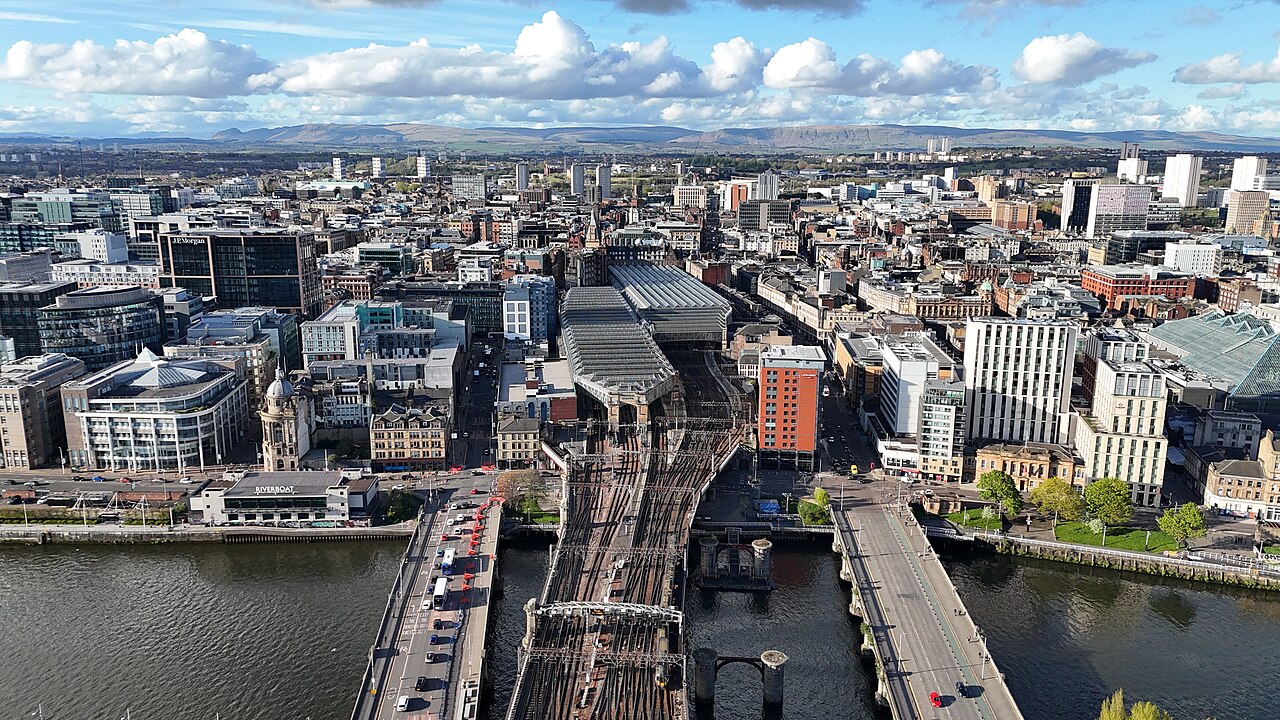
A photograph of Glasgow
Photograph · 瑞丽江的河水 · CC BY-SA 4.0

Glasgow is a compact central city with major visitor districts stretching west along the River Clyde and university corridor. The city centre and Merchant City are walkable, while the West End, Riverside Museum and Southside are better reached by subway, train or bus. Two main railway stations serve different directions. Plan the central core and West End as separate blocks rather than walking every transfer.

Practical information

Language spoken
English; Welsh is official in Wales
National practical orientation; regional and minority languages may also be used
Dialling code
+44
International calling code; local area and mobile prefixes still apply
Currency
Pound sterling (GBP)
Use the official local currency; card acceptance varies by place
Emergency number
999 or 112
Use only for an emergency; tourist assistance may use a separate number
Plug type
Type G · 230 V
Check that chargers support the recorded voltage before using an adapter
Tap water
Safe from the mains
Public water suppliers regulate mains drinking water; use cold mains taps

Planning a visit

Suggested stay
2-3 days
Getting around
Walking, Subway, train and bus
  1. January: seasonal closure recorded
  2. February: seasonal closure recorded
  3. March: seasonal closure recorded
  4. April: seasonal closure recorded
  5. May: seasonal closure recorded
  6. June: seasonal closure recorded
  7. July: seasonal closure recorded
  8. August: no seasonality data recorded — this month
  9. September: seasonal closure recorded
  10. October: seasonal closure recorded
  11. November: seasonal closure recorded
  12. December: seasonal closure recorded

Top things to see

Ranked by importance — sitelinks, pageviews and heritage status, not editor preference.

  1. Glasgow Green
    02 1 hour

    Glasgow Green

    Glasgow Green is a historic public park situated on the north bank of the River Clyde in the east end of Glasgow. Established in the fifteenth century, it ranks among the oldest public spaces in Britain.

    • Must see
    • Nature site
  2. Bellahouston Park
    03 1 hour

    Bellahouston Park

    Bellahouston Park is a major public park in Glasgow, Scotland. It lies southwest of the city centre and serves as significant green space for residents and visitors.

    • Must see
    • Nature site
  3. Barrowland Park
    04 1 hour

    Barrowland Park

    Barrowland Park is an outdoor public space in Glasgow, Scotland, situated in the East End of the city. The park takes its name from the legendary Barrowland Ballroom, the iconic music venue that stands nearby on Gallowgate.

    • High
    • Nature site
  4. Alexandra Park
    05 1 hour

    Alexandra Park

    Alexandra Park is a public park located in Glasgow, Scotland. It was established in the nineteenth century and remains one of the city's significant green spaces.

    • High
    • Nature site
  5. Barshaw Park
    06 1 hour

    Barshaw Park

    Barshaw Park is a public park located in Paisley, within the Greater Glasgow urban area of Scotland. The park forms part of the green space network serving the western Central Belt.

    • High
    • Nature site
  6. Blythswood Square
    07 1 hour

    Blythswood Square

    Blythswood Square is a Georgian garden square in Glasgow, Scotland. The square forms part of the Blythswood Hill area and represents a notable example of planned urban development from the early nineteenth century.

    • High
    • Nature site
  7. Cathkin Braes
    09 1 hour

    Cathkin Braes

    Cathkin Braes is a country park situated on the southern edge of Glasgow, Scotland. It forms part of the elevated terrain overlooking the city and represents one of Glasgow's accessible green spaces.

    • High
    • Nature site
  8. Cathkin Park
    10 1 hour

    Cathkin Park

    Cathkin Park is a public park located in Glasgow, Scotland. The site occupies land that was formerly home to a football stadium, which served as the ground for Third Lanark A.C., a historic Scottish football club.

    • High
    • Nature site
  9. Dawsholm Park
    11 1 hour

    Dawsholm Park

    Dawsholm Park Local Nature Reserve is a public green space in Glasgow, Scotland. It forms part of the city's network of parks and natural areas, providing accessible countryside experience within an urban setting.

    • High
    • Nature site
  10. Drumpellier country park
    12 1 hour

    Drumpellier country park

    Drumpellier Country Park is a public green space located in the Glasgow area of Scotland. The park forms part of the broader landscape around Coatbridge in North Lanarkshire, near Glasgow's eastern boundary.

    • High
    • Nature site
  11. Greenbank Garden
    32 1 hour

    Greenbank Garden

    Greenbank Garden, locally known as Greenbank Gardens, is a horticultural attraction in Glasgow, Scotland. It forms part of the city's network of public gardens and green spaces.

    • High
    • Nature site
  12. Linn Park
    33 1 hour

    Linn Park

    Linn Park is a public park in Glasgow, Scotland. It is one of the city's larger green spaces, situated in the southern part of Glasgow.

    • High
    • Nature site
  13. National Museum of Rural Life
    34 1 hour

    National Museum of Rural Life

    The National Museum of Rural Life is a museum in Glasgow operated by National Museums Scotland. It preserves and interprets Scotland's rural heritage through collections of farming equipment, tools, and domestic items.

    • High
    • Nature site

Source: OpenStreetMap contributors, Wikidata ·

How the city is laid out

The city centre is a regular street grid between Glasgow Central and Queen Street stations, with Merchant City immediately east. The River Clyde forms the southern edge of the core and leads west toward the SEC and Riverside Museum. The West End clusters around the University of Glasgow, Kelvingrove and Byres Road. South of the river, Pollok Country Park and the Burrell Collection form another distinct outing. The compact Subway loop links the centre, West End and parts of the Southside.

Checked 2026-08-26

Getting around

Walk through the city centre and Merchant City, then use the Subway, suburban trains or buses for the West End and Southside. Visit Glasgow identifies the Subway as a simple link among the centre, West End and south of the river, while rail reaches a much wider Greater Glasgow area. Central and Queen Street stations are separate but close enough to connect on foot. Check the operator journey planner before combining rail and Subway legs.

Checked 2026-08-26

Common questions

How many days does Glasgow need?

Two to three days cover the principal districts. Use one day for the city centre and Merchant City, another for the West End, and add a third for the Southside or Clyde waterfront.

When is the best time to visit Glasgow?

May through September provides longer daylight for architecture, parks and river routes. Rain is possible in every season, so museums work well as flexible anchors rather than fixed weather bets.

Is Glasgow easy to explore on foot?

The city centre and Merchant City are easy to walk. The West End, Southside and farther Clyde attractions are better linked by Subway, train or bus.

What does the Glasgow Subway connect?

The circular Subway links the city centre with the West End and parts of the Southside. It is useful for district-to-district travel but does not replace suburban rail or buses for every attraction.

Which station should visitors use in Glasgow?

Glasgow Central mainly serves routes south and west, while Queen Street mainly serves routes north and east. They are separate stations, so confirm the departure point before planning a connection.

Turn this list into a plan

Set your days, your pace and the hours you actually want to be out. The planner works around closing days and travel time, and leaves room to eat.

Plan Glasgow