


.jpg)

27 min walk
National Museum of Rural Life
- High
- Nature site
Language · 11 published
Nature site · Glasgow
Cathkin Braes Country Park

Cathkin Braes is a country park situated on the southern edge of Glasgow, Scotland. It forms part of the elevated terrain overlooking the city and represents one of Glasgow's accessible green spaces. The area falls within the administrative boundaries of Glasgow City Council. The braes, a Scots term for hillside slopes, characterise the topography of this location. The park serves as a recreational resource for residents and visitors seeking elevated vantage points across the urban landscape. Its position on higher ground distinguishes it from flatter parkland elsewhere in the city.
Checked 2026-08-26
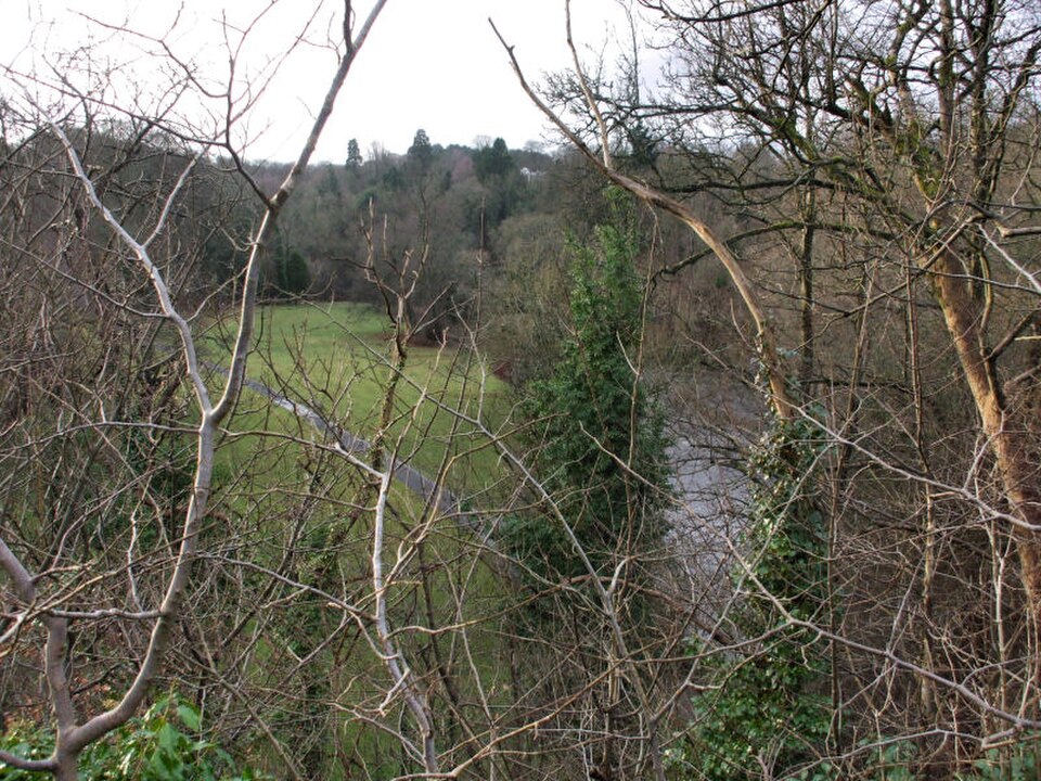
The country park contains open moorland, grassland, and areas of rough vegetation typical of elevated urban fringe environments. Paths traverse the terrain, though specific trail networks are not recorded in available sources. The elevated position provides extensive views across Glasgow and surrounding areas. Natural features include the undulating hillside character that gives the location its name. The park contains no visitor centre, café, or formal garden installations according to available documentation. Wildlife present would reflect standard upland-edge species common to the Glasgow region, though specific ecological inventories are not recorded in supplied sources.
Checked 2026-08-26

Visit duration depends entirely on individual activity choices and weather conditions. Casual walkers exploring the main paths might spend one to two hours. Those seeking panoramic viewpoints or undertaking more extensive hillside walking could extend this to half a day. The terrain's uneven nature affects walking pace significantly. No guided tours or timed attractions structure visits. Visitors should assess their own fitness against the sloping ground. The absence of facilities means self-sufficient planning is necessary. Return visits may appeal to those using the location for regular exercise or repeated viewpoint access across different weather conditions.
Checked 2026-08-26

Seasonal conditions vary considerably at this exposed elevated site. Winter brings colder temperatures, stronger winds, and reduced daylight hours that affect safety and comfort. Spring and summer offer longer days and generally more favourable conditions for outdoor activity. Autumn presents changeable weather typical of west-central Scotland. Operator-confirmed hours are Not recorded pending review. Visitors should consult Glasgow City Council or official channels for any access restrictions, maintenance closures, or specific seasonal arrangements before travelling. Weather forecasts merit particular attention given the exposed hillside position. Self-reliance regarding timing and preparedness remains essential.
Checked 2026-08-26
Cathkin Braes Country Park appears to operate as publicly accessible open space without admission charges. No ticketing infrastructure or entry control points are indicated in available sources. Operator-confirmed prices are Not recorded pending review. Visitors should verify current arrangements through Glasgow City Council channels, as policies may change. No concession categories, family rates, or membership schemes are documented. Any parking charges at nearby locations would fall under separate arrangements. Commercial activity or events might introduce temporary charging that standard sources do not capture. Verification before visiting represents prudent practice for all financial aspects.
Checked 2026-08-26

The park occupies elevated ground south of Glasgow city centre. Public transport connections require checking current bus routes serving the surrounding residential areas of Castlemilk and Rutherglen, with onward walking necessary. Private vehicle access involves roads to the vicinity followed by finding appropriate stopping points. No dedicated car park details are confirmed in supplied sources. Cyclists may approach via road connections, though dedicated cycle infrastructure is not documented. The terrain itself is not suitable for standard road bicycles. Walking approaches from surrounding neighbourhoods are possible but require local knowledge. Journey planning resources should be consulted for specific routing.
Checked 2026-08-26

Exposed hillside conditions present weather-related risks including wind, rain, and rapid condition changes. Path surfaces may be uneven, muddy, or slippery. No staffed presence or emergency facilities are indicated. Mobile telephone coverage in elevated areas can be unpredictable. Visitors should carry appropriate clothing, footwear, and provisions. Isolation from immediate assistance requires self-sufficiency. Livestock may graze some areas, requiring dog control and gate adherence. Boundary areas near roads or steep slopes demand caution. Darkness falls earlier in hollows than visible from city viewpoints. Informal paths may not represent maintained routes. Personal risk assessment remains the visitor's responsibility throughout.
Checked 2026-08-26

The elevated position offers panoramic photographic opportunities across Glasgow's urban expanse, subject to atmospheric clarity. Wide-angle lenses capture the broad vista; telephoto lenses isolate distant landmarks. Weather conditions dramatically affect results, with clear days offering definition and overcast conditions producing muted tones. Golden hour positioning requires planning given open access without time restrictions. The terrain itself provides textural foreground interest. No tripod restrictions are documented. Drone operation would fall under standard aviation regulations and any local byelaws. Sunrise and sunset angles vary seasonally across the visible cityscape. Persistent mist or low cloud may obscure views entirely, representing an inherent location uncertainty.
Checked 2026-08-26
The sloping, uneven terrain presents significant challenges. Specific accessibility provisions are not recorded. Cautious visitor judgement is advised.
No facilities are documented in available sources. Visitors should plan accordingly.
Open country park status suggests dogs may be permitted, but specific regulations and livestock considerations require verification. Responsible control is essential.
No visitor centre is indicated in supplied sources. Self-directed visiting with prior research is necessary.
Specific regulations are not recorded. Given moorland characteristics and typical Scottish park management, open fires likely carry restrictions. Verification is essential.
Specific elevation measurements are not recorded in supplied sources.
Loading the interactive map…
The interactive map could not be loaded.
Last updated:
Source: OpenStreetMap contributors, Wikidata ·