Smart Self-Managed Tours

City guide · Taiwan

Taipei

A photograph of Taipei
Photograph · Heeheemalu · CC BY-SA 4.0

Taipei is organised around a highly connected MRT grid rather than one single old centre. Ximending and the historic west side sit near Taipei Main Station, civic and commercial districts extend east toward Taipei 101, and the northern museum and hot-spring areas follow separate rail corridors. Riverside parks and mountain trailheads form another outer layer.

Practical information

Language spoken
Mandarin Chinese; Taiwanese Hokkien and other languages are widely used
National practical orientation; regional and minority languages may also be used
Dialling code
+886
International calling code; local area and mobile prefixes still apply
Currency
New Taiwan dollar (TWD)
Use the official local currency; card acceptance varies by place
Emergency number
110 police · 119 fire and ambulance
Use only for an emergency; tourist assistance may use a separate number
Plug type
Type A and B · 110 V
Check that chargers support the recorded voltage before using an adapter
Tap water
Not recorded
No verified nationwide visitor drinking-water statement was recorded

Turn this list into a plan

Set your days, your pace and the hours you actually want to be out. The planner works around closing days and travel time, and leaves room to eat.

Plan Taipei

Planning a visit

Suggested stay
Not recorded
Getting around
Walking, MRT and city bus
  1. January: good time to visit
  2. February: good time to visit
  3. March: good time to visit
  4. April: good time to visit
  5. May: viable with meaningful trade-offs
  6. June: viable with meaningful trade-offs
  7. July: viable with meaningful trade-offs
  8. August: viable with meaningful trade-offs — current month
  9. September: viable with meaningful trade-offs
  10. October: viable with meaningful trade-offs
  11. November: best time to visit
  12. December: good time to visit
  • Best time
  • Good time
  • Viable with trade-offs
  • Difficult conditions

Sources

Top things to see

Ranked by importance — sitelinks, pageviews and heritage status, not editor preference.

  1. Bihu Park
    09 1 hour

    Bihu Park

    碧湖公園

    • High
    • Nature site
  2. Dahu Park
    12 1 hour

    Dahu Park

    大湖公園

    • High
    • Nature site
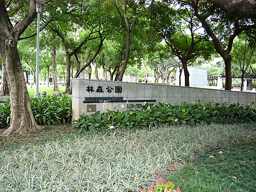
  3. Linsen Park Linsen Park
    14 1 hour

    Linsen Park

    林森公園

    • High
    • Nature site
  4. Milk Lake
    24 1 hour

    Milk Lake

    牛奶湖

    • High
    • Nature site
  5. Bade Park
    26 1 hour

    Bade Park

    八德公園

    • High
    • Nature site
  6. Kangle Park
    31 1 hour

    Kangle Park

    康樂公園

    • High
    • Nature site
  7. Lihe Eco Park
    32 1 hour

    Lihe Eco Park

    黎和生態公園

    • High
    • Nature site
  8. Minzhu Park
    33 1 hour

    Minzhu Park

    民族公園

    • High
    • Nature site
  9. Muzha Park
    34 1 hour

    Muzha Park

    木柵公園

    • High
    • Nature site
  10. Sanmin Park
    36 1 hour

    Sanmin Park

    三民公園

    • High
    • Nature site
  11. Sinsin Park
    38 1 hour

    Sinsin Park

    新新公園

    • High
    • Nature site
  12. Yudong Park
    49 1 hour

    Yudong Park

    玉東公園

    • High
    • Nature site

Source: OpenStreetMap contributors, Wikidata ·

How the city is laid out

Group Longshan Temple, Bopiliao and Ximending on the west side, then use Taipei Main Station as the interchange for other zones. Plan Chiang Kai-shek Memorial Hall separately from the eastern Taipei 101 and Xinyi cluster. Beitou, National Palace Museum, Maokong and Yangmingshan each require a deliberate transit leg beyond the central grid.

Checked 2026-08-26

Getting around

Taipei Travel identifies the MRT as the city’s most convenient public transport, with frequent services and connections to buses. Walk within each neighbourhood cluster and use rail between them. QR single-journey tickets and other accepted fare media are available, but check current operator guidance before travel. Buses or final walking sections are needed for several hillside attractions.

Checked 2026-08-26

Common questions

How many days should I spend in Taipei?

A fixed stay length is not recorded. Build the visit around the west side, civic centre and Xinyi, then add Beitou, Maokong and Yangmingshan only when the available time supports a separate journey.

What is the best way to organise sightseeing in Taipei?

Group places by district instead of crossing the city repeatedly. Start with the west side, civic centre and Xinyi; treat Beitou, Maokong and Yangmingshan as separate routes with their own travel allowance.

How do I get around Taipei?

Use Walking, MRT and city bus. Walk within compact clusters and consult the linked official transport information before making longer transfers or relying on a particular route.

Can I explore Taipei mainly on foot?

Only within individual neighbourhood clusters. The main visitor areas are separated by distances, waterways, major roads or regional approaches, so longer links normally need public transport or a licensed vehicle.

Which Taipei sights need separate transport planning?

Plan Beitou, Maokong and Yangmingshan separately from the west side, civic centre and Xinyi. Check the current route, return connection and any access requirements on the official source before departure.