Smart Self-Managed Tours

City guide · Switzerland

Zurich

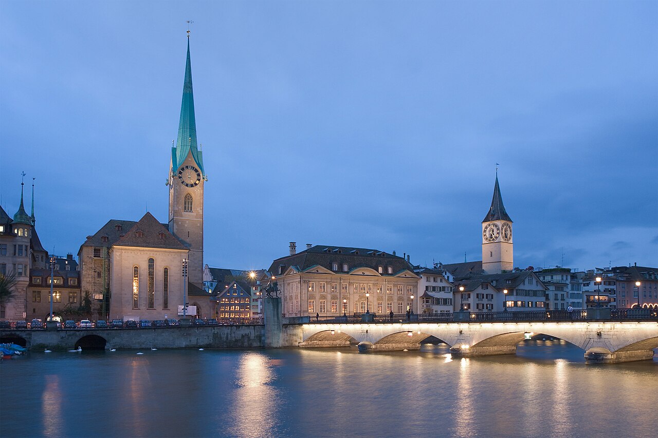
A photograph of Zurich
Photograph · Ikiwaner · CC BY-SA 3.0

Zurich’s centre is compact and organised around the Limmat River, the lakefront and the main railway station. The Old Town occupies both riverbanks, while the university terraces rise east and the former industrial districts extend west. Trams, S-Bahn trains, buses, boats and funiculars share an integrated zonal network. Walk the historic core, then use public transport for Uetliberg, outer neighbourhoods and longer lake connections.

Practical information

Language spoken
German, French, Italian and Romansh
National practical orientation; regional and minority languages may also be used
Dialling code
+41
International calling code; local area and mobile prefixes still apply
Currency
Swiss franc (CHF)
Use the official local currency; card acceptance varies by place
Emergency number
112 · 117 police · 144 ambulance
Use only for an emergency; tourist assistance may use a separate number
Plug type
Type C and J · 230 V
Check that chargers support the recorded voltage before using an adapter
Tap water
Safe from the mains
Public drinking water is controlled under Swiss food-safety rules

Planning a visit

Suggested stay
2-3 days
Getting around
Tram, S-Bahn, bus, boat, funicular and walking
  1. January: seasonal closure recorded
  2. February: seasonal closure recorded
  3. March: seasonal closure recorded
  4. April: seasonal closure recorded
  5. May: seasonal closure recorded
  6. June: seasonal closure recorded
  7. July: seasonal closure recorded
  8. August: seasonal closure recorded — this month
  9. September: seasonal closure recorded
  10. October: seasonal closure recorded
  11. November: seasonal closure recorded
  12. December: seasonal closure recorded

Top things to see

Ranked by importance — sitelinks, pageviews and heritage status, not editor preference.

  1. Bürkliplatz
    02 20 min

    Bürkliplatz

    Bürkliplatz is a prominent public square in central Zurich, situated at the western end of Lake Zurich.

    • Must see
    • Viewpoint
  2. Polyterrasse
    03 20 min

    Polyterrasse

    Polyterrasse is a prominent elevated terrace located on the campus of ETH Zurich, the Swiss Federal Institute of Technology.

    • Must see
    • Viewpoint
  3. Rigiblick
    04 20 min

    Rigiblick

    Rigiblick is a locality in Zurich, Switzerland, situated on elevated terrain in the city's northern area. The name derives from its position offering views across the city and toward Lake Zurich.

    • High
    • Viewpoint
  4. Zürichberg
    05 20 min

    Zürichberg

    Zürichberg is a hill and district in northeastern Zurich, Switzerland. Rising approximately 200 metres above the Limmat valley, it forms part of the wooded escarpment bordering the city.

    • High
    • Viewpoint
  5. Adlisberg
    07 20 min

    Adlisberg

    Adlisberg is a forested hill rising east of central Zurich, Switzerland. It forms part of the chain of wooded elevations between the Limmat and Glatt valleys.

    • High
    • Viewpoint
  6. Hönggerberg
    09 20 min

    Hönggerberg

    Hönggerberg is a hill in the northern part of Zurich, Switzerland. It rises within the city limits and forms part of the urban landscape that distinguishes Zurich's topography.

    • High
    • Viewpoint
  7. Käferberg
    10 20 min

    Käferberg

    Käferberg is a hill and elevated area in Zurich, Switzerland, forming part of the city's northern landscape. The name refers to both the geographical elevation and the surrounding residential zone.

    • High
    • Viewpoint
  8. Karlsturm
    11 20 min

    Karlsturm

    Karlsturm is a tower structure in Zurich, Switzerland. The name derives from Karl, suggesting historical association with a person or family of that designation. As a named tower within the city, it forms part of Zurich's built heritage.

    • High
    • Viewpoint
  9. Brand
    15 20 min

    Brand

    • Notable
    • Viewpoint
  10. Büel
    17 20 min

    Büel

    • Notable
    • Viewpoint
  11. Waid
    31 20 min

    Waid

    • Notable
    • Viewpoint
  12. Loorenkopf tower
    33 20 min

    Loorenkopf tower

    The Loorenkopf tower, known locally as Loorenkopf-Turm, is a viewing structure situated in Zurich. It stands as an elevated observation point within the city's broader landscape, offering visitors a raised platform from which to survey surrounding areas.

    • Notable
    • Viewpoint
  13. Gubrist
    34 20 min

    Gubrist

    Gubrist is a locality within the city of Zurich, Switzerland. The name identifies a specific point of interest recorded in open geographic data.

    • Notable
    • Viewpoint

Source: OpenStreetMap contributors, Wikidata ·

How the city is laid out

The main station anchors the northern edge of central Zurich. Bahnhofstrasse runs south toward Lake Zurich, with Lindenhof and the western Old Town between it and the Limmat. Niederdorf and the eastern Old Town climb toward the university and Polyterrasse. Enge and the lake promenades continue south, while Zurich West occupies converted industrial ground beyond the centre. Uetliberg, the zoo and farther lake destinations are separate excursions reached efficiently by rail or tram.

Checked 2026-08-26

Getting around

Use the ZVV network for trams, buses, S-Bahn trains, boats and funicular railways. Zurich Tourism notes that one zonal ticket can cover these modes within the selected zones, which makes transfers straightforward. The central Old Town and lakefront are best walked, while rail is the practical choice for Uetliberg and the airport. Check the zones before travel and do not assume a scenic boat or mountain connection uses the same validity area.

Checked 2026-08-26

Common questions

How many days does Zurich need?

Two to three days are enough for a first visit. Two cover the Old Town, lakefront and central museums; add a third for Uetliberg, the zoo or a longer trip on the lake.

When is the best time to visit Zurich?

May through September gives longer daylight for the lakefront, viewpoints and outdoor district walks. Winter is better suited to museums and shorter central routes unless snow activities are the main purpose.

Is Zurich easy to explore on foot?

The Old Town, Bahnhofstrasse, lakefront and university terraces fit into connected walking routes. Use transit for Zurich West, the zoo, Uetliberg and other destinations beyond the compact centre.

Does one ticket cover different transport modes?

Within the relevant ZVV zones, tickets can cover trams, buses, trains, boats and funicular or cable connections included in the network. Confirm the required zones for longer journeys.

Which Zurich areas combine well?

Combine both sides of the Old Town with Bahnhofstrasse and the lakefront. Give Zurich West, Uetliberg or a longer lake trip its own block to avoid repeated crossings through the main station.

Turn this list into a plan

Set your days, your pace and the hours you actually want to be out. The planner works around closing days and travel time, and leaves room to eat.

Plan Zurich