

.jpg)
.jpg)
.jpg)
.jpg)
1 min walk · Paris 1er Arrondissement
Charles V clock
- High
- Historic monument
Language · 1 published
Historic monument · Paris 4e Arrondissement, Paris
Pont au Change
| Monday | 00:00 – 23:59 |
|---|---|
| Tuesday | 00:00 – 23:59 |
| Wednesday | 00:00 – 23:59 |
| Thursday | 00:00 – 23:59 |
| Friday | 00:00 – 23:59 |
| Saturday | 00:00 – 23:59 |
| Sunday | 00:00 – 23:59 |
Parsed from OpenStreetMap opening hours on 2026-08-24.
Read from the OpenStreetMap access tags; anything not listed has no tag recorded.
Set the group type to family in the planner and the day window contracts to about three quarters of a solo day.
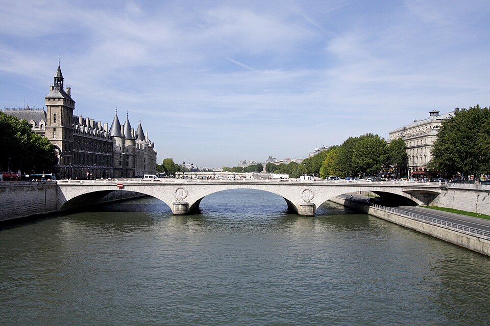
Pont au Change carries rue de Rivoli's continuation across the northern arm of the Seine, linking the Ile de la Cite -- at the Conciergerie and the Palais de Justice -- to the Right Bank at Place du Chatelet.
Its name records the money-changers who kept shops on the bridge from the Middle Ages, close to the royal palace on the island; the crossing has existed in some form since at least the ninth century, though the present bridge dates from 1858 to 1860, built under Haussmann's renovation of Paris.
Checked 2026-08-24 · Source
The bridge is a single road-and-pedestrian structure, not a building, so there is nothing enclosed to visit.
Its three stone arches carry the paired letter N, Napoleon III's monogram, cast into the ironwork of the parapet, a detail that dates the current structure clearly to the Second Empire rather than to any earlier bridge on the same crossing. Earlier bridges on this spot carried houses and shops lining both sides, in the pattern common to Paris bridges before the eighteenth century, none of which survives.
An eighteenth-century rebuild had already cleared the houses off the bridge in the 1780s, decades before Haussmann's engineers replaced that structure again with the present three-arch bridge to carry the wider road his renovation cut through the area.
Checked 2026-08-24 · Source
Five minutes to cross on foot; the bridge is usually walked as part of a longer route between the Conciergerie, the Chatelet theatres and the Hotel de Ville rather than visited on its own.
A slower look at the ironwork and the view along the Seine in both directions adds another five to ten minutes.
Because the bridge sits between two dense sightseeing clusters -- the Ile de la Cite to the south and the Chatelet-Hotel de Ville district to the north -- most visitors cross it more than once in a day without treating it as a separate stop at all.
Checked 2026-08-24 · Source

The bridge is open around the clock with no gate. Early morning gives the clearest light down the river toward Notre-Dame to the east and the Pont Neuf to the west, before the Chatelet end fills with commuter and tour-bus traffic.
The view of the Conciergerie's turrets from the bridge is a classic postcard angle at any season, though winter's low sun lights the facade more directly in the early afternoon.
Checked 2026-08-24 · Source
There is no ticket and no door: Pont au Change is a public road bridge, crossed on foot, by bicycle or by car at any hour, free of charge.
The Conciergerie and Palais de Justice at its southern end are separately ticketed buildings and are not part of the bridge itself.
Checked 2026-08-24 · Source

Metro Chatelet, one of the network's largest interchange stations, sits at the bridge's northern end; Cite, on Line 4, is a short walk across the island at the southern end.
Batobus and other river cruise stops operate near both ends of the bridge along the Seine embankments.
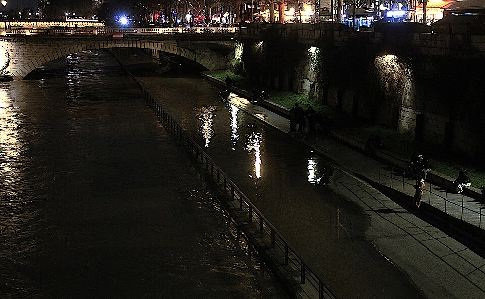
The quays below the bridge on both banks carry the riverside walking paths that run for long stretches along the Seine through central Paris, making the bridge a convenient point to drop down to the water level rather than staying on the street above.
Checked 2026-08-24 · Source

The Chatelet end is one of the busiest pedestrian and traffic junctions in central Paris, with buses, taxis and cyclists converging at once; crossing against the signal here is a common and avoidable risk.
Pickpocketing around the Chatelet metro entrances is a known issue reported by Paris police in the wider area, as at any major interchange, and is worth the same basic caution as elsewhere in the city centre.
The bridge's pavements narrow at the parapet, which matters when a tour group stops to photograph the view and blocks the through-path for other pedestrians crossing at the same time.
Checked 2026-08-24 · Source

The bridge frames the Conciergerie's round towers and the Palais de Justice spire from its northern end, one of the most photographed views of medieval royal Paris still standing.
Looking downstream from mid-bridge takes in the Pont Notre-Dame and the towers of the cathedral beyond; a boat passing beneath the central arch gives scale to a otherwise static composition.
Blue hour, just after sunset, catches the Conciergerie's turret lighting against a darkening sky and is a reliably better result than a midday shot into flat overhead light.
Checked 2026-08-24 · Source
For the money-changers who kept shops on the bridge from the Middle Ages, close to the royal palace on the Ile de la Cite.
The present bridge dates from 1858 to 1860, built during Haussmann's renovation of Paris; earlier bridges stood on the same crossing since at least the ninth century.
No. It is a public road bridge, open at all hours and free to cross on foot, by bicycle or by car.
The Conciergerie and the Palais de Justice, the historic royal palace and law courts, sit at its southern end.
It is Napoleon III's monogram, cast into the parapet ironwork and dating the current structure to the Second Empire rebuild of 1858 to 1860.
Loading the interactive map…
The interactive map could not be loaded.
Last updated:
Source: OpenStreetMap contributors, Wikidata ·