
_and_the_Brooklyn_Heights_Promenade_from_Brooklyn_Bridge_Park_in_Brooklyn,_New_York_City,_New_York.jpg)
_just_southwest_of_the_Brooklyn_Heights_Promenade_from_Brooklyn_Bridge_Park_in_Brooklyn,_New_York_City,_New_York.jpg)
_and_the_southwest_end_of_the_Brooklyn_Heights_Promenade_from_Brooklyn_Bridge_Park_in_Brooklyn,_New_York_City,_New_York.jpg)
_and_the_southwest_end_of_the_Brooklyn_Heights_Promenade_from_Brooklyn_Bridge_Park_in_Brooklyn,_New_York_City,_New_York.jpg)
_and_the_southwest_end_of_the_Brooklyn_Heights_Promenade_from_Brooklyn_Bridge_Park_in_Brooklyn,_New_York_City,_New_York.jpg)
3 min walk
Brooklyn Bridge Park
- Notable
- Nature site
Language · 1 published
Historic monument · New York
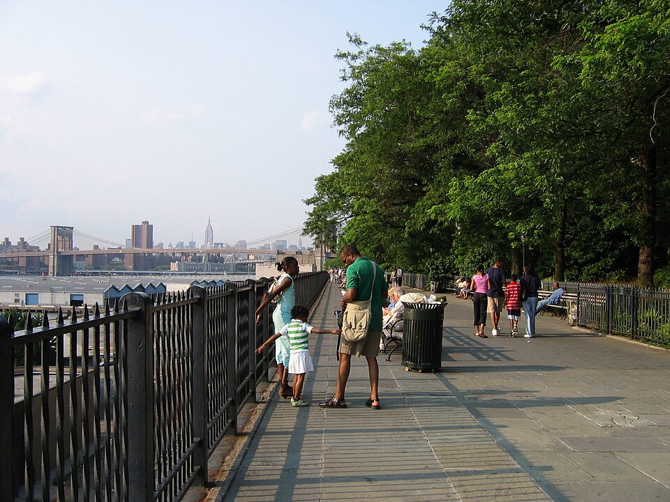
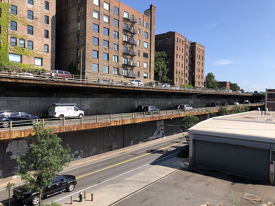
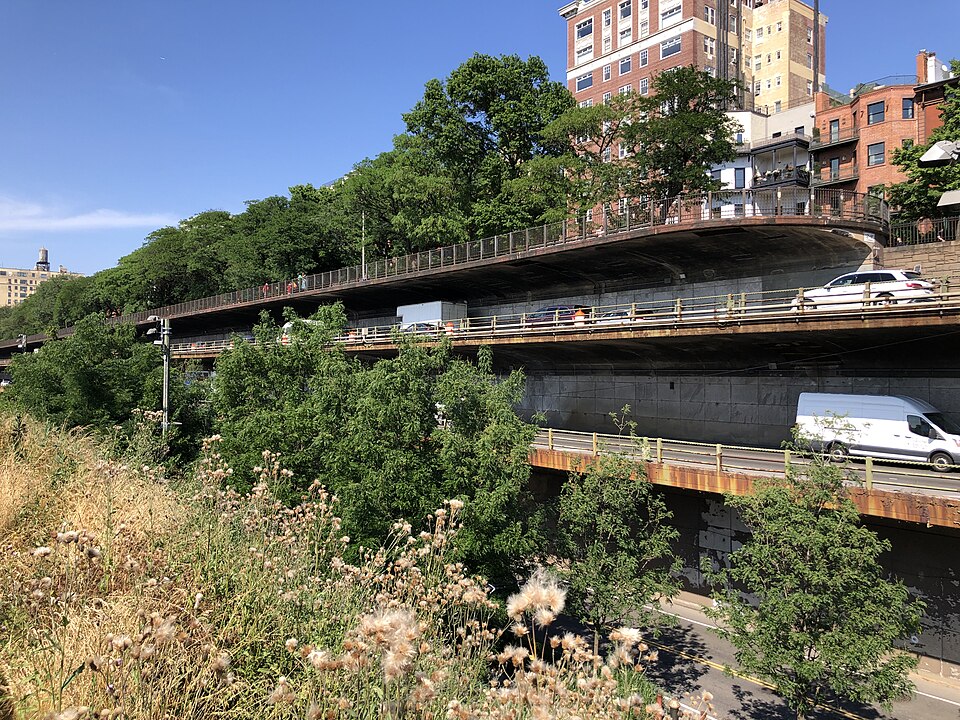
The Brooklyn Heights Promenade is an elevated pedestrian walkway in Brooklyn Heights, New York City. It runs parallel to the East River, offering panoramic views of the Manhattan skyline, the Brooklyn Bridge, and Lower Manhattan. The promenade sits above the Brooklyn-Queens Expressway, creating a distinctive urban design where a tranquil public space exists above active highway traffic. It serves as both a scenic overlook and a neighborhood gathering place for residents and visitors alike. The strongest visit keeps attention on what is distinctive here while leaving room for the next stop. That approach makes Brooklyn Heights Promenade useful in both a focused first visit and a slower return to the city.
Checked 2026-08-26
The promenade consists of a linear paved walkway lined with benches, trees, and landscaping. Not recorded. Visitors will find open views across the East River toward Manhattan, with the Statue of Liberty visible in the distance on clear days. The surrounding Brooklyn Heights neighborhood features historic brownstone architecture and tree-lined streets. The promenade connects to nearby Brooklyn Bridge Park at its southern end, extending recreational possibilities along the waterfront. Brooklyn Heights Promenade also earns time in a new york itinerary because Exact production identity verified by OSM ID, canonical name, and coordinates; no near match was used. Its value becomes clearer when the stop is compared with the surrounding streets and the other ranked places nearby.
Checked 2026-08-26

Not recorded. The promenade extends approximately 1,826 feet along the waterfront. A leisurely walk from one end to the other typically takes 15 to 25 minutes, though many visitors spend considerably longer seated on benches, taking photographs, or simply observing the river traffic and skyline. The experience duration depends entirely on individual pacing and whether visitors combine their promenade walk with exploration of adjacent Brooklyn Bridge Park or the surrounding historic district streets.
Checked 2026-08-26
Operator-confirmed hours are Not recorded pending review. The promenade is an outdoor public space generally accessible during daylight and evening hours. Visitors should exercise cautious judgement regarding personal safety and comfort when visiting after dark. Weather conditions significantly affect the experience, as the elevated position exposes visitors to wind and temperature variations. Sunset hours attract substantial crowds seeking photographs of the illuminated Manhattan skyline. Seasonal considerations include summer heat, winter cold, and variable foliage in autumn.
Checked 2026-08-26
Operator-confirmed prices are Not recorded pending review. The Brooklyn Heights Promenade is a public pedestrian walkway with no admission fee. No ticketing infrastructure exists for entry. Visitors should be prepared for incidental expenses including transportation to the site, food and beverages from neighborhood establishments, and any optional activities in adjacent areas. The promenade itself imposes no financial barrier to access, consistent with its function as public open space maintained for general community use. A flexible visit lets travellers connect Brooklyn Heights Promenade with the rest of the day without treating one room, viewpoint or photograph as the whole experience. The useful pace depends on personal interest and conditions on arrival.
Checked 2026-08-26
The promenade is accessible via multiple subway lines serving Brooklyn Heights. The 2, 3, 4, 5, N, R, and W trains serve nearby stations including Clark Street, Borough Hall, and Court Street. Walking from these stations involves navigating the neighborhood's characteristic hilltop terrain. Bus routes also serve the area. Visitors arriving by vehicle should note that parking in Brooklyn Heights is extremely limited and subject to residential permit restrictions. Walking or public transit represents the most reliable approach.
Checked 2026-08-26
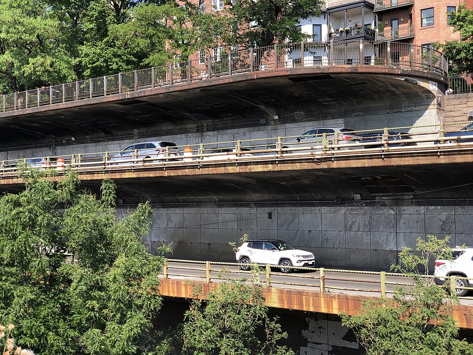
The promenade's elevation above the expressway means no protective barrier exists between pedestrians and the highway below in all areas; visitors should remain behind designated railings. The walkway surface may become slippery in wet conditions. Evening visitors should exercise standard urban awareness. The area experiences significant tourist foot traffic, particularly during peak photography hours. Cyclists occasionally use the promenade despite pedestrian priority. Strong winds from the river can affect stability and comfort, particularly for lightweight items and small children.
Checked 2026-08-26

The promenade offers exceptional photography opportunities of the Manhattan skyline, Brooklyn Bridge, and East River activity. The unobstructed northern views capture Midtown and Lower Manhattan skyscrapers. Sunrise illuminates the Brooklyn Bridge and eastern sky; sunset backlights Manhattan with warm tones transitioning to blue-hour city illumination. Tripod use may attract attention in crowded conditions. The railing line creates natural framing possibilities. Weather clarity dramatically affects long-distance visibility. Night photography captures distinctive urban lighting, though visitors should remain aware of surroundings and equipment security in darkness.
Checked 2026-08-26
Yes, the promenade is a public pedestrian walkway with no admission fee.
Sunset and the subsequent blue hour are particularly popular for Manhattan skyline photography, though personal preference and weather conditions vary.
Multiple subway lines including the 2, 3, 4, 5, N, R, and W serve stations within walking distance, though the neighborhood's hills require navigating elevated terrain.
Not recorded.
The promenade is designated for pedestrian use; cyclists should exercise cautious judgement regarding local regulations and courtesy to walkers.
The walkway surface is paved and generally level, though visitors should exercise cautious judgement regarding specific access points from surrounding streets given the neighborhood's topography.
Loading the interactive map…
The interactive map could not be loaded.
Last updated:
Source: OpenStreetMap contributors, Wikidata ·