
.jpg)
.jpg)
.jpg)
16 min walk
Humboldt Park
- Must see · Heritage site
- Nature site
Language · 1 published
Nature site · Chicago

| Monday | 06:00 – 23:00 |
|---|---|
| Tuesday | 06:00 – 23:00 |
| Wednesday | 06:00 – 23:00 |
| Thursday | 06:00 – 23:00 |
| Friday | 06:00 – 23:00 |
| Saturday | 06:00 – 23:00 |
| Sunday | 06:00 – 23:00 |
Parsed from OpenStreetMap opening hours on 2026-08-26.
The 606 is an elevated linear park and trail system on Chicago's Northwest Side. Built on a former railway embankment, it runs through several neighborhoods. The formal name is Bloomingdale Trail Park. The park opened in 2015 after years of community advocacy and planning. It serves as both recreational space and transportation corridor. The name references Chicago's ZIP code prefix. The trail is managed by the Chicago Park District in partnership with the Trust for Public Land. It has become a distinctive urban amenity and green infrastructure project.
Checked 2026-08-26
The trail features paved paths for walking, running, and cycling. Access points include ramped entrances and stairways at various locations. The park includes landscaping with native and adapted plants. Several art installations appear along the route. Seating areas and gathering spaces are distributed at intervals. The elevated structure provides unique views of surrounding neighborhoods. Some sections include educational signage about local ecology and history. The width varies but accommodates multiple user types. Adjacent parks and facilities connect at ground level. The design preserves industrial heritage while creating contemporary public space.
Checked 2026-08-26
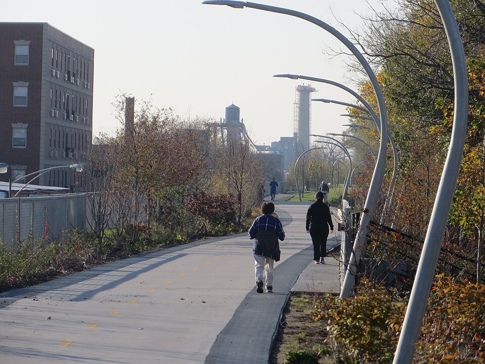
The 606 extends approximately 2.7 miles east-west. The exact length is not recorded pending review. The trail connects several community areas from Ashland Avenue on the east to Ridgeway Avenue on the west. Travel time depends on activity and pace. Cyclists may complete the route in fifteen to twenty minutes without stops. Pedestrians typically require longer. The linear nature means users can enter and exit at multiple points rather than completing the full distance. Connections to neighborhood streets occur at regular intervals.
Checked 2026-08-26
The 606 operates seasonally with varying hours. Operator-confirmed hours are Not recorded pending review. The trail typically experiences heavier use during temperate months and weekends. Morning and evening hours attract runners and commuters. Midday periods see more casual visitors and families. Weather conditions affect experience significantly given the exposed elevated structure. Winter access may be limited or conditions hazardous. Users should check current status before visiting. Evening use may be affected by lighting conditions. Special events occasionally cause temporary closures or congestion.
Checked 2026-08-26

Access to The 606 is free of charge. No admission fee is collected at entry points. Operator-confirmed prices are Not recorded pending review. The park operates as public infrastructure. No ticket purchase or reservation system exists for general use. Special events or programs may have separate arrangements. Bicycle rentals are available from private vendors nearby but not through the park itself. Users should bring their own equipment or arrange rentals independently. Donations to supporting organizations are accepted but not required. The 606 also earns time in a chicago itinerary because Elevated linear park mapped under its formal Bloomingdale Trail Park name. Its value becomes clearer when the stop is compared with the surrounding streets and the other ranked places nearby.
Checked 2026-08-26

Multiple access points serve The 606. The trail crosses several major streets with designated entrances. Public transit options include CTA bus routes on intersecting streets. The Blue Line has stations within walking distance of some access points. Divvy bike-share stations exist near several entrances. Street parking is available in surrounding neighborhoods with varying restrictions. Users should observe posted regulations. The linear nature means no single correct arrival point. Selection depends on intended activity distance and direction. Some access points offer better facilities than others.
Checked 2026-08-26
Users share the trail with cyclists, runners, and pedestrians simultaneously. Speed differentials create safety considerations. The elevated structure lacks shade over much of its length. Sun exposure and wind are more intense than at ground level. Winter conditions may include ice and snow accumulation. Some access points use stairs, limiting accessibility. Users should remain aware of surroundings and trail etiquette. Emergency access points are limited compared to ground-level parks. After-dark use requires personal lighting and caution. Neighborhood context varies along the route. Visitors should exercise standard urban awareness.
Checked 2026-08-26

The elevated position offers distinctive vantage points of Chicago's residential architecture and skyline glimpses. Morning and evening light creates dramatic conditions along the linear corridor. The industrial structure itself provides graphic compositional elements. Neighborhood murals and street art appear visible from certain sections. Seasonal vegetation changes affect visual character. The trail's straight geometry creates strong leading lines. Users photographing should remain aware of moving traffic on the path. Tripod use may obstruct other visitors. Drone operation requires compliance with city and federal regulations. Private property boundaries adjoin the trail.
Checked 2026-08-26
Yes. The 606 is the popular name for the elevated park, while Bloomingdale Trail Park is the formal name. Both refer to the same facility.
Yes. Cycling is permitted and is a common use of the trail. Users should follow posted rules and exercise caution around pedestrians.
No. The trail is free to access. No admission is charged at entry points.
Operator-confirmed hours are Not recorded pending review. Visitors should consult official Chicago Park District sources before planning their visit.
Some access points have ramps, while others use stairs. Accessibility varies by entrance point. Visitors with mobility needs should research specific access locations.
The trail connects to neighborhood streets and parks at multiple points. Specific connections to other major trail systems are not recorded pending review.
Loading the interactive map…
The interactive map could not be loaded.
Last updated:
Source: OpenStreetMap contributors, Wikidata ·