
.jpg)


.jpg)
9 min walk
Whanki Museum
- High
- Museum
Language · 1 published
Viewpoint · Seoul
북악산
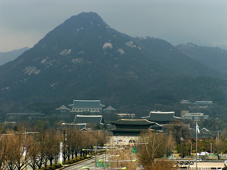
Bugaksan is a mountain in Seoul, South Korea, known locally as 북악산. It forms part of the city's northern boundary and is one of the mountains surrounding the historic center. The area carries significance as a natural landmark within the urban environment. Its proximity to central Seoul makes it accessible for residents and visitors seeking elevated terrain. The mountain is situated near other notable Seoul locations and contributes to the city's distinctive topography of peaks interspersed with dense development. As with many Korean mountains, it holds cultural and recreational value for those who visit.
Checked 2026-08-26
The mountain terrain comprises forested slopes and hiking trails of varying difficulty. Trail infrastructure exists for pedestrian access, though specific features depend on seasonal conditions and maintenance status. Some routes pass near historical or security-sensitive zones, reflecting Seoul's complex modern history. Vegetation consists of typical Korean temperate forest species. Views from elevated points encompass parts of the Seoul metropolitan area. The exact trail network, rest facilities, and summit markers should be verified through current local sources, as conditions may change. Visitors report encountering both natural scenery and reminders of the divided peninsula's ongoing realities in certain sectors.
Checked 2026-08-26
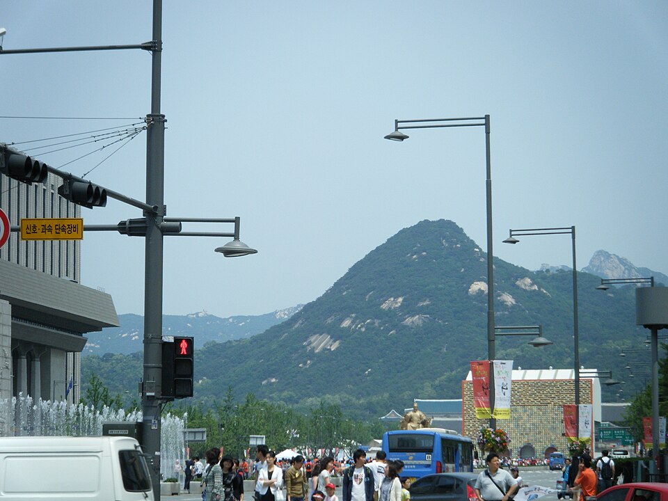
Hiking duration varies substantially based on chosen route, physical condition, and weather circumstances. Typical mountain ascents in this elevation range require several hours for a complete round trip, though specific timing depends on individual pace and trail selection. Some paths permit shorter partial excursions. Visitors should consult current trail maps and local guidance before estimating their itinerary. Factors including daylight hours, personal fitness, and trail conditions affect practical duration. Adequate time should be allowed for descent before darkness. Group composition and frequency of stops similarly influence total time spent on the mountain.
Checked 2026-08-26
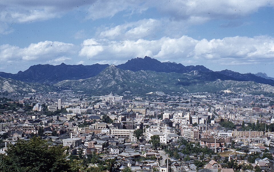
Operator-confirmed hours are Not recorded pending review. Seasonal considerations affect visitor experience significantly. Spring and autumn generally offer moderate temperatures and clearer visibility for metropolitan views. Summer brings humidity and potential rainfall that may affect trail safety. Winter conditions can include snow and ice at elevation, requiring appropriate equipment and caution. Weekend and holiday periods typically see increased local visitor numbers. Early morning departures may help avoid congestion on popular routes. Visitors should verify current access status before traveling, as restrictions may apply to certain trail segments regardless of season.
Checked 2026-08-26
Operator-confirmed prices are Not recorded pending review. Many urban mountains in Seoul operate without entrance fees, though this cannot be assumed for all access points or facilities. Potential costs may include transportation to trailheads, parking where applicable, or guided services if arranged. Visitors should carry sufficient funds for incidental expenses. Any required permits or registration procedures for specific zones should be confirmed through official channels. Commercial services near access points may operate independently with separate pricing structures. Budget planning should remain flexible pending verification of actual costs at time of visit.
Checked 2026-08-26

Multiple access points exist depending on trail selection and origin within Seoul. Public transportation options include bus and subway connections to stations near various trailheads, with walking required to reach actual mountain entry points. Specific routes and transfer points depend on departure location and chosen path. Taxi or private vehicle access may reach closer to certain trailheads, though parking availability varies. Visitors should identify their intended route before determining optimal transportation. Current transit schedules and any service modifications should be verified through official Seoul transportation resources. Signage and wayfinding assistance may be limited in some approaches.
Checked 2026-08-26
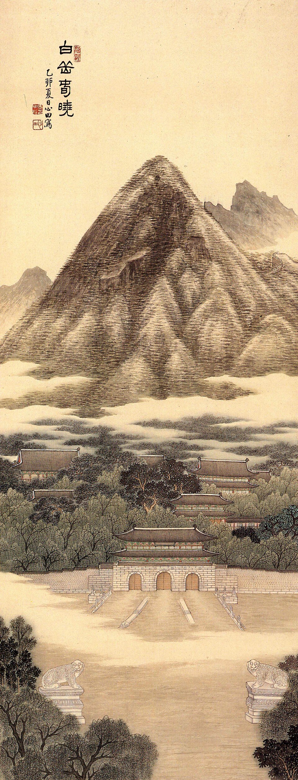
Certain trail areas maintain security significance requiring identification checks or access controls; compliance with official instructions is mandatory. Weather changes at elevation can occur rapidly; appropriate layered clothing and emergency supplies are prudent. Trail conditions vary; sturdy footwear is essential. Mobile phone coverage may be inconsistent in some sectors. Solo hiking, particularly on less frequented routes, warrants extra precaution. Wildlife encounters, while generally not dangerous, merit respectful distance. Litter removal and trail etiquette preserve conditions for subsequent visitors. Physical demands exceed casual walking; honest self-assessment of fitness prevents difficulties. Informing others of intended route and expected return enhances safety.
Checked 2026-08-26

Elevated viewpoints offer perspectives of Seoul's urban expanse and surrounding mountains, though atmospheric conditions significantly affect results. Certain areas may restrict photography due to security considerations; observe posted regulations and official guidance. Early morning and late afternoon typically provide favorable natural lighting. Equipment weight merits consideration given hiking demands. Tripod use may be impractical on narrow or crowded trail sections. Seasonal vegetation changes alter visual character substantially. Panoramic compositions benefit from clear atmospheric conditions uncommon during humid summer periods. Respect for other visitors and any operational restrictions should govern photographic behavior. Backup power sources accommodate extended outings.
Checked 2026-08-26
Trail difficulty varies by route. Some paths accommodate casual walkers while others demand greater fitness and experience. Beginners should research specific trail options and select appropriately.
Specific amenity locations are Not recorded. Visitors should not assume facility availability and plan accordingly before ascending.
Winter access is possible but requires preparation for cold, ice, and potentially shorter daylight hours. Equipment and conditions assessment are essential.
Reservation requirements for any trail segments are Not recorded pending review. Visitors should verify current access procedures through official sources.
Specific regulations regarding animals are Not recorded. Visitors should seek current guidance from managing authorities before bringing pets.
Essential items include water, appropriate footwear, weather-appropriate clothing, and basic emergency supplies. Specific quantities depend on route and conditions.
Loading the interactive map…
The interactive map could not be loaded.
Last updated:
Source: OpenStreetMap contributors, Wikidata ·