City guide · Philippines
Manila
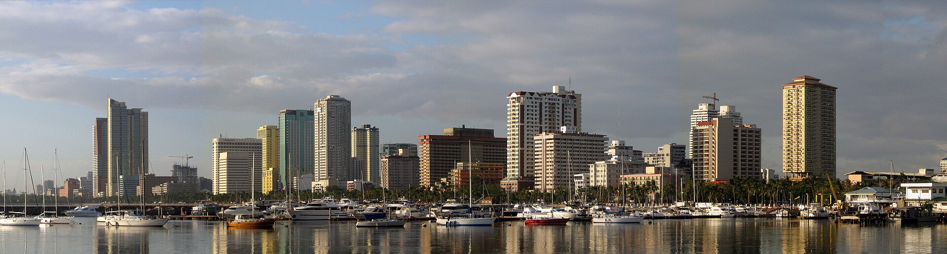

Manila is best understood as a set of historic and waterfront districts inside the wider Metro Manila region. Intramuros and Rizal Park form the principal heritage cluster, Binondo and Quiapo sit north of the Pasig River, and Ermita and Malate extend south toward Manila Bay. Makati, BGC and Quezon City are separate metropolitan journeys.
Practical information
Practical information
- Language spoken
- Filipino and English
- National practical orientation; regional and minority languages may also be used
- Dialling code
- +63
- International calling code; local area and mobile prefixes still apply
- Currency
- Philippine peso (PHP)
- Use the official local currency; card acceptance varies by place
- Emergency number
- 911
- Use only for an emergency; tourist assistance may use a separate number
- Plug type
- Type A, B and C · 220 V
- Check that chargers support the recorded voltage before using an adapter
- Tap water
- Not recorded
- No verified nationwide visitor drinking-water statement was recorded
Turn this list into a plan
Set your days, your pace and the hours you actually want to be out. The planner works around closing days and travel time, and leaves room to eat.
Planning a visit
- Suggested stay
- Not recorded
- Getting around
- Walking, urban rail, public road transport and licensed car services
- January: best time to visit
- February: best time to visit
- March: good time to visit
- April: viable with meaningful trade-offs
- May: viable with meaningful trade-offs
- June: viable with meaningful trade-offs
- July: recurring difficult conditions
- August: recurring difficult conditions — current month
- September: recurring difficult conditions
- October: recurring difficult conditions
- November: viable with meaningful trade-offs
- December: good time to visit
- Best time
- Good time
- Viable with trade-offs
- Difficult conditions
Sources
- worldweather.wmo.int Checked 2026-08-28
- www.pagasa.dost.gov.ph Checked 2026-08-28
Top things to see
Ranked by importance — sitelinks, pageviews and heritage status, not editor preference.
Filter the list
0 places match
0 places match
Nothing in Manila matches all of those filters
The list is built from real place data, so an empty result means the combination genuinely has no match — not that the page failed. Loosen one filter and the ranking returns.
Clear all filtersSource: OpenStreetMap contributors, Wikidata ·
How the city is laid out
Combine Intramuros, the National Museum complex and Rizal Park in one central route. Cross toward Binondo for its churches and food streets, and keep Quiapo as a nearby but distinct market district. The bayfront and Malate work together later in the day. Do not treat Makati or Quezon City as short walking extensions of old Manila.
Checked 2026-08-26
Getting around
Walk inside Intramuros and other compact heritage clusters, then use rail, public road transport or an accredited taxi or transport-network vehicle between districts. The Tourism Promotions Board notes that transport-network vehicle services are available. Metro Manila traffic makes cross-city timing variable, so avoid building a day that repeatedly crosses the Pasig River or the metropolitan core.
Checked 2026-08-26
Common questions
How many days should I spend in Manila?
A fixed stay length is not recorded. Build the visit around Intramuros, Rizal Park, Binondo and the bayfront, then add Makati, BGC and Quezon City only when the available time supports a separate journey.
What is the best way to organise sightseeing in Manila?
Group places by district instead of crossing the city repeatedly. Start with Intramuros, Rizal Park, Binondo and the bayfront; treat Makati, BGC and Quezon City as separate routes with their own travel allowance.
How do I get around Manila?
Use Walking, urban rail, public road transport and licensed car services. Walk within compact clusters and consult the linked official transport information before making longer transfers or relying on a particular route.
Can I explore Manila mainly on foot?
Only within individual neighbourhood clusters. The main visitor areas are separated by distances, waterways, major roads or regional approaches, so longer links normally need public transport or a licensed vehicle.
Which Manila sights need separate transport planning?
Plan Makati, BGC and Quezon City separately from Intramuros, Rizal Park, Binondo and the bayfront. Check the current route, return connection and any access requirements on the official source before departure.