Smart Self-Managed Tours

City guide · Peru

Cusco

A photograph of Cusco
Photograph · gertrudis2010 · CC BY-SA 3.0

Cusco's visitor core is compact but steep, centred on Plaza de Armas and adjoining historic streets. San Blas rises above the centre, while Qorikancha and the southern streets form another walkable cluster. Sacsayhuamán and nearby archaeological sites sit beyond the central grid, and the Sacred Valley and Machu Picchu are separate regional journeys. Altitude and cobbled slopes make realistic pacing more important than short map distances.

Practical information

Language spoken
Spanish; Quechua, Aymara and other Indigenous languages have official status where predominant
National practical orientation; regional and minority languages may also be used
Dialling code
+51
International calling code; local area and mobile prefixes still apply
Currency
Peruvian sol (PEN)
Use the official local currency; card acceptance varies by place
Emergency number
105 police · 116 fire
Use only for an emergency; tourist assistance may use a separate number
Plug type
Type A and C · 220 V
Check that chargers support the recorded voltage before using an adapter
Tap water
Not recorded
No verified nationwide visitor drinking-water statement was recorded

Turn this list into a plan

Set your days, your pace and the hours you actually want to be out. The planner works around closing days and travel time, and leaves room to eat.

Plan Cusco

Planning a visit

Suggested stay
Not recorded
Getting around
Walking, authorised taxi, bus and regional train
  1. January: viable with meaningful trade-offs
  2. February: viable with meaningful trade-offs
  3. March: viable with meaningful trade-offs
  4. April: good time to visit
  5. May: best time to visit
  6. June: good time to visit
  7. July: good time to visit
  8. August: best time to visit — current month
  9. September: best time to visit
  10. October: good time to visit
  11. November: viable with meaningful trade-offs
  12. December: viable with meaningful trade-offs
  • Best time
  • Good time
  • Viable with trade-offs
  • Difficult conditions

Sources

Top things to see

Ranked by importance — sitelinks, pageviews and heritage status, not editor preference.

  1. Parque Orellana Pumaqchupan Parque Orellana Pumaqchupan
    02 1 hour

    Parque Orellana Pumaqchupan

    Parque Orellana Pumaqchupan is a landscaped urban park situated along Avenida El Sol in Cusco, Peru. The green space functions as a central pause point within the city's dense historic core, offering vegetated relief near major landmarks.

    • Must see
    • Nature site
  2. Tres Hermanas Falls Tres Hermanas Falls
    03 1 hour

    Tres Hermanas Falls

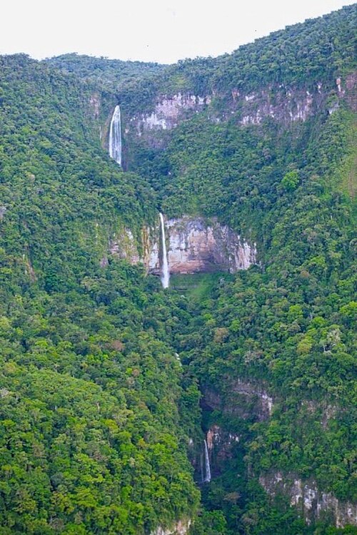
    Tres Hermanas Falls, known locally as Cataratas las Tres Hermanas, is a waterfall attraction near Cusco, Peru. The name translates to Three Sisters Falls, referencing its three distinct cascades.

    • High
    • Nature site
  3. Lake Sibinacocha Lake Sibinacocha
    04 1 hour

    Lake Sibinacocha

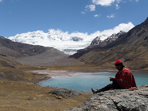
    Lake Sibinacocha is a large high-Andean lake in the Urubamba basin of southern Peru. Peru's National Water Authority inventory records a surface area of about 28.11 square kilometres, making it one of the major glacial lakes identified in that basin.

    • High
    • Nature site
  4. Mandor
    39 1 hour

    Mandor

    • High
    • Nature site
  5. 1
    63 1 hour

    1

    • Notable
    • Nature site
  6. Água Água
    64 1 hour

    Água

    • Notable
    • Nature site
  7. Alameda
    66 1 hour

    Alameda

    • Notable
    • Nature site

Source: OpenStreetMap contributors, Wikidata ·

How the city is laid out

Plaza de Armas anchors the cathedral, museums and colonial streets. San Blas occupies the hillside northeast of the square, with narrow lanes and steep approaches. Qorikancha and Avenida El Sol extend south. Sacsayhuamán, Q'enqo, Puka Pukara and Tambomachay form an archaeological corridor outside the compact core. The Sacred Valley, Rainbow Mountain and Machu Picchu require dedicated transport and should never be treated as nearby city stops.

Checked 2026-08-26

Getting around

Walk within the historic centre when altitude and slopes allow, and use authorised taxis or organised transport for higher or outlying sites. Regional trains, buses and licensed transfers serve Sacred Valley and Machu Picchu routes, but departure stations and ticket conditions vary. Confirm each leg through the official traveller guide and relevant operator. Build extra time into the first day rather than scheduling a dense itinerary immediately after arrival.

Checked 2026-08-26

Common questions

How is Cusco organised for sightseeing?

Plaza de Armas, Qorikancha and lower central streets form the main walking core

How many days should I spend in Cusco?

No fixed stay length is recorded; separate city time from regional archaeological journeys.

What is the easiest way to get around Cusco?

Walk the centre slowly and use authorised transport for higher or outlying sites.

Which places need a separate trip from central Cusco?

Machu Picchu requires separate train, road and ticket arrangements outside a city walking day.

What is the most practical way to plan a day in Cusco?

A lighter first day accounts for altitude, slopes and the effort of cobbled streets.