Lapangan Banteng
Lapangan Banteng is a historic public square in central Jakarta, Indonesia. The site holds colonial-era significance as a former military parade ground during Dutch administration.
- Must see
- Nature site
Language · 11 published
City guide · Indonesia
Jakarta is a large metropolitan city whose visitor sights are divided among distinct corridors. Kota Tua and Glodok form the historic northern cluster, Monas and major national institutions anchor Central Jakarta, and the modern business, shopping and cultural axis continues south through Menteng, Sudirman and Blok M. Use the integrated rail and bus network to connect clusters rather than planning a single cross-city walk.
Ranked by importance — sitelinks, pageviews and heritage status, not editor preference.
50 places match
Category
Typical visit duration
Lapangan Banteng is a historic public square in central Jakarta, Indonesia. The site holds colonial-era significance as a former military parade ground during Dutch administration.
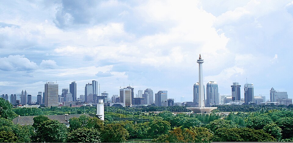
Merdeka Square, known locally as Medan Merdeka, is a vast public square in central Jakarta. It ranks among the city's most significant visitor destinations and serves as a major civic and symbolic space in Indonesia's capital.
Muara Angke Wildlife Reserve, known locally as Suaka Margasatwa Muara Angke, is a protected mangrove forest area located in North Jakarta. It serves as one of the remaining green spaces within Indonesia's densely populated capital city.
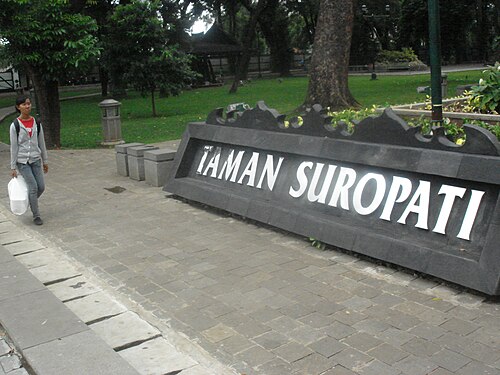
Taman Suropati is a public park located in the Menteng district of central Jakarta, Indonesia. The park occupies a triangular plot formed by the convergence of three major roads.
Taman Situ Lembang is a public park located in the Menteng district of central Jakarta. The park centers on a historic artificial lake, Situ Lembang, which gives the area its name.
Tribeca Park is an urban green space situated within the Central Park Jakarta complex in the city. The park serves as a recreational area for residents and visitors seeking respite from the dense urban environment of the capital.
Source: OpenStreetMap contributors, Wikidata ·
Kota Tua, Sunda Kelapa and Glodok sit in the north. Monas, the National Museum and government landmarks form a central block, while Menteng and the Hotel Indonesia roundabout lead into the Sudirman corridor. Blok M and southern creative districts are farther south. The Thousand Islands require a separate boat plan and should never be treated as an extension of a central-city day.
Checked 2026-08-26
Use MRT, LRT, TransJakarta and KRL Commuter Line for longer journeys, then walk within individual sightseeing clusters. Jakarta’s official visitor service describes these modes as an integrated public-transport system, and the official tourism guide links key destinations along MRT and TransJakarta corridors. Allow extra transfer time and consult current operator information before setting out.
Checked 2026-08-26
A fixed official stay length is not recorded. Plan separate blocks for Kota Tua, Central Jakarta and the southern corridor, then add further districts according to time.
Use the integrated MRT, LRT, TransJakarta and KRL networks for longer journeys, then walk within each sightseeing cluster.
Kota Tua and Glodok form one northern route, while Monas and the National Museum form a central cluster. The Sudirman and Blok M corridor is a separate southern route.
Yes. Jakarta’s official tourism guide presents a route linking Kota Tua, Monas and southern stops using MRT and TransJakarta.
No. They require a separate boat plan and should be scheduled independently from mainland museum and neighbourhood clusters.
Set your days, your pace and the hours you actually want to be out. The planner works around closing days and travel time, and leaves room to eat.