Smart Self-Managed Tours

City guide · Brazil

São Paulo

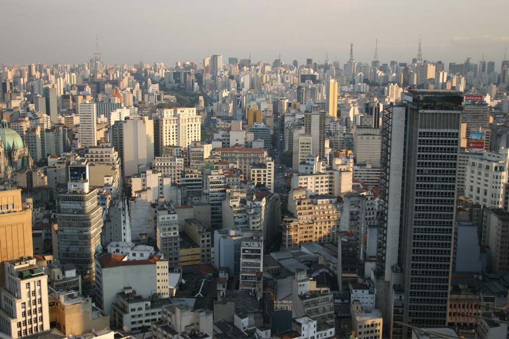
A photograph of São Paulo
Photograph · Thomas Hobbs · CC BY-SA 2.0

São Paulo is a vast inland metropolis whose visitor sights are spread among the historic centre, Avenida Paulista, Liberdade, Ibirapuera and specialised neighbourhoods. The city guide groups attractions by district and marks nearby Metro access because distance and major roads shape every itinerary. Use central clusters for architecture and markets, Paulista for museums, and Ibirapuera as its own park-and-museum block rather than crossing the city between isolated stops.

Practical information

Language spoken
Portuguese
National practical orientation; regional and minority languages may also be used
Dialling code
+55
International calling code; local area and mobile prefixes still apply
Currency
Brazilian real (BRL)
Use the official local currency; card acceptance varies by place
Emergency number
190 police · 192 ambulance · 193 fire
Use only for an emergency; tourist assistance may use a separate number
Plug type
Type N · 127 or 220 V by location
Check that chargers support the recorded voltage before using an adapter
Tap water
Not recorded
Voltage and water guidance must be checked for the destination

Planning a visit

Suggested stay
Not recorded
Getting around
Metro, metropolitan rail, bus and taxi
  1. January: no seasonality data recorded
  2. February: no seasonality data recorded
  3. March: no seasonality data recorded
  4. April: no seasonality data recorded
  5. May: no seasonality data recorded
  6. June: no seasonality data recorded
  7. July: no seasonality data recorded
  8. August: no seasonality data recorded — this month
  9. September: no seasonality data recorded
  10. October: no seasonality data recorded
  11. November: no seasonality data recorded
  12. December: no seasonality data recorded

Top things to see

Ranked by importance — sitelinks, pageviews and heritage status, not editor preference.

  1. Bourbom
    12 20 min

    Bourbom

    • Notable
    • Viewpoint

Source: OpenStreetMap contributors, Wikidata ·

How the city is laid out

The historic centre clusters around Sé, Pátio do Colégio, the Municipal Theatre and the markets. Avenida Paulista and nearby Jardins form a separate museum, architecture and dining corridor. Liberdade lies south of the centre, while Ibirapuera Park sits farther southwest. Pinheiros and Vila Madalena add galleries and evening activity. Attractions described as São Paulo destinations can still be far apart, so district names are essential planning information.

Checked 2026-08-26

Getting around

Metro and metropolitan rail are the practical backbone for long cross-city journeys, with buses covering gaps between stations. The official city guide identifies attractions within roughly 1.5 kilometres of a Metro station, but that can still be a substantial walk. Build each day around one or two connected districts, check the current transit map, and use a bus or taxi when large avenues or distance make walking inefficient.

Checked 2026-08-26

Common questions

How is São Paulo organised for sightseeing?

the historic centre, Paulista, Ibirapuera, Liberdade and western districts are separate clusters

How many days should I spend in São Paulo?

No fixed stay length is recorded; the useful measure is how many districts you want to explore.

What is the easiest way to get around São Paulo?

Use rail for cross-city journeys and buses or taxis for the final connection.

Which places need a separate trip from central São Paulo?

Avenida Paulista and Ibirapuera can share a selective day, but they are distinct clusters.

What is the most practical way to plan a day in São Paulo?

No official best-month range is recorded; check current conditions and events before travel.

Turn this list into a plan

Set your days, your pace and the hours you actually want to be out. The planner works around closing days and travel time, and leaves room to eat.

Plan São Paulo