Smart Self-Managed Tours

City guide · Austria

Vienna

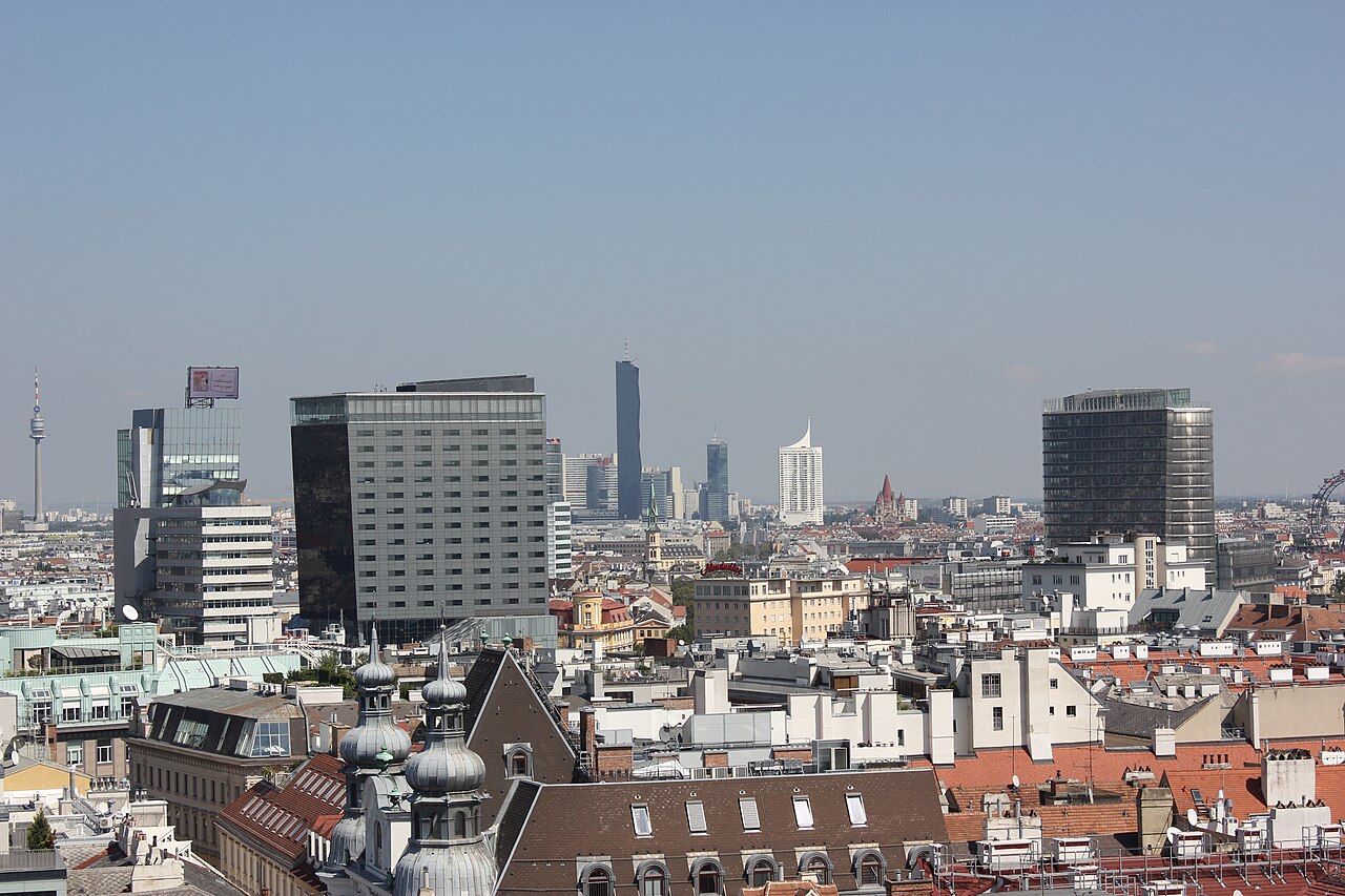
A photograph of Vienna
Photograph · Andrzej Otrębski · CC BY-SA 4.0

Vienna is 414.78 km² holding 2,028,499 people, and almost everything a visitor comes for sits inside a single ring road less than a kilometre across. The Innere Stadt — the 1st district — is the medieval core, and the Ringstrasse that surrounds it was built in the second half of the nineteenth century on the line of the demolished bastions. The 371-hectare historic centre has been a UNESCO World Heritage Site since 2001; it was on the endangered list from 2017 to 2026. The wider urban area holds 2,223,236 people and the metropolitan area 2,890,577, which makes Vienna the tenth largest city in Europe and by a long way the largest in Austria.

Practical information

Language spoken
German
German is Austria's official language; Croatian, Slovenian and Hungarian also have official status in some regions
Dialling code
+43 1
Vienna landlines; drop the leading 0 of 01 when calling from abroad
Currency
Euro (€, EUR)
Austria introduced euro banknotes and coins in 2002
Emergency number
112
One number across the country; 144 reaches an ambulance directly
Plug type
Not recorded
No verified national official source was found
Tap water
Safe to drink
Austria's national tourism authority states that tap water is drinkable in every region

Planning a visit

Suggested stay
3–4 days
Getting around
U-Bahn and tram
  1. January: seasonal closure recorded
  2. February: seasonal closure recorded
  3. March: seasonal closure recorded
  4. April: seasonal closure recorded
  5. May: recorded as a best month to visit
  6. June: recorded as a best month to visit
  7. July: seasonal closure recorded
  8. August: seasonal closure recorded — this month
  9. September: recorded as a best month to visit
  10. October: seasonal closure recorded
  11. November: seasonal closure recorded
  12. December: seasonal closure recorded

Top things to see

Ranked by importance — sitelinks, pageviews and heritage status, not editor preference.

  1. Hermannskogel
    02 30 min

    Hermannskogel

    Hermannskogel is, at 542 metres, the highest point within Vienna's city limits, standing in the Vienna Woods north of the built-up city and topped by a stone lookout tower, the Habsburgwarte.

    • Must see
    • Viewpoint
    • Döbling
  2. Leopoldsberg
    03 45 min

    Leopoldsberg

    Leopoldsberg is a 425-metre hill at the northern edge of the Vienna Woods, overlooking the point where the Danube leaves the city, and one of two viewpoint hills — with its taller neighbour Kahlenberg — that form Vienna's best-known skyline…

    • Must see
    • Viewpoint
    • Döbling
  3. Druk Yul Park
    04 15 min

    Druk Yul Park

    Druk Yul Park is a small neighbourhood park in Vienna's third district, Landstraße, named after Bhutan's own name for itself, Druk Yul, "Land of the Thunder Dragon".

    • Must see
    • Nature site
    • Liesing
  4. Burggarten
    06 1 hour

    Burggarten

    • Must see
    • Nature site
    • Innere Stadt
  5. Donaupark
    07 1 hour

    Donaupark

    • Must see
    • Nature site
    • Donaustadt
  6. Hackenberg
    09 20 min

    Hackenberg

    • Must see
    • Viewpoint
    • Döbling
  7. Laaer Berg
    10 20 min

    Laaer Berg

    • Must see
    • Viewpoint
    • Favoriten
  8. Burgstall
    15 20 min

    Burgstall

    • High
    • Viewpoint
    • Döbling
  9. Latisberg
    18 20 min

    Latisberg

    • High
    • Viewpoint
    • Döbling
  10. Neuberg
    19 20 min

    Neuberg

    • High
    • Viewpoint
    • Döbling
  11. Girardipark
    23 1 hour

    Girardipark

    • High
    • Nature site
    • Innere Stadt
  12. Modenapark
    26 1 hour

    Modenapark

    • High
    • Nature site
    • Landstraße
  13. Brandberg
    28 20 min

    Brandberg

    • High
    • Viewpoint
    • Hietzing
  14. Faßlberg
    30 20 min

    Faßlberg

    • High
    • Viewpoint
    • Hietzing
  15. Hagenberg
    33 20 min

    Hagenberg

    • High
    • Viewpoint
    • Hietzing
  16. Nussberg
    44 20 min

    Nussberg

    • High
    • Viewpoint
    • Döbling
  17. Sauberg
    46 20 min

    Sauberg

    • High
    • Viewpoint
    • Liesing
  18. Schafberg
    47 20 min

    Schafberg

    • High
    • Viewpoint
    • Währing
  19. Haydnpark
    54 1 hour

    Haydnpark

    • High
    • Nature site
    • Meidling
  20. Hameau
    61 20 min

    Hameau

    • High
    • Viewpoint
    • Hernals
  21. Heuberg
    62 20 min

    Heuberg

    • High
    • Viewpoint
    • Hernals
  22. Satzberg
    68 20 min

    Satzberg

    • High
    • Viewpoint
    • Penzing
  23. Herderpark
    73 1 hour

    Herderpark

    • High
    • Nature site
    • Simmering
  24. Leberberg
    87 20 min

    Leberberg

    • High
    • Viewpoint
    • Simmering
  25. Rosskopf
    89 20 min

    Rosskopf

    • High
    • Viewpoint
    • Penzing
  26. Bacherpark
    96 1 hour

    Bacherpark

    • High
    • Nature site
    • Margareten

Source: OpenStreetMap contributors, Wikidata ·

Where to base yourself

District boundaries come from OSM administrative relations, so a district page holds exactly the places inside it — plus, for the islands and the coast, the nearest district by proximity.

  • Innere Stadt

    Places
    929
    Across the district
    27 min
  • Leopoldstadt

    Places
    414
    Across the district
    2 hr 21 min
  • Alsergrund

    Places
    330
    Across the district
    34 min
  • Hietzing

    Places
    264
    Across the district
    2 hr 5 min
  • Döbling

    Places
    282
    Across the district
    1 hr 20 min
  • Liesing

    Places
    281
    Across the district
    2 hr 30 min
  • Donaustadt

    Places
    304
    Across the district
    3 hr 29 min
  • Neubau

    Places
    282
    Across the district
    23 min
  • Landstraße

    Places
    251
    Across the district
    54 min
  • Favoriten

    Places
    253
    Across the district
    1 hr 51 min
  • Währing

    Places
    186
    Across the district
    1 hr 7 min
  • Wieden

    Places
    186
    Across the district
    23 min
  • Penzing

    Places
    162
    Across the district
    2 hr 9 min
  • Mariahilf

    Places
    204
    Across the district
    29 min
  • Floridsdorf

    Places
    187
    Across the district
    1 hr 47 min
  • Meidling

    Places
    181
    Across the district
    59 min
  • Simmering

    Places
    158
    Across the district
    1 hr 49 min
  • Rudolfsheim-Fünfhaus

    Places
    176
    Across the district
    35 min
  • Josefstadt

    Places
    142
    Across the district
    18 min
  • Ottakring

    Places
    142
    Across the district
    1 hr 18 min
  • Margareten

    Places
    129
    Across the district
    25 min
  • Hernals

    Places
    102
    Across the district
    1 hr 23 min
  • Brigittenau

    Places
    93
    Across the district
    43 min

How the city is laid out

Twenty-three districts, numbered roughly in the order they were absorbed, arranged around the 1st.

The Innere Stadt is the 1st and holds the cathedral, the Hofburg, the opera and most of what a short visit will see. Districts 2 to 9 and 20 were incorporated in 1850 and lie inside the Gürtel, the outer ring road; they are the inner districts and are where most visitors sleep and eat. Districts 10 to 19 and 21 to 23 came in between 1874 and 1938, mostly in 1892.

Districts 21 and 22 are across the Danube on the left bank — Floridsdorf is the northernmost part of the city and Donaustadt the largest by area. Districts 2 and 20 sit on the island between the Danube and the Donaukanal.

The postal code gives the district: 1XXA, where the middle two digits are the district number. An address at 1070 is in the 7th.

Checked 2026-08-23

Getting around

The U-Bahn, the trams, and a ticket that covers both.

The U-Bahn has five lines, 109 stations and 83.9 km of track, and it opened on 25 February 1978. It carried 404.8 million passengers in 2023. Trains run from about 05:00 to 01:00 at intervals of two to fifteen minutes, and run all night at fifteen-minute intervals on Friday and Saturday nights and before public holidays.

A sixth line, the U5, is under construction for completion between 2026 and 2032; the network will then be 90 km with 116 stations.

Tickets are integrated with the trams, the buses and the S-Bahn through the VOR system, so one ticket covers the whole journey. Some airport services are outside it.

Inside the Ring, walking beats all of it.

Checked 2026-08-23

Common questions

How many days does Vienna need?

Three to four. Two days cover the Innere Stadt and the Ring — the cathedral, the Hofburg, the opera, the museums on the Maria-Theresien-Platz. A third takes Schönbrunn and the Belvedere, and a fourth allows a proper concert or an afternoon in the wine villages.

How do the districts work?

Twenty-three of them, numbered roughly in the order they joined the city. The 1st is the medieval centre, districts 2–9 and 20 came in 1850 and lie inside the Gürtel, and the rest arrived between 1874 and 1938. The postal code carries the number: 1070 is the 7th district.

What is the Ringstrasse?

The boulevard built in the second half of the nineteenth century on the line of the demolished city bastions, encircling the Innere Stadt. Most of Vienna's great public buildings face onto it.

Is the U-Bahn the best way around?

For anything beyond the Ring, yes. Five lines, 109 stations, 83.9 km, running from about 05:00 to 01:00 and all night at weekends. Inside the Ring, walking is faster.

When is the best time to come?

April to June and September to October. Summer afternoons reach 27–32°C and the palace gardens have little shade; winter hovers around freezing but brings the concert season and the Christmas markets.

How big is Vienna really?

414.78 km² with 2,028,499 people in the city proper, 2,223,236 in the urban area and 2,890,577 in the metropolitan area — the tenth largest city in Europe.

Turn this list into a plan

Set your days, your pace and the hours you actually want to be out. The planner works around closing days and travel time, and leaves room to eat.

Plan Vienna