


113 min walk · Kula
Kula Kent Meydanı
- Notable
- Nature site
Language · 1 published
Viewpoint · Kula, Manisa
Kula
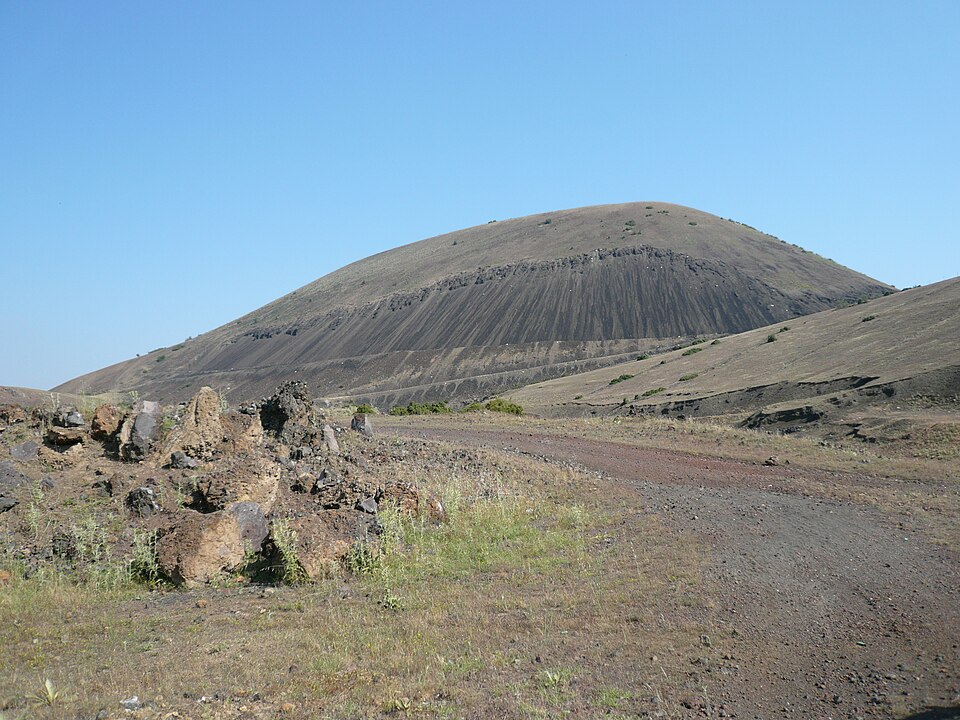
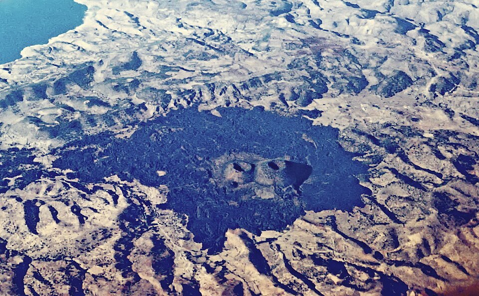
Kula Volcano is an extinct cinder cone in the Kula volcanic field, the feature that gives the field and the surrounding Kula-Salihli Geopark their name. The Kula-Salihli Geopark is Türkiye's only UNESCO Global Geopark, designated in 2013. The cone stands about 10 km west-northwest of Kula town, at roughly 750 m above sea level, inside a field that Wikidata and the geopark itself record as roughly eighty cinder cones and five maars spread across about 300 km2 on the northern edge of the Gediz Graben. Volcanism here began in the Miocene and continued through the Quaternary in several eruptive phases, making this the youngest volcanic landscape in western Anatolia. The exact date of this particular cone's last eruption is not recorded in the sources this page uses, and it is classified as extinct, not dormant.
Checked 2026-08-24 · Source
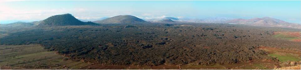
The cone itself is a straightforward scoria cone: loose, reddish-black cinder built up around a shallow summit crater, unfenced and crossed by a walking track rather than a paved path. There is no visitor building, ticket booth or interpretive panel directly on the cone; the geopark concentrates its marked trails and information panels, more than 12 km of them, at other geosites across the field. From the rim the ground drops into the wider volcanic field: other cinder cones on the horizon, dark basaltic lava flows on the plain below, and, on a clear day, the Gediz Graben running east and west. The rock is basalt carrying xenoliths, the material geologists use to date the field's Miocene-to-Quaternary eruptive history.
Checked 2026-08-24 · Source
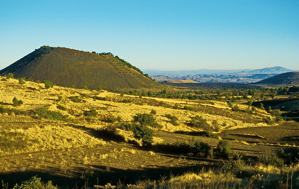
Walking from a parking spot to the crater rim and back takes about 45 minutes to an hour, since loose scoria slows the climb more than the modest height suggests. Most visitors combine the cone with a half-day loop by car through the wider volcanic field, since the fairy chimneys near Yurtbaşı and the field's other named cones are each a drive rather than a walk away. Budget two to three hours if this cone is one stop among several, rather than the only one on the day.
Checked 2026-08-24
The field sits in a Mediterranean climate zone, so summer heat on unshaded black cinder is intense by midday; spring and autumn mornings are more comfortable for the climb. There is no shade anywhere on the cone, so early morning or the last two hours before sunset are the only times the dark scoria is not radiating heat back. Winter rain softens the approach track, and the final stretch is harder without a higher-clearance vehicle after wet weather.
Checked 2026-08-24 · Source
There is no ticket and no admission fee: Kula Volcano is open, unfenced volcanic terrain rather than a managed monument, and nothing on the cone charges for entry. The Kula-Salihli Geopark visitor center, elsewhere in the district, is the closest thing to a gate for the wider field, but its current opening hours and any charge for its exhibits are not published on the sources this page uses and are not reproduced here. Geopark conservation rules apply regardless of whether a fee is charged anywhere: nothing is removed from the ground.
Checked 2026-08-24 · Source

Kula town is about 100 km east of Manisa city on the road toward Uşak, with no rail or metro connection; intercity buses reach Kula's otogar from Manisa, Salihli and Uşak, after which a car is needed. From Kula, the volcano lies roughly 10 km west-northwest of town; the final approach is an unpaved track, passable by an ordinary car in dry weather but safer with higher clearance after rain. There is no public transport onto the volcanic field itself — every geosite in the geopark, including this cone, is a drive rather than a walk from town.
Checked 2026-08-24
The ground underfoot is loose, sharp-edged scoria rather than a packed trail, so ordinary shoes slip and closed hiking shoes are worth the trouble. The crater rim is unfenced, with no barrier and no signage marking a safe edge, so footing needs full attention right up to it. There are no facilities anywhere on the cone: no water, no toilet, no shade, and mobile signal thins out away from the main road. Geopark rules prohibit removing rock or cinder from the ground and require vehicles to stay on existing tracks rather than cutting across the cone.
Checked 2026-08-24

The clearest photographs of the cone's texture come with low sun, early morning or the last light before sunset, when raking light picks out the ridges of loose scoria that flatten out under midday sun. From the rim, wide shots take in the neighbouring cones scattered across the volcanic field, especially on a clear day when the graben's flat floor gives a long, uninterrupted sightline. No permit or restriction is documented for photography on the open cone; anyone flying a drone should check current Turkish civil aviation rules independently, since none of the sources this page uses cover drone regulation.
Checked 2026-08-24
No. Wikidata classifies it as an extinct volcano, and the field's most recent activity dates to the late Pleistocene or early Holocene, with the exact date of this cone's last eruption not recorded in the sources this page uses.
Not practically. Intercity buses reach Kula town, but the volcano is about 10 km further out on an unpaved track with no public transport, so a car is needed for the final approach.
No. It is open, unfenced volcanic terrain rather than a ticketed site, and no admission fee is documented for it.
Around eighty cinder cones and five maars, spread across roughly 300 km2 on the northern edge of the Gediz Graben.
Closed hiking shoes for the loose cinder, sun protection since there is no shade, and enough water for the walk, since nothing is sold on site.
Yes. It lies inside the Kula-Salihli Geopark, designated a UNESCO Global Geopark in 2013 and Türkiye's only one.
Loading the interactive map…
The interactive map could not be loaded.
Last updated:
Source: OpenStreetMap contributors, Wikidata ·