


193 min walk · Kula
Meryem Ana Kilisesi
- High
- Historic monument
Language · 1 published
Viewpoint · Kula, Manisa
Kula Perbacaları seyir terası

Kuladokya is a fairy-chimney viewing terrace and 1.2 kilometre walking trail inside the Kula-Salihli UNESCO Global Geopark, near Yurtbaşı village on the İzmir-Ankara highway, about 16 km from Kula town. It is a single stop, not the geopark itself: the geopark is a 2,320 square kilometre volcanic field across two districts, while Kuladokya is one fenceless viewpoint within it, built around a cluster of eroded volcanic-ash formations that resemble Cappadocia's fairy chimneys closely enough that the name is a deliberate portmanteau of Kula and Cappadocia.
It is also the geopark's most visited single point. Where the geopark as a whole has no dedicated tourist-review listing, Kuladokya carries its own TripAdvisor entry, a sign of how much more visitor traffic concentrates on this one terrace than on the volcanic field around it.
Checked 2026-08-24 · Source
The formations at Kuladokya, called peribacaları — fairy chimneys — on the ground and on local signage, are hoodoos: tall, narrow columns of soft volcanic tuff each capped by a harder boulder that has protected the column beneath it from rain erosion while the surrounding softer rock washed away. The same process shaped Cappadocia's fairy chimneys hundreds of kilometres east, on a different volcanic field and a different rock chemistry, which is why the resemblance is visual rather than geological.
A marked walking and cycling path of about 1.2 kilometres loops past the formations, leading to a viewing terrace that gives a roughly 180-degree panorama over the eroded badlands and the wider Kula volcanic countryside. There are no buildings, shops or staffed facilities at the terrace itself; it is a viewpoint and a trail, nothing more.
Checked 2026-08-24 · Source
Thirty to forty-five minutes covers the terrace and the loop trail at an unhurried pace, including time to walk the full 1.2 kilometre path rather than just the viewing terrace itself. There is little to detain a visitor beyond the formations and the view, so this is a short stop rather than a half-day destination on its own.
Checked 2026-08-24
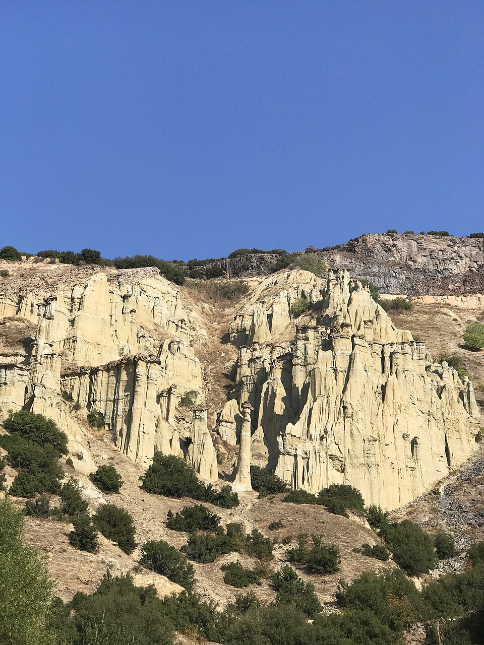
Early morning or late afternoon gives the softest light on the tuff formations and avoids the exposed midday sun, since the terrace and trail sit in open countryside with no shade. The site is open around the clock with no gate and no seasonal closure, so timing is a matter of light and heat rather than access.
Checked 2026-08-24 · Source
Free. Entry to Kuladokya carries no admission charge: visitors can drive in and park without paying, and the site has no gate, no ticket booth and no staffed entrance to pay at. This is different from Spil Dağı Milli Parkı on the other side of Manisa province, which charges 60 TRY per adult (30 TRY reduced) plus a separate per-vehicle fee starting at 60 TRY for a bicycle; Kuladokya sits inside the unticketed Kula-Salihli Geopark, not inside a national park, and none of that fee schedule applies here. No source consulted for this page records any charge for the terrace, the trail, or the parking area beside it, at any point in the visit.
Checked 2026-08-24 · Source
A car is required. Kuladokya sits about 16 km from Kula town near Burgaz village, close to the 140th kilometre of the İzmir-Ankara highway, and no public transport serves the site directly. From Manisa city, which is roughly 100 km west of Kula, the drive runs by road through Kula town before the final stretch to the terrace; there is no rail or metro option for any leg of the trip.
Checked 2026-08-24 · Source
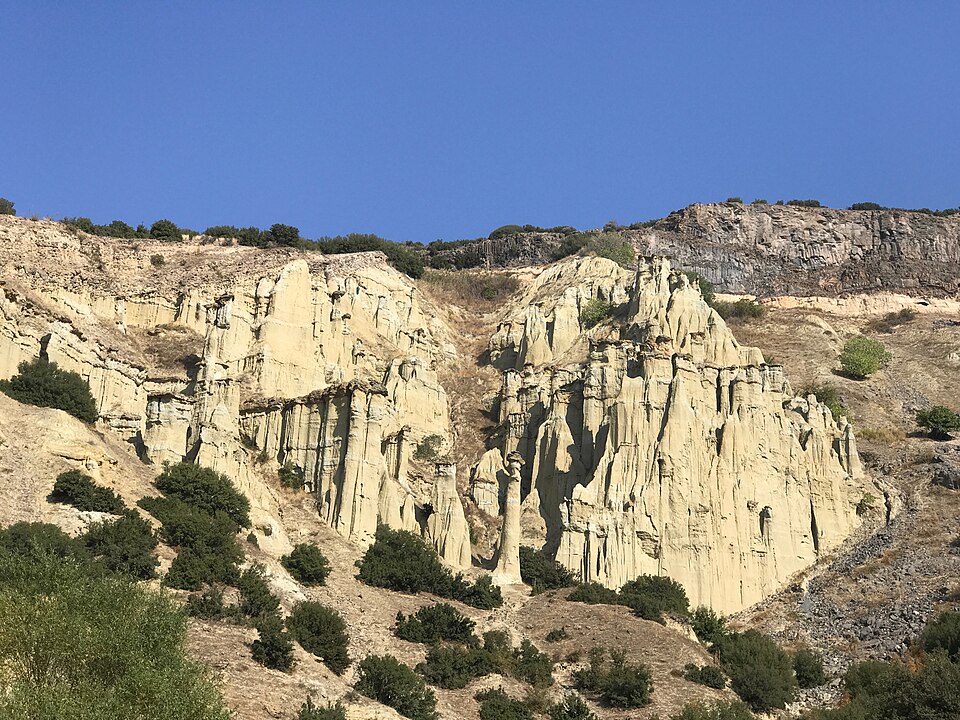
The terrace and trail are unfenced, so the main risk is the drop at the edge of the eroded formations rather than any rule to follow. There is no barrier stopping a visitor from walking close to a soft-tuff edge that can crumble underfoot, so footing matters more here than caution around any posted restriction. There are no staffed facilities on site, no toilets recorded on the sources this page uses, and no dress code or photography restriction, since Kuladokya is an open natural viewpoint rather than a managed monument.
Checked 2026-08-24
The viewing terrace is the vantage point: its roughly 180-degree panorama is built for photographing the formation cluster as a whole rather than any single hoodoo. Low sun, early or late in the day, throws shadow into the grooves and ridges the erosion has cut into the tuff and gives the terrain far more depth than the flat light of midday. No permit or restriction applies.
Checked 2026-08-24
No. Kuladokya is one viewing terrace and trail inside the geopark's 2,320 square kilometre boundary. The geopark covers the whole volcanic field across Kula and Salihli districts; Kuladokya is its single most-visited stop.
The name combines Kula with Cappadocia, because the eroded tuff formations here resemble Cappadocia's fairy chimneys closely enough that visitors and marketers adopted the comparison, even though the two sites sit on different volcanic fields.
No. Entry to Kuladokya is free, with no gate or ticket booth, unlike Spil Dağı Milli Parkı elsewhere in the province, which does charge admission.
About 1.2 kilometres, looping past the fairy-chimney formations to the viewing terrace and back; it is also open to cyclists.
Yes. Kuladokya is about 16 km from Kula town near Burgaz village on the İzmir-Ankara highway, and no public transport reaches the site.
No. It is an open, unfenced natural viewpoint with no staff on site, so visitors are responsible for their own footing near the eroded edges.
Loading the interactive map…
The interactive map could not be loaded.
Last updated:
Source: OpenStreetMap contributors ·