


113 min walk · Kula
Kula Kent Meydanı
- Notable
- Nature site
Language · 1 published
Nature site · Kula, Manisa
Kula Volkanik Jeoparkı
| Per person | Free entry |
|---|
Checked 2026-08-24
Recorded for Divlit Volcano, not for this site as a whole. View Divlit Volcano's guide
Recorded for Kula volcano, not for this site as a whole. View Kula volcano's guide
Recorded for Kula Fairy Chimneys Viewing Terrace, not for this site as a whole. View Kula Fairy Chimneys Viewing Terrace's guide
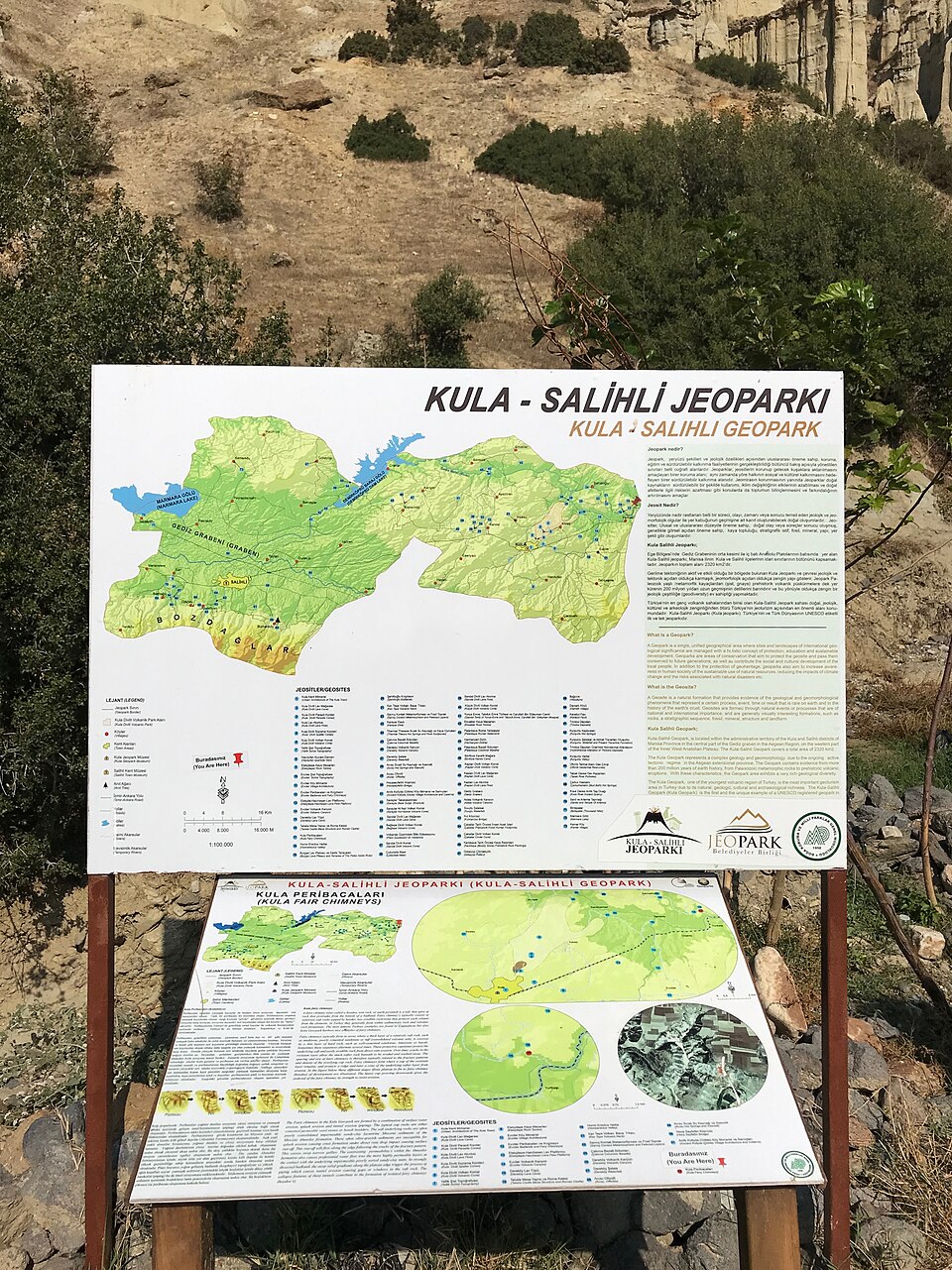
Kula-Salihli UNESCO Global Geopark, signed locally as Kula Volkanik Jeoparkı, is a 2,320 square kilometre protected volcanic landscape spanning the Kula and Salihli districts of Manisa Province, roughly 100 km east of Manisa city. It is Turkiye's only UNESCO Global Geopark, accepted into the European and UNESCO-assisted Global Geoparks Network in September 2013. The geopark was defined at about 300 square kilometres in early reporting on its 2013 designation; the geopark's own current figure for its boundary is 2,320 square kilometres.
The ground here is one of the youngest volcanic fields in Turkiye. Ancient geographers already knew it: Strabo described the area as Katakekaumene, "the burnt land," for the dark colour its lava left across the plain. Three eruption phases during the Quaternary period, roughly 1.1 million, 300,000 and as recently as 15,000 years ago, built roughly 80 scoria cones and five maars across the district. This is a designation covering an entire volcanic field, not a single site to walk around in an afternoon; individual stops inside it, such as the fairy-chimney viewing terrace at Kuladokya, are separate places within the boundary, each reached by its own road.
Checked 2026-08-24 · Source
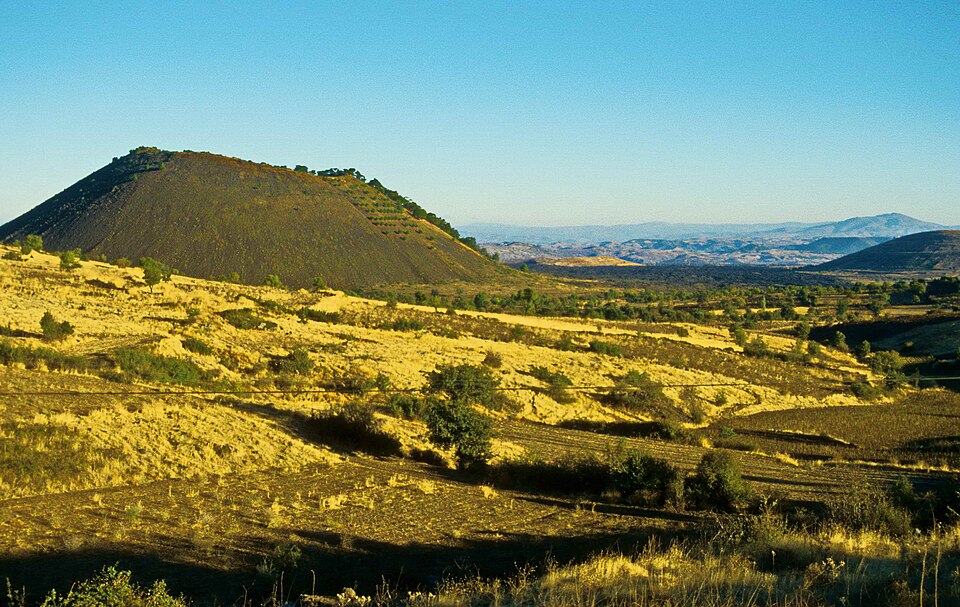
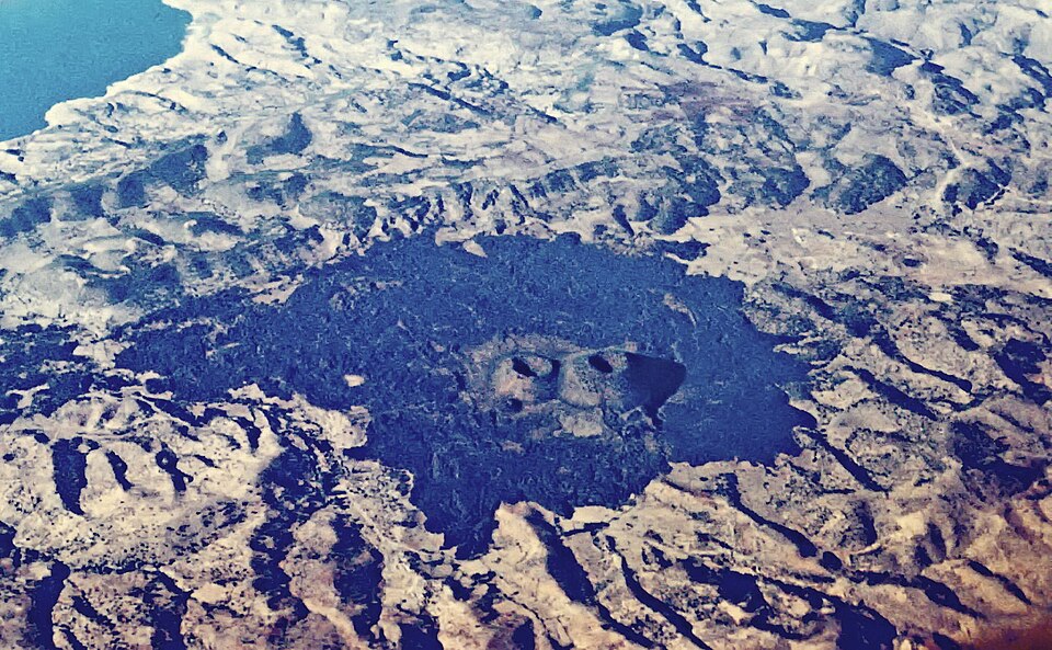
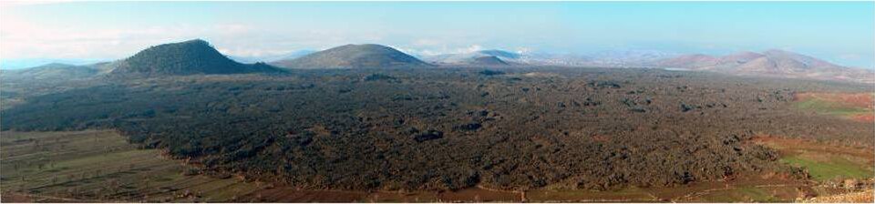
The geopark protects a working volcanic geology open-air. Its defining features are the scoria cones and maars themselves, low dark cinder hills and shallow crater basins scattered across the Kula and Salihli countryside, some rising to about 150 metres. Columnar basalt is exposed in several villages, including Sarnıç and Çakırca, where cooling lava cracked into hexagonal columns exceeding 20 metres in height. Lava tubes and volcanic caves run beneath parts of the field.
Two features stand out beyond the volcanic rock. Wind and water erosion has carved fairy-chimney formations, marketed as "Kuladokya" for their resemblance to Cappadocia, near Yurtbaşı village along the İzmir-Ankara highway; this is the single most visited stop inside the geopark and is covered on its own page. And near the Çakallar volcanic cone, more than 200 fossilised human footprints were found in 1968, when workers excavating scoria for the Demirköprü dam uncovered them pressed into volcanic ash. Their age is disputed rather than settled: Tekkaya's 1976 study, the figure both the Turkish and English Wikipedia articles carry, dates them to roughly 10,000-12,000 years old, while a 2019 study using cosmogenic chlorine-36 and zircon dating on the same deposits places the eruption that buried them at about 4,700 years ago, in the Bronze Age — a figure the Turkish Mineral Research and Exploration institute, MTA, now uses on its own pages for the field. This page states both rather than picking one. A visitor centre and research facility, JARUM, opened with the geopark in 2013 and functions as a small museum on the area's geology.
Checked 2026-08-24 · Source
A single stop inside the geopark, such as the Kuladokya terrace, takes under an hour. Seeing a meaningful cross-section of the geopark, one or two volcanic cones, a basalt column village and the fairy-chimney terrace, takes most of a day by car, since the sites sit tens of kilometres apart across Kula and Salihli districts and there is no public transport linking them. The geopark maintains over 12 kilometres of marked trails with interpretive signage for visitors who want to walk sections rather than drive between viewpoints.
Checked 2026-08-24
Spring and autumn suit this landscape best: the volcanic terrain has almost no tree cover, so a summer midday visit is exposed to full sun with little shade at any of the outdoor stops. The geopark itself carries no seasonal closure and no gate, so the choice is about comfort rather than access. Early morning or late afternoon light also suits the dark scoria cones and basalt columns better than the flat light of midday.
Checked 2026-08-24
The geopark charges no admission. It is an open, unfenced landscape across two districts, not a single gated site, and current sources record no entrance fee at any of its outdoor volcanic features. The JARUM visitor centre's own admission terms are not published on the sources this page uses and are not reproduced here.
Checked 2026-08-24 · Source

A car is the only practical way to see the geopark. Kula town is about 100 km east of Manisa city; there is no metro or useful rail link, and intercity buses reach the towns of Kula and Salihli but not the volcanic sites scattered around them. From Kula or Salihli town, the individual cones, basalt-column villages and the Kuladokya terrace each require a further drive on local roads, since the geopark's 2,320 square kilometre area has no single access gate or road.
Checked 2026-08-24
The main hazard is the terrain itself, not restrictions on it. Scoria cones and lava fields are unfenced and the volcanic rock is often loose or sharp underfoot, so sturdy shoes matter more here than at a managed archaeological site. There are no ticket gates, opening hours or dress codes to plan around, since this is open countryside rather than a single monument, but that also means there is no on-site staff at most points if a visitor needs help. Mobile signal is patchy in parts of the volcanic field away from the two towns.
Checked 2026-08-24

Low sun angle is what makes this landscape photograph well: early morning or late afternoon light rakes across the scoria cones and basalt columns and brings out their texture, where midday sun flattens the dark rock into a featureless grey-black. Wide shots work better than close detail for the cones and maars, since their scale is the point; the basalt columns at Sarnıç and Çakırca reward a closer, more graphic composition. No permit or restriction applies to photography anywhere in the geopark.
Checked 2026-08-24
No. Kuladokya is one stop, a single viewing terrace and walking trail, inside the geopark's 2,320 square kilometre boundary. The geopark itself is the whole protected volcanic field across Kula and Salihli districts, of which Kuladokya is the most visited single point.
Because as of its current recognition, it is the sole site in the country to hold UNESCO Global Geopark status, granted in September 2013 through the European and UNESCO-assisted Global Geoparks Network.
The Quaternary volcanism that built the geopark's cones and maars occurred in three phases, roughly 1.1 million, 300,000 and 15,000 years ago, making the youngest cones geologically recent by any standard.
More than 200 human footprints were discovered near the Çakallar volcanic cone in 1968, left in ground that had recently cooled from volcanic activity. Their age is disputed: a 1976 study, the figure both Wikipedias carry, put them at 10,000-12,000 years old; a 2019 study using cosmogenic and zircon dating instead puts them at about 4,700 years, in the Bronze Age.
No. It is an open, unfenced landscape with no single gate, and current sources record no admission charge at its outdoor sites.
Yes. Kula and Salihli towns are reachable by intercity bus, but the volcanic cones, basalt columns and the Kuladokya terrace are spread across the 2,320 square kilometre geopark with no public transport between them.
Loading the interactive map…
The interactive map could not be loaded.
Last updated:
Source: OpenStreetMap contributors ·